Buttstädt
| Buttstädt | ||
|---|---|---|
| ||
 Buttstädt | ||
Location of Buttstädt within Sömmerda district 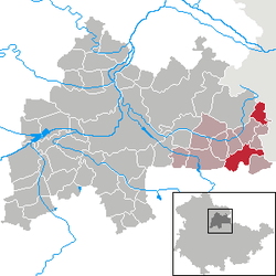 | ||
| Coordinates: 51°7′0″N 11°25′0″E / 51.11667°N 11.41667°ECoordinates: 51°7′0″N 11°25′0″E / 51.11667°N 11.41667°E | ||
| Country | Germany | |
| State | Thuringia | |
| District | Sömmerda | |
| Municipal assoc. | Buttstädt | |
| Government | ||
| • Mayor | Hendrik Blose (SPD) | |
| Area | ||
| • Total | 18.31 km2 (7.07 sq mi) | |
| Population (2013-12-31)[1] | ||
| • Total | 2,469 | |
| • Density | 130/km2 (350/sq mi) | |
| Time zone | CET/CEST (UTC+1/+2) | |
| Postal codes | 99628 | |
| Dialling codes | 036373 | |
| Vehicle registration | SÖM | |
| Website |
stadt-buttstaedt | |

Buttstädt is a town in the district of Sömmerda, in Thuringia, Germany. It is situated 16 km northeast of Weimar.
History
Within the German Empire (1871-1918), Buttstädt was part of the Grand Duchy of Saxe-Weimar-Eisenach.
Village center
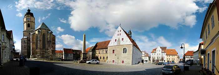
Market place with St. Michaelis church to the left
References
- ↑ "Bevölkerung der Gemeinden, erfüllenden Gemeinden und Verwaltungsgemeinschaften nach Geschlecht in Thüringen". Thüringer Landesamt für Statistik (in German). 13 July 2013.