Butler County, Alabama
| Butler County, Alabama | |
|---|---|
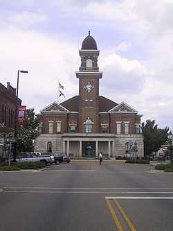 Butler County courthouse in Greenville | |
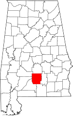 Location in the state of Alabama | |
 Alabama's location in the U.S. | |
| Founded | December 13, 1819 |
| Named for | William Butler |
| Seat | Greenville |
| Largest city | Greenville |
| Area | |
| • Total | 778 sq mi (2,015 km2) |
| • Land | 777 sq mi (2,012 km2) |
| • Water | 1.1 sq mi (3 km2), 0.1% |
| Population | |
| • (2010) | 20,947 |
| • Density | 27/sq mi (10.4/km²) |
| Congressional district | 2nd |
| Time zone | Central: UTC-6/-5 |
| Website |
butlercountyal |
Butler County is a county in the U.S. state of Alabama. As of the 2010 census, the population was 20,947.[1] Its county seat is Greenville. Its name is in honor of Captain William Butler, who was born in Virginia and fought in the Creek War, and who was killed in May 1818.
History
Butler County was formed from Conecuh County, Alabama, and Monroe County, Alabama, by an act passed December 13, 1819, by the Legislature while in session at Huntsville. This was the first session of the Legislature of Alabama as a State. The name of Fairfield was first proposed for this county, but was changed on the passage of the bill to Butler, in honor of Captain William Butler.
The exact date of the first settlement made by white people in the limits of Butler County is not exactly known. Some records have it as early as 1814, but the earliest settler of no dispute is James K. Benson, who settled in the Flat in 1815, and built the first house ever erected in Butler County. It was built near where Pine Flat Methodist Church now stands, and was made of logs. Shortly after, William Ogly and John Dickerson came with their families and made a settlement on the Federal Road, about three miles (5 km) south of where Fort Dale was later erected. In the fall of 1816, a party from the state of Georgia came to settle in Pine Flat, including Thomas Hill, Warren A. Thompson, Captain John Watts, and Benjamin Hill. In 1817, many more settlers arrived, since the hardest work had already been done by these brave original souls.
Geography
According to the U.S. Census Bureau, the county has a total area of 778 square miles (2,020 km2), of which 777 square miles (2,010 km2) is land and 1.1 square miles (2.8 km2) (0.1%) is water.[2]
Major highways
.svg.png) Interstate 65
Interstate 65 U.S. Highway 31
 State Route 10
 State Route 106
 State Route 185
 State Route 263
Adjacent counties
- Lowndes County (north)
- Crenshaw County (east)
- Covington County (southeast)
- Conecuh County (southwest)
- Monroe County (west)
- Wilcox County (northwest)
Demographics
| Historical population | |||
|---|---|---|---|
| Census | Pop. | %± | |
| 1820 | 1,405 | — | |
| 1830 | 5,650 | 302.1% | |
| 1840 | 8,685 | 53.7% | |
| 1850 | 10,836 | 24.8% | |
| 1860 | 18,122 | 67.2% | |
| 1870 | 14,981 | −17.3% | |
| 1880 | 19,649 | 31.2% | |
| 1890 | 21,641 | 10.1% | |
| 1900 | 25,761 | 19.0% | |
| 1910 | 29,030 | 12.7% | |
| 1920 | 29,531 | 1.7% | |
| 1930 | 30,195 | 2.2% | |
| 1940 | 32,447 | 7.5% | |
| 1950 | 29,228 | −9.9% | |
| 1960 | 24,560 | −16.0% | |
| 1970 | 22,007 | −10.4% | |
| 1980 | 21,680 | −1.5% | |
| 1990 | 21,892 | 1.0% | |
| 2000 | 21,399 | −2.3% | |
| 2010 | 20,947 | −2.1% | |
| Est. 2013 | 20,265 | −3.3% | |
| U.S. Decennial Census[3] 1790-1960[4] 1900-1990[5] 1990-2000[6] 2010-2013[1] | |||
As of the 2010 United States Census, there were 20,947 people residing in the county. 54.4% were White, 43.4% Black or African American, 0.8% Asian, 0.3% Native American, 0.2% of some other race and 0.8% of two or more races. 0.9% were Hispanic or Latino (of any race).
As of the census[7] of 2000, there were 21,399 people, 8,398 households, and 5,870 families residing in the county. The population density was 28 people per square mile (11/km2). There were 9,957 housing units at an average density of 13 per square mile (5/km2). The racial makeup of the county was 58.38% White, 40.81% Black or African American, 0.21% Native American, 0.16% Asian, 0.05% from other races, and 0.39% from two or more races. 0.67% of the population were Hispanic or Latino of any race.
There were 8,398 households out of which 32.50% had children under the age of 18 living with them, 47.70% were married couples living together, 18.20% had a female householder with no husband present, and 30.10% were non-families. 27.50% of all households were made up of individuals and 13.50% had someone living alone who was 65 years of age or older. The average household size was 2.52 and the average family size was 3.06.
In the county the population was spread out with 26.90% under the age of 18, 8.60% from 18 to 24, 25.10% from 25 to 44, 23.00% from 45 to 64, and 16.40% who were 65 years of age or older. The median age was 38 years. For every 100 females there were 88.00 males. For every 100 females age 18 and over, there were 82.90 males.
The median income for a household in the county was $24,791, and the median income for a family was $30,915. Males had a median income of $28,968 versus $18,644 for females. The per capita income for the county was $15,715. About 20.40% of families and 24.60% of the population were below the poverty line, including 31.30% of those under age 18 and 28.60% of those age 65 or over.
Communities
City
Towns
- Georgiana
- McKenzie (part of McKenzie is in Conecuh County)
Unincorporated community
Notable residents
- William Butler, militiaman during the Creek War
- Hilary A. Herbert, Secretary of the Navy under President Grover Cleveland
- Warren A. Thompson, explorer
- Hank Williams, country singer
See also
- National Register of Historic Places listings in Butler County, Alabama
- Properties on the Alabama Register of Landmarks and Heritage in Butler County, Alabama
References
- ↑ 1.0 1.1 "State & County QuickFacts". United States Census Bureau. Retrieved May 15, 2014.
- ↑ "US Gazetteer files: 2010, 2000, and 1990". United States Census Bureau. 2011-02-12. Retrieved 2011-04-23.
- ↑ "U.S. Decennial Census". United States Census Bureau. Retrieved May 15, 2014.
- ↑ "Historical Census Browser". University of Virginia Library. Retrieved May 15, 2014.
- ↑ "Population of Counties by Decennial Census: 1900 to 1990". United States Census Bureau. Retrieved May 15, 2014.
- ↑ "Census 2000 PHC-T-4. Ranking Tables for Counties: 1990 and 2000" (PDF). United States Census Bureau. Retrieved May 15, 2014.
- ↑ "American FactFinder". United States Census Bureau. Retrieved 2011-05-14.
External links
Coordinates: 31°44′58″N 86°40′56″W / 31.74944°N 86.68222°W
 |
Wilcox County | Lowndes County | | |
| Monroe County | |
Crenshaw County | ||
| ||||
| | ||||
| Conecuh County | Covington County |
| |||||||||||||||||||||||||
| ||||||||||||||||||||||||||||||||||