Bushmoor
Coordinates: 52°28′59″N 2°50′02″W / 52.483°N 2.834°W
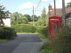
The village telephone box at Bushmoor.
Bushmoor is a hamlet in Shropshire, England.
It is located in the parish of Wistanstow, 1¼ miles north of that village, and half a mile west of the A49 road.
The lane running into the village from Wistanstow is a Roman road, which ran between the Roman settlements and forts at Leintwardine and Wroxeter. The present day lane turns a sharp corner (to the east and the A49) off this ancient route and this is known as The Corner.
| ||||||||||||||||||||||