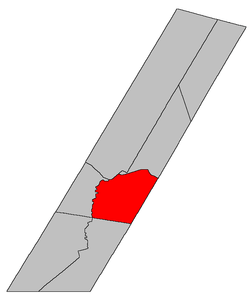
Burton Parish, New Brunswick
Burton is a Canadian parish in Sunbury County, New Brunswick.[2]
History
Burton Parish first established in 1765 as a Nova Scotia township: named for Brigadier General Ralph Burton who served at the capture of Fort Louisbourg in 1758 and the capture of Québec in 1759: Burton became a parish in New Brunswick in 1786: included part of Blissville Parish until 1834.
Delineation
Blissville Parish is defined in the Territorial Division Act as:
Communities
Parish population total does not include incorporated municipalities (in bold):
|
|
- Goan
- Haneytown
- Hersey Corner
- Lower Burton
- McGowans Corner
|
|
Bodies of water & Islands
This is a list of rivers, lakes, streams, creeks, marshes and Islands that are at least partially in this parish
Demographics
Population
Population trend[3]
| Census |
Population |
Change (%) |
| 2011 |
|
N/A |
| 2006 |
5019 |
 0.4% 0.4% |
| 2001 |
5000 |
 0.0% 0.0% |
| 1996 |
|
0.0% |
| 1991 |
|
N/A |
|
Language
Mother tongue language (2006)[4]
| Language |
Population |
Pct (%) |
| French only |
|
% |
| English only |
|
% |
| Both English and French |
0 |
0.00% |
| Other languages |
0 |
0.00% |
|
Access Routes
Highways and numbered routes that run through the parish, including external routes that start or finish at the parish limits:[5]
See also
References
- ↑ 1.0 1.1 2011 Statistics Canada Census Profile: Burton Parish, New Brunswick
- ↑ New Brunswick Provincial Archives - Burton Parish
- ↑ Statistics Canada: 2001, 2006 census
- ↑ Profile: Burton Parish, New Brunswick
- ↑ Atlantic Canada Back Road Atlas ISBN 978-1-55368-618-7
|
|---|
| | Subdivisions | |
|---|
| | Cities | |
|---|
| | Counties | |
|---|
|
-
 Category:New Brunswick Category:New Brunswick
-
 Portal:New Brunswick Portal:New Brunswick
-
 WikiProject:New Brunswick WikiProject:New Brunswick
|
|
Coordinates: 45°48′05″N 66°24′18″W / 45.8014°N 66.405°W / 45.8014; -66.405