Burstall, Suffolk
| Burstall | |
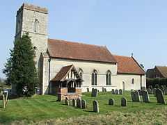 St Mary's, Burstall |
|
 Burstall |
|
| Population | 189 (2001) |
|---|---|
| OS grid reference | TM0944 |
| District | Babergh |
| Shire county | Suffolk |
| Region | East |
| Country | England |
| Sovereign state | United Kingdom |
| Post town | Hadleigh |
| Postcode district | IP |
| Dialling code | 01473 |
| EU Parliament | East of England |
Coordinates: 52°03′36″N 1°03′25″E / 52.06°N 1.057°E
Burstall is a village and civil parish in Suffolk, England. Located around 4 miles (6 km) west of Ipswich, it is part of Babergh district. The parish includes the hamlet of Burstallhill. Recorded in the Domesday Book as Burgestala / Burghestala.
The south-western boundary of the parish is delineated by Belstead Brook, a tributary of the River Orwell. The A1071 between Ipswich and Hadleigh crosses Belstead Brook at Burstall Bridge.
Burstall Hall is ⅔ mile (1 km) northeast from the village.
Mill Farm is to the west and Hill Farm to the east.
The village hall built in 1910 in memory of John Cranfield. It is a Mock Tudor building with a recent lottery grant improvements. No alcohol is sold in the hall.
The Half Moon public house closed in 1968. There is no post office as this was closed in 2006 due to cutbacks at that time.
External links
| Wikimedia Commons has media related to Burstall, Suffolk. |