Burraboi, New South Wales
| Burraboi New South Wales | |
|---|---|
|
The largest rice silo complex in the southern hemisphere at Burraboi | |
|
Burraboi | |
| Coordinates | 35°20′S 144°24′E / 35.333°S 144.400°ECoordinates: 35°20′S 144°24′E / 35.333°S 144.400°E |
| Population | 419 (2006 census)[1] |
| Postcode(s) | 2732 |
| Location | |
| LGA(s) | Wakool Shire |
| County | Wakool |
| State electorate(s) | Murray |
| Federal Division(s) | Farrer |

Burraboi is a community in New South Wales, Australia. It is in the southwestern part of the Riverina and situated about 34 kilometres north of Barham and 50 km south of Moulamein. At the 2006 census, Burraboi had a population of 419.[1]
Burraboi Post Office opened on 1 July 1929 and closed in 1942 (a telephone office remained open until 1957).[3]
The largest rice silo complex in the southern hemisphere is located at Burraboi.[4]
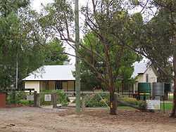
Burraboi Public School
References
- ↑ 1.0 1.1 Australian Bureau of Statistics (25 October 2007). "Burraboi (State Suburb)". 2006 Census QuickStats. Retrieved 2007-10-29.
- ↑ Travelmate
- ↑ Premier Postal History. "Post Office List". Retrieved 2009-06-11.
- ↑ "Wakool - SMH travel". Sydney Morning Herald. 2004-02-08. Retrieved 2007-02-23.
| Wikimedia Commons has media related to Burraboi, New South Wales. |