Burnand
For other uses, see Burnand (disambiguation).
| Burnand | |
|---|---|
 | |
 Burnand | |
|
Location within Burgundy region  Burnand | |
| Coordinates: 46°35′45″N 4°37′52″E / 46.5958°N 4.6311°ECoordinates: 46°35′45″N 4°37′52″E / 46.5958°N 4.6311°E | |
| Country | France |
| Region | Burgundy |
| Department | Saône-et-Loire |
| Arrondissement | Mâcon |
| Canton | Saint-Gengoux-le-National |
| Intercommunality | Entre Grosne et Guye |
| Area1 | 6.52 km2 (2.52 sq mi) |
| Population (2006)2 | 117 |
| • Density | 18/km2 (46/sq mi) |
| INSEE/Postal code | 71067 / 71460 |
| Elevation |
219–403 m (719–1,322 ft) (avg. 260 m or 850 ft) |
|
1 French Land Register data, which excludes lakes, ponds, glaciers > 1 km² (0.386 sq mi or 247 acres) and river estuaries. 2 Population without double counting: residents of multiple communes (e.g., students and military personnel) only counted once. | |
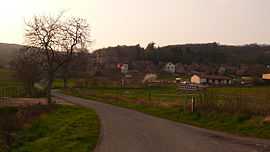
Burnand is a commune in the Saône-et-Loire department in the region of Bourgogne in eastern France.
See also
- Communes of the Saône-et-Loire department
References
| Wikimedia Commons has media related to Burnand. |