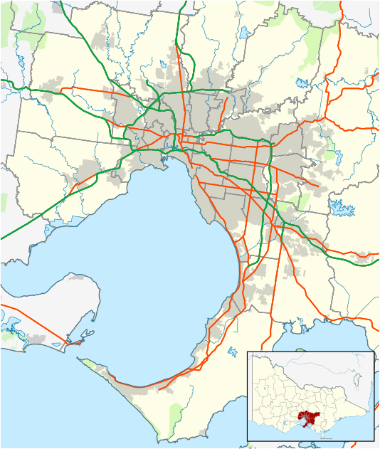
Bundoora, Victoria
| Bundoora Melbourne, Victoria | |||||||||||||
|---|---|---|---|---|---|---|---|---|---|---|---|---|---|
|
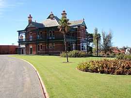
Historic Bundoora Homestead and Art Gallery | |||||||||||||
 Bundoora | |||||||||||||
| Coordinates | 37°41′42″S 145°03′50″E / 37.695°S 145.064°ECoordinates: 37°41′42″S 145°03′50″E / 37.695°S 145.064°E | ||||||||||||
| Population | 25,709 (2011 census)[1] | ||||||||||||
| • Density | 1,710/km2 (4,440/sq mi) | ||||||||||||
| Postcode(s) | 3083 | ||||||||||||
| Area | 15 km2 (5.8 sq mi) | ||||||||||||
| Location | 16 km (10 mi) from Melbourne | ||||||||||||
| LGA(s) | |||||||||||||
| State electorate(s) | Bundoora | ||||||||||||
| Federal Division(s) | |||||||||||||
| |||||||||||||
Bundoora is a suburb of Melbourne, Victoria, Australia, 16 km north from Melbourne's Central Business District.[2] Its local government areas are the Cities of Banyule, Darebin and Whittlesea. At the 2011 Census, Bundoora had a population of 25,709.
Bundoora is the headquarters of La Trobe University, Bundoora Campus. Royal Melbourne Institute of Technology (RMIT) also has a campus situated in Bundoora.
The word Bundoora is derived from "Kelbundoora", the name of a 19th-century Wurundjeri tribesman.[3]
History
Bundoora Post Office opened on 1 October 1863.[4]
Geography
Bundoora is home to Mount Cooper. Mount Cooper is located within Bundoora Park, a large (180 ha) public park. Often claimed to be metropolitan Melbournes highest point.
Bundoora is situated on the traditional lands of the Wurundjeri people, and the name "Bundoora" is derived from "Kelbundoora", the name of a 19th-century Wurundjeri man.[3]
Demographics
The most common ancestries in Bundoora were Australian 16.4%, English 15.1%, Italian 10.7%, Chinese 9.1% and Irish 5.8%.
58.6% of people were born in Australia. The most common countries of birth were China (excludes SARs and Taiwan) 7.1%, Italy 3.0%, India 2.3%, Greece 2.2% and the Republic of Macedonia 2.0%.
Local sites
- Big Daddys, a well-known pizza establishment, originated in Bundoora, and was the protagonist in the Melbourne $5 Pizza Wars of the early 2000s. It has now been bought-out by the Pizza franchise Domino's.
- Although, technically in Thomastown, the Bundoora All-Weather Market was until recently a major Melbourne market. This market has been demolished and replaced by a homemaker centre.
- Greensborough Lanes is a bowling alley that, despite its name, is located in Bundoora.
- University Hill is a business park home to the Australian Headquarters of Continental AG and Bundoora BMW] with many others and a Hotel to serve visitors to the area.
- Brand Junction, a DFO-styled discount shopping mall, was opened at University Hill in November 2008. It is now known as UHFO featuring brands such as Nike, Converse, Witchery, Country Road, Mimco, Sheridan and many in between.
- St. Damian's Primary School – A co-ed Roman Catholic primary school.
Education
- RMIT University's Bundoora West Campus is located at the terminus of the tramline. Further down the road is the East Campus area, home of RMIT's Wind Tunnel. It is also home of the RMIT University Sports Statistics Research Group.
- La Trobe University On 12 July 2007, Australia’s first campus-based Microsoft Centre that brings together cutting edge hardware and software, opened at La Trobe University.
- Bundoora Secondary College is a coeducational public secondary school.
- Parade College is a Catholic independent secondary school for boys .
- Loyola College is a Catholic independent secondary school in the Ignation tradition, bordering Bundoora and Watsonia.
- The Concord School for students with additional learning needs.
- Northside Christian College
- Norris Bank Primary School
- Bundoora Primary School
- St Damians Primary School
Healthcare
- [Northpark Private Hospital] contributes to the provision of a broad range of specialist in-patient, day-patient and out-patient services. These services encompass surgical, medical, mental health, maternity, nursery care and mother baby services.
- [ Bundoora Extended Care Centre] Part of the Northern Health Network. A sub acute hospital providing medical care for over 100 inpatients and community outpatients.
- [Latrobe Private Hospital] is a 53 bed modern facility. The hospital provides specialist care for patients with medical and surgical needs including day surgery.
Transport
Bundoora is the terminus of tram route 86. The line was completed in 1986. The last W2 class tram ran along this route in mid-1987. The closest train station is Watsonia on the Hurstbridge line.
The Western Ring Road Trail and Darebin Creek Trail provides facilities for recreational and commuting cyclists.
Throughout Bundoora buses offer transport to the surrounding area. From the Latrobe University bus link on Plenty Road there is access to many suburbs throughout Melbourne, even connecting the north to the south. On a weekend the the Nightrider has services running through Bundoora for late night travel.
Sport
Bundoora has a football team competing in the Northern Football League.[5]
Golfers play at the Bundoora Park Public Course on Plenty Road,[6] at the course of the Strathallan Golf Club on Main Drive[7] or at the course of the Kings Park Golf Club on Plenty Road.[8]
Bundoora is also home to the Bundoora Brumbies Baseball Club, the club competes in the Melbourne Winter Baseball League in B and D grade division with reserves teams in both B reserve and D reserve. The club also has a Women's team that competes in the Baseball Victoria Summer League Women's section.
Notable residents
- Pseudo Echo an Australian Pop music band
- Peter Helliar comedian
- Clinton McKay, Australian cricketer
- Australian performer Gotye studied at Parade College
See also
- City of Preston - A former Local Government Area which Bundoora was a part of.
- Shire of Diamond Valley - A former Local Government Area which Bundoora was a part of.
- Electoral district of Bundoora
References
- ↑ Australian Bureau of Statistics (31 October 2012). "Bundoora (State Suburb)". 2011 Census QuickStats. Retrieved 2012-06-23.
- ↑ http://www.postcodes-australia.com/areas/vic/preston/bundoora
- ↑ 3.0 3.1 http://www.darebin.vic.gov.au/Files/language_aboriginal.PDF
- ↑ Premier Postal History, Post Office List, retrieved 2008-04-11
- ↑ Full Points Footy, Bundoora, retrieved 2009-04-15
- ↑ Golf Select, Bundoora Park, retrieved 2009-05-11
- ↑ Golf Select, Strathallan, retrieved 2009-05-11
- ↑ Golf Select, Kings Park, retrieved 2009-05-11