Bukit Larut
| Bukit Larut Maxwell Hill | |
|---|---|
|
Elevation of 1036 metres at the Land Rover station | |
| Coordinates: 4°51′44.28″N 100°47′34.8″E / 4.8623000°N 100.793000°ECoordinates: 4°51′44.28″N 100°47′34.8″E / 4.8623000°N 100.793000°E | |
| Country |
|
| State |
|
| District | Taiping |
| Founded | 1884 |
| Elevation | 1,250 m (4,100 ft) |
| Time zone | MST (UTC+8) |
Bukit Larut, formerly known as Maxwell Hill (but still often referred to by its latter name), is a hill resort located 10 km from Taiping, Perak, Malaysia. Founded in 1884, it is the oldest hill resort in Malaysia.[1][2] It is approximately 1250 m above sea level. Bukit Larut receives the highest rainfall in Malaysia because it is located in the wettest part of the country.[3]
Maxwell Hill was named after William George Maxwell, who was the British Assistant Resident in Perak.[4]
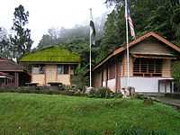
Not as developed as other hill resorts such as the Genting Highlands and Cameron Highlands, Bukit Larut retains a colonial atmosphere with its quaint bungalows and English gardens.
Access is available only by (government owned) resort authority's Land Rovers (private vehicles are not allowed without a permit) although people are free to walk up the hill as many do for exercise (reaching the peak can take up to 3–5 hours). The journey, 13 kilometres from the base to the top of Bukit Larut using Land Rovers take around 30 minutes. Maxwell Hill still retains its colonial origins with its old bungalows and gardens. This hill is ideal for birdwatchers and nature lovers, as the area provides a welcoming environment for the local wildlife.
Climate
Temperature at Maxwell Hill is between 15 and 25 °C and can drop to 10 °C at night.
Bukit Larut is one of the wettest place in Malaysia with heavy rainfall all year round that can reach up to more than 4,000 mm (160 in) yearly.
Comparison Bukit Larut annual mean rainfall with other places in Malaysia can be refer in Annual Mean Rainfall Location In Malaysia 2013
| Climate data for Bukit Larut Precipitation In 2013 (Mean Rainfall : 2006-2012) | |||||||||||||
|---|---|---|---|---|---|---|---|---|---|---|---|---|---|
| Month | Jan | Feb | Mar | Apr | May | Jun | Jul | Aug | Sep | Oct | Nov | Dec | Year |
| Average precipitation mm (inches) | 235 (9.25) |
270 (10.63) |
134 (5.28) |
369 (14.53) |
568 (22.36) |
236 (9.29) |
124 (4.88) |
459 (18.07) |
374 (14.72) |
518 (20.39) |
179 (7.05) |
150 (5.91) |
3,616 (142.36) |
| Average rainfall mm (inches) | 232.7 (9.161) |
184.2 (7.252) |
363.5 (14.311) |
349 (13.74) |
432.5 (17.028) |
297.7 (11.72) |
299 (11.77) |
438.8 (17.276) |
385.5 (15.177) |
398.6 (15.693) |
495.8 (19.52) |
299.2 (11.78) |
4,176.5 (164.428) |
| Source: Department Of Irrigation & Drainage Malaysia | |||||||||||||
| Climate data for Bukit Larut Precipitation In 2012 | |||||||||||||
|---|---|---|---|---|---|---|---|---|---|---|---|---|---|
| Month | Jan | Feb | Mar | Apr | May | Jun | Jul | Aug | Sep | Oct | Nov | Dec | Year |
| Average precipitation mm (inches) | 135 (5.31) |
293 (11.54) |
569 (22.4) |
581 (22.87) |
482 (18.98) |
311 (12.24) |
221 (8.7) |
325 (12.8) |
528 (20.79) |
456 (17.95) |
671 (26.42) |
380 (14.96) |
4,952 (194.96) |
| Source: Department Of Irrigation & Drainage Malaysia | |||||||||||||
| Climate data for Bukit Larut Precipitation In 2011 | |||||||||||||
|---|---|---|---|---|---|---|---|---|---|---|---|---|---|
| Month | Jan | Feb | Mar | Apr | May | Jun | Jul | Aug | Sep | Oct | Nov | Dec | Year |
| Average precipitation mm (inches) | 175 (6.89) |
285 (11.22) |
542 (21.34) |
486 (19.13) |
547 (21.54) |
268 (10.55) |
232 (9.13) |
515 (20.28) |
386 (15.2) |
374 (14.72) |
519.5 (20.453) |
321 (12.64) |
4,650.5 (183.091) |
| Source: Department Of Irrigation & Drainage Malaysia | |||||||||||||
| Climate data for Bukit Larut Precipitation In 2010 | |||||||||||||
|---|---|---|---|---|---|---|---|---|---|---|---|---|---|
| Month | Jan | Feb | Mar | Apr | May | Jun | Jul | Aug | Sep | Oct | Nov | Dec | Year |
| Average precipitation mm (inches) | 290 (11.42) |
120 (4.72) |
150 (5.91) |
147 (5.79) |
216 (8.5) |
393 (15.47) |
407 (16.02) |
475 (18.7) |
350 (13.78) |
124 (4.88) |
534 (21.02) |
407 (16.02) |
3,613 (142.23) |
| Source: Department Of Irrigation & Drainage Malaysia | |||||||||||||
| Climate data for Bukit Larut Precipitation In 2009 | |||||||||||||
|---|---|---|---|---|---|---|---|---|---|---|---|---|---|
| Month | Jan | Feb | Mar | Apr | May | Jun | Jul | Aug | Sep | Oct | Nov | Dec | Year |
| Average precipitation mm (inches) | 296 (11.65) |
93 (3.66) |
646 (25.43) |
152 (5.98) |
489 (19.25) |
377 (14.84) |
421 (16.57) |
377 (14.84) |
567 (22.32) |
635 (25) |
360 (14.17) |
126 (4.96) |
4,539 (178.67) |
| Source: Department Of Irrigation & Drainage Malaysia | |||||||||||||
| Climate data for Bukit Larut Precipitation In 2008 | |||||||||||||
|---|---|---|---|---|---|---|---|---|---|---|---|---|---|
| Month | Jan | Feb | Mar | Apr | May | Jun | Jul | Aug | Sep | Oct | Nov | Dec | Year |
| Average precipitation mm (inches) | 230 (9.06) |
138 (5.43) |
196 (7.72) |
283 (11.14) |
300 (11.81) |
170 (6.69) |
470 (18.5) |
616 (24.25) |
233 (9.17) |
254 (10) |
647 (25.47) |
452 (17.8) |
3,989 (157.04) |
| Source: Department Of Irrigation & Drainage Malaysia | |||||||||||||
Attraction
Unlike more developed hills in Malaysia, Bukit Larut has remained pretty much as it was years ago, hence it’s low impact on tourism. Up on the peak, the cool weather is a welcome to many visitors mostly nature lovers and birdwatchers. The appeal of the resort lies in its untouched beauty, embellished with flowers, birds and tree ferns.
There are many jungle trails and one of the popular one is the Gunung Hijau trail. This trail leads to the peak of Gunung Hijau at 1,449 m above sea level. Along the way, one will be able to see many species of birds, the vantage view of Taiping town, the exotic wild orchids, ferns and other flora and fauna.
A few metres below Bukit Larut Rest House is a playground. Nearby it lies a bridge that leads to a watch tower, from where one can have a beautiful view of Taiping. On a clear day, one can even see the coastline all the way from Pangkor Island to Penang.
Tulip cultivation began in 2009 and was then abandoned by 2012

|
|
Cottages
The cottages on Maxwell Hill all carry their own personalities and names. Each cottage had its name relating to their owner or style. Today most of these names have been localised. Sadly some of these cottages are in various stages of deterioration and in need of restoration.
Permai View
This bungalow is located at 1034m above sea level.
| Permai View | ||||||
|---|---|---|---|---|---|---|
|
Beringin
Formerly known as Watson's Rest House. Located at 1036 m above sea level, it is one of the better maintained bungalows on Maxwell Hill. It consists of a living room, dining area, two bedrooms and two bathrooms.
| Beringin | ||||||||||||
|---|---|---|---|---|---|---|---|---|---|---|---|---|
|
Rumah Rehat Bukit Larut
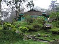
Formerly known as Maxwell Hill Rest House. Located at 1036 m above sea level. The building underwent major renovation in 2010. Unfortunately not much care was taken and as of 2012, the condition of the building started to deteriorate.
| Rumah Rehat Bukit Larut | ||
|---|---|---|
|
Angkasa
Built in 1906, it was formerly known as The Federal Bungalows. Located at 1036 m above sea level and is rented out only to VIPs.
| Angkasa | ||||
|---|---|---|---|---|
|
Rumah Rehat Gunung Hijau
Formerly known as Speedy's Chalet. Located at 1113 m above sea level.
| Rumah Rehat Gunung Hijau | ||||||
|---|---|---|---|---|---|---|
|
Cendana
Formerly known as The Hut. Located at 1128 m above sea level. It was build it 1889 at a cost of RM2000. It is the only bungalow with a cafeteria - the only operational cafeteria on Maxwell Hill as of 2012.
| Cendana | ||
|---|---|---|
|
Tempinis
Formerly known as Treacher. Located at 1143 m above sea level.
The Nest
The Nest is the only private-owned residence on Maxwell Hill. It was built in 1920 to serve the needs of Methodist Church members, especially the Caucasian missionaries and their families. In 1990, it was closed down because of maintenance costs and other problems. Later the bungalow was renovated and furnished at a cost of RM200,000. It can accommodate a total of 35 persons in six rooms.
Sri Kayangan
Formerly known as The Box. Located at 1242 m above sea level. It was previously the official bungalow for the Sultan of Perak.
Miscellaneous Buildings
A few buildings are left abandoned. Some of their origins are unknown.
| Miscellaneous Buildings | ||||||||||||||
|---|---|---|---|---|---|---|---|---|---|---|---|---|---|---|
|
Sri Maha Kaliamman Temple
The construction of this temple was laid by brothers Mr. Rama Pillay and Mr. Kochdai Pillay who came from South India to work as supervisors here. The temple was believed to be built around the 1890s and is about 120 years old. Later on during the 1900s more Indian workers worked and stayed in Bukit Larut. As the Indian community there was mostly Hindus, they needed a Hindu Temple to pray and carry out religious activities at that time. As such, the British gave them a plot of land to build a Hindu Temple. They were given their basic amenities. At first the Indians there built a small temple with the permission and help of the British. Gradually the British assisted them to build a bigger temple. Most of the materials used were the remaining ones from the construction of the bungalows and rest houses. The British also provided a small building as a nursery for the workers children beside the temple.
This temple was the first to be built on the oldest Hill Resort in Malaysia. The main granite deity Kaliamman (inner sanctum) of temple is about 70 years old. The temple stands on a 2 acre land.
There is a shrine dedicated to Lord Ayyappan right beside the temple.
History
Not long after the murder of British Resident J. W. W.Birch in 1875, William Edward Maxwell was appointed as Assistant Resident of Perak. Maxwell was a distinguished Malay scholar, whom unlike his peers was well versed with the customs and sensitivities of the locals. His timely promotion was initiated to sooth the displeasure among Malays and Chinamen in the Larut area brought on by the rather insensitive Birch. He lived and worked in the Larut area.
At that time, the British were looking for a hill retreat away from the tropical heat for its senior officers. Several hill stations were proposed, including Gunung Angsi in Negri Sembilan, Bukit Kutu in Selangor and Gunung Kledang in Perak, none of which served the purpose adequately. After much search, Maxwell discovered that there’s a hill right at his doorstep, within Larut district that has so far missed his consideration.
The Larut ridge was narrow and the difficulty was the steep climb to the summit. At 1250m above sea level and 13km from the base of the hill, it was a wonder that the idea of a hill station could have been developed here. It did and by the 1880s, adventurers and famous writers like Isabella Bird and Ambrose Rathborne had the pleasure of visiting the hill. However, in the early years, the road to the peak was really more a rough track. Visitors had a choice of walking, taking a pony trek, or be carried on a sedan chair.
It wasn’t until the mid-1940s that the tarmac road was built and made suitable for vehicles. That was during World War II, when Taiping was declared the administrative center for Perak and Indonesia by the occupying Japanese forces. The Japanese official made Maxwell Hill his residency. He forced the prisoners of war to build the road up the hill. Although the road was only opened in 1948, three years after the Japanese’ surrender, much of it was built through the sweat, blood and lives of ragged prisoners of war. First British Resident, J.W.W. Birch’s bungalow known as The Cottage is located at 1,376m above sea level. This bungalow was built in 1884 and not opened to public because the location was too close to the telecommunication station. The Tea Garden was developed in 1887, and Assam Tea, the earlier tea from Ceylon was planted here before being replanted in Cameron Highlands after the project failed.
A number of economic activities were carried out during the colonial times. Ninety percent of the activities were carried out by Indian labourers who came from India. They were involved in tea, vegetable and flower cultivation, cattle rearing and also in the transportation and construction sectors. They also worked as security guards and general workers in the bungalows and rest houses. As such Bukit Larut was called as The First Indian Style Hill Station at one time. It was estimated that around 120 Indian families stayed in Bukit Larut during the 1900s. The British provided quarters for them.
W.J.G. Warbeck British officer served as overseer of botanical gardens, streets and public buildings at Maxwell Hill in 1883. Maxwell Hill was gazetted as a Permanent Forest Reserve in 1910. The name Maxwell Hill was changed to Bukit Larut in 1979.
Contradictions and unknown origin
J.W.W. Birch is said to have reached the top of the hill in 1875, as indicated on a commemorative stone found on Birch Hill, which is located 2.5km above the top of Maxwell Hill. Although the engraving states “THE FIRST ENGLISHMAN TO CLIMB THIS HILL WAS MR T.W.W. Birch , FIRST BRITISH RESIDENT OF PERAK IN 1875” It is believed that there was an engraving mistake as the first British resident of Perak was J.W.W Birch and not T.W.W. Birch.
If in fact, J.W.W. Birch was the first to discover the hill, why did William Edward Maxwell search far for a hill station when there was one discovered by Birch? There are arguments that Birch could not have climbed the hill in 1875, because that is the year of his assassination, but Birch was killed in November 1875 and the month of his climb is unknown.
It is believed that Birch Hill is the upper heights of Maxwell Hill.
Media
Bukit Larut has TV and radio transmitter that covers Taiping, North Perak, South Penang, and even South Kedah.
TV
- TV1 - Channel 43
- TV2 - Channel 47
- TV3 - Channel 41
- ntv7- Channel 31
Radio
- 89.3 MHz- Lite FM
- 90.5 MHz- Hot FM
- 91.3 MHz- Mix FM
- 91.7 MHz- Suria FM
- 93.6 MHz- hitz.fm
- 95.2 MHz- ERA FM
- 96.4 MHz- SINAR FM
- 98.2 MHz- Red FM (ended of transmission since May 2009)
- 100.2 MHz- MY FM
- 101.0 MHz- 988 FM
- 102.1 MHz- THR.FM (Raaga)
- 103.3 MHz- Radio Klasik
- 104.1 MHz- Perak FM
- 104.9 MHz- Melody FM
- 105.3 MHz- Traxx FM
- 106.1 MHz- Ai FM
- 107.1 MHz- Nasional FM
- 107.9 MHz- Minnal FM
References
- ↑ Orientations Published by Pacific Communications Ltd., 1977; Item notes: v.8 1977
- ↑ China By Damian Harper Published by Lonely Planet, 2007; ISBN 1-74059-357-X, ISBN 978-1-74059-357-1
- ↑ Malaysia Handbook: The Travel Guide By Joshua Eliot, Jane Bickersteth Published by Footprint Travel Guides, 2002; ISBN 1-903471-27-3, ISBN 978-1-903471-27-2
- ↑ Malaysia, Singapore and Brunei By Charles De Ledesma, Mark Lewis, Pauline Savage, Rough Guides (Firm) Published by Rough Guides, 2003; ISBN 1-84353-094-5, ISBN 978-1-84353-094-7
External links
| Wikimedia Commons has media related to Bukit Larut. |
| ||||||

