Bugojno
| Bugojno | |
|---|---|
| Municipality and town | |
.jpg) | |
 Location of Bugojno within Bosnia and Herzegovina. | |
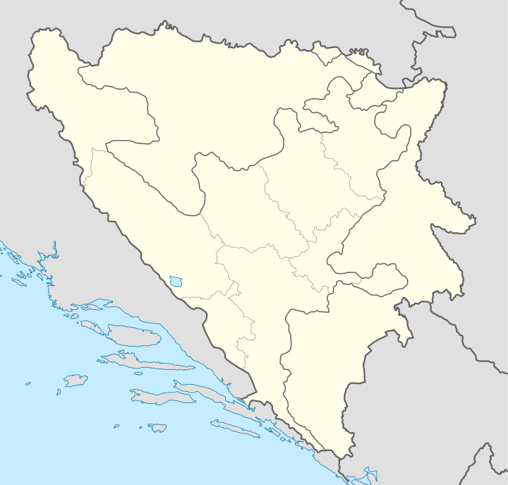 Bugojno Location of Bugojno | |
| Coordinates: 44°03′N 17°27′E / 44.050°N 17.450°ECoordinates: 44°03′N 17°27′E / 44.050°N 17.450°E | |
| Country | Bosnia and Herzegovina |
| Government | |
| • Municipality president | Hasan Ajkunić (SDA) |
| Area | |
| • Total | 361 km2 (139 sq mi) |
| Population (2013[1]) | |
| • Total | 34,559 |
| • Density | 96/km2 (250/sq mi) |
| Time zone | CET (UTC+1) |
| • Summer (DST) | CEST (UTC+2) |
| Area code(s) | +387 30 |
| Website | Official Website |
Bugojno is a town and municipality in central Bosnia and Herzegovina on the river Vrbas. It is located in the Central Bosnia Canton of the Federation of Bosnia and Herzegovina entity. The town is 130 km (81 mi) to the northwest from Sarajevo, with an estimated population of 50,000 (as of July 2007).
To the west towards Kupres is a region called Koprivica. This enormous forest was once one of Tito's (the president of former Yugoslavia) favorite hunting spots. The dense forest and lack of any human settlements have created a sanctuary for bears, wolves, deer, boar and a plethora of other wild animals. Hunting associations are very active in this region and there are many mountain and hunting lodges dotting the forest. Duboka Valley (deep valley) is a designated hunting area covered by thick spruce. Kalin Mountain is a popular weekend area for hikers and nature lovers.
Geography
The municipality of Bugojno has an average elevation of 570 meters above sea level. Much of its 366 km2 is forested. The terrain is mountainous with several prominent features. Stozer (1662m), Kalin (1,530m) and Rudina (1,385m) are the tallest mountains in Bugojno.
Demographics
Municipality
| Ethnic Composition | |||||||||||||
| Year | Serbs | % | Bosniaks | % | Croats | % | Yugoslavs | % | Others | % | Total | ||
|---|---|---|---|---|---|---|---|---|---|---|---|---|---|
| 1961 | 5,212 | 21.61% | 7,194 | 29.83% | 9,682 | 40.15% | 1,871 | 7.76% | 155 | 0.64% | 24,114 | ||
| 1971 | 6,295 | 19.76% | 13,050 | 40.96% | 12.040 | 37.79% | 197 | 0.61% | 274 | 0.88% | 31,856 | ||
| 1981 | 7,458 | 18.65% | 16,214 | 40.56% | 14,187 | 35.49% | 1,731 | 4.33% | 379 | 0.97% | 39,969 | ||
| 1991 | 8,673 | 18.50% | 19,697 | 42.01% | 16,031 | 34.19% | 1,561 | 3.33% | 927 | 1.98% | 46,889 | ||
Town Itself
In 1991 town of Bugojno had a population of 22, 641 including;
Economy
Bugojno was once a major industrial center in Bosnia and Herzegovina. In 1981, Bugujno's GDP per capita was 98% of the Yugoslav average.[2] However, hardships caused by the war in Bosnia and Herzegovina took a toll on the industry of Bugojno. Forestry has always been an important contributor to the local economy. Winter tourism has emerged in recent years.
Gallery
-

Center of the city
-

Center of the city
-

High school
-

Ski lift Rostovo
-
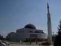
Princess Gevher mosque
-

Princess Gevher mosque
-

Sultan Ahmed mosque, 1693
-

Sultan Ahmed mosque, 1693
-

Sultan Ahmed mosque, 1693
-

Sultan Ahmed mosque, 1693
-

Sultan Ahmed mosque, 1693
-

Catholic church of Saint Anthony of Padua
-

Catholic church of Saint Anthony of Padua
-

Catholic church of Saint Anthony of Padua and Princess Gevher mosque in background
-

Catholic church of Saint Anthony of Padua
References
- ↑ http://www.bhas.ba/obavjestenja/Preliminarni_rezultati_bos.pdf
- ↑ Radovinović, Radovan; Bertić, Ivan, eds. (1984). Atlas svijeta: Novi pogled na Zemlju (in Croatian) (3rd ed.). Zagreb: Sveučilišna naklada Liber.
External links
| ||||||||
| Wikimedia Commons has media related to Bugojno. |