Buchanan Township, Atchison County, Missouri
| Buchanan Township | |
|---|---|
| Township | |
 | |
| Coordinates: 40°32′26″N 095°37′16″W / 40.54056°N 95.62111°WCoordinates: 40°32′26″N 095°37′16″W / 40.54056°N 95.62111°W | |
| Country | United States |
| State | Missouri |
| County | Atchison |
| Area | |
| • Total | 42.02 sq mi (108.84 km2) |
| • Land | 41.25 sq mi (106.84 km2) |
| • Water | 0.77 sq mi (2.00 km2) 1.84% |
| Elevation[1] | 909 ft (277 m) |
| Population (2010) | |
| • Total | 83 |
| • Density | 2/sq mi (0.8/km2) |
| FIPS code | 29-09244[2] |
| GNIS feature ID | 0766231 |
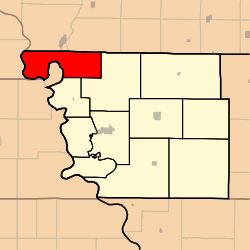
Buchanan Township is one of eleven townships in Atchison County, Missouri, United States. As of the 2010 census, its population was 83.[3] The northwest corner of the township is the northwest corner of the entire state.
Geography
Buchanan Township covers an area of 41.7 square miles (108.0 km2) and contains no incorporated settlements. Buchanan Township has one cemetery: Union. Greys Lake is within this township.
References
- ↑ "US Board on Geographic Names". United States Geological Survey. 2007-10-25. Retrieved 2008-01-31.
- ↑ "American FactFinder". United States Census Bureau. Retrieved 2008-01-31.
- ↑ "Geographic Identifiers: 2010 Demographic Profile Data (G001): Buchanan township, Atchison County, Missouri". U.S. Census Bureau, American Factfinder. Retrieved June 25, 2013.
External links
| |||||||||||||||||||||||||||||
