Buchanan, Oregon
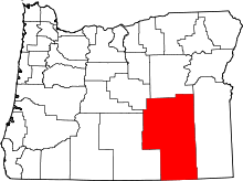
Buchanan is an unincorporated community in Harney County, Oregon, United States.[1] It is located about 20 miles east of Burns on U.S. Route 20.[2]
The community was named after the family of William D. Buchanan, who, with his sons Joe and George, homesteaded there beginning in 1886.[3][4][5] Buchanan post office was established in 1911, with Hattie E. Buchanan the first postmaster.[3] The office closed in 1919 but the area around the Buchanan Ranch is still known as Buchanan.[3] By 1978 the community had a single store.[6] Today Buchanan has a Burns mailing address and a business that includes a tractor repair shop, gas station, gallery, and free museum,[7] all located within the only building in the community.[8]
The school once stood along Little Rock Creek on the site of the present-day Buchanan Springs Rest Area on U.S. 20, a mile northeast of the community.[1][4]
Transportation
William Buchanan and his sons ran a stage stop at the top of the hill, north of the present-day Buchanan, on the former J. W. Buchanan ranch.[4] The stop served the route from Vale to Burns.[5] Meals for stagecoach passengers were fifty cents, while those traveling with horses only paid thirty-five cents, but they paid twenty-five cents per head for feed and water for their livestock.[4] The stop was later run by Thomas Buchanan.[5]
Today Buchanan is a stop on the Eastern Point intercity bus line between Bend and Ontario.[9]
References
- ↑ 1.0 1.1 "Buchanan". Geographic Names Information System. United States Geological Survey. November 28, 1980. Retrieved July 24, 2011.
- ↑ Oregon Atlas & Gazetteer (7th ed.). Yarmouth, Maine: DeLorme. 2008. p. 82. ISBN 0-89933-347-8.
- ↑ 3.0 3.1 3.2 McArthur, Lewis A.; McArthur, Lewis L. (2003) [First published 1928]. Oregon Geographic Names (7th ed.). Portland, Oregon: Oregon Historical Society Press. ISBN 9780875952772. OCLC 53075956.
- ↑ 4.0 4.1 4.2 4.3 "Buchanan Rural Community: A Brief History". Harney County Economic Development. Retrieved July 24, 2011.
- ↑ 5.0 5.1 5.2 Writers' Program of the Work Projects Administration in the State of Oregon (1940). Oregon: End of the Trail. American Guide Series. Portland, Oregon: Binfords & Mort. p. 468. OCLC 4874569.
- ↑ Friedman, Ralph (1978). "Great Basin Blues". Tracking Down Oregon. Caldwell, Idaho: The Caxton Printers, Ltd. p. 259. ISBN 0-87004-257-2.
- ↑ "Oard's Indian Art Museum". Travel Oregon. Retrieved July 24, 2011.
- ↑ Hays, Jim (August 7, 2010). "U.S. 20: Route crosses the Cascades and heads east". The Oregonian. Retrieved July 30, 2011.
- ↑ "Eastern Point Schedule". TAC Transportation. Retrieved July 24, 2011.
External links
- Images of Buchanan from Flickr
- Images of Buchanan from Waymarking.com
Coordinates: 43°38′33″N 118°37′43″W / 43.642378°N 118.628539°W
| |||||||||||||||||||||||||||||