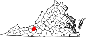
Brush Harbor, Virginia
| Brush Harbor, Virginia | |
|---|---|
| Unincorporated community | |
 Brush Harbor, Virginia | |
| Coordinates: 37°11′03″N 80°17′27″W / 37.18417°N 80.29083°WCoordinates: 37°11′03″N 80°17′27″W / 37.18417°N 80.29083°W | |
| Country | United States |
| State | Virginia |
| County | Montgomery |
| Elevation | 1,699 ft (518 m) |
| Time zone | Eastern (EST) (UTC-5) |
| • Summer (DST) | EDT (UTC-4) |
| Area code(s) | 540 |
| GNIS feature ID | 1495316[1] |
Brush Harbor is an unincorporated community in Montgomery County, Virginia, United States. Brush Harbor is located along State Route 636 7.5 miles (12.1 km) east-northeast of Christiansburg.
The Nealy Gordon Farm was listed on the National Register of Historic Places in 1989.[2]
References
- ↑ "Brush Harbor". Geographic Names Information System. United States Geological Survey.
- ↑ "National Register Information System". National Register of Historic Places. National Park Service. 2010-07-09.
| |||||||||||||||||||||||||
