Brugheas
| Brugheas | |
|---|---|
|
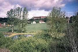
A general view of Brugheas | |
 Brugheas | |
|
Location within Auvergne region  Brugheas | |
| Coordinates: 46°04′39″N 3°22′07″E / 46.0775°N 3.3686°ECoordinates: 46°04′39″N 3°22′07″E / 46.0775°N 3.3686°E | |
| Country | France |
| Region | Auvergne |
| Department | Allier |
| Arrondissement | Vichy |
| Canton | Escurolles |
| Intercommunality | Vichy Val d'Allier |
| Government | |
| • Mayor (2014–2020) | Guy Soalhat |
| Area1 | 26.81 km2 (10.35 sq mi) |
| Population (2011)2 | 1,377 |
| • Density | 51/km2 (130/sq mi) |
| INSEE/Postal code | 03044 / 03700 |
| Elevation |
269–383 m (883–1,257 ft) (avg. 350 m or 1,150 ft) |
|
1 French Land Register data, which excludes lakes, ponds, glaciers > 1 km² (0.386 sq mi or 247 acres) and river estuaries. 2 Population without double counting: residents of multiple communes (e.g., students and military personnel) only counted once. | |
Brugheas is a commune in the Allier department in central France.
Population
| Historical population | ||
|---|---|---|
| Year | Pop. | ±% |
| 1793 | 1,310 | — |
| 1800 | 1,600 | +22.1% |
| 1806 | 1,495 | −6.6% |
| 1821 | 1,766 | +18.1% |
| 1831 | 1,828 | +3.5% |
| 1836 | 1,803 | −1.4% |
| 1841 | 1,759 | −2.4% |
| 1846 | 1,827 | +3.9% |
| 1851 | 1,871 | +2.4% |
| 1856 | 1,741 | −6.9% |
| 1861 | 1,710 | −1.8% |
| 1866 | 1,669 | −2.4% |
| 1872 | 1,622 | −2.8% |
| 1876 | 1,686 | +3.9% |
| 1881 | 1,636 | −3.0% |
| 1886 | 1,560 | −4.6% |
| 1891 | 1,462 | −6.3% |
| 1896 | 1,464 | +0.1% |
| 1901 | 1,325 | −9.5% |
| 1906 | 1,275 | −3.8% |
| 1911 | 1,255 | −1.6% |
| 1921 | 1,042 | −17.0% |
| 1926 | 1,080 | +3.6% |
| 1931 | 1,071 | −0.8% |
| 1936 | 1,005 | −6.2% |
| 1946 | 910 | −9.5% |
| 1954 | 1,005 | +10.4% |
| 1962 | 1,012 | +0.7% |
| 1968 | 1,012 | +0.0% |
| 1975 | 1,096 | +8.3% |
| 1982 | 1,200 | +9.5% |
| 1990 | 1,213 | +1.1% |
| 1999 | 1,223 | +0.8% |
| 2008 | 1,311 | +7.2% |
| 2011 | 1,377 | +5.0% |
See also
References
| Wikimedia Commons has media related to Brugheas. |
