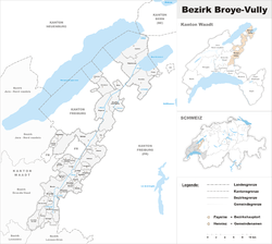
Broye-Vully District
| Broye-Vully District District de la Broye-Vully | |
|---|---|
| District | |
 | |
| Country |
|
| Canton |
|
| Capital | Payerne |
| Area | |
| • Total | 264.98 km2 (102.31 sq mi) |
| Population (2013) | |
| • Total | 39,868 |
| • Density | 150/km2 (390/sq mi) |
| Time zone | CET (UTC+1) |
| • Summer (DST) | CEST (UTC+2) |
| Municipalities | 37 |
Broye-Vully District (French: District de la Broye-Vully) is a district in Vaud Canton in Switzerland.
Geography
Broye-Vully has an area, as of 2009, of 264.99 square kilometers (102.31 sq mi). Of this area, 173.61 km2 (67.03 sq mi) or 65.5% is used for agricultural purposes, while 56.85 km2 (21.95 sq mi) or 21.5% is forested. Of the rest of the land, 29.29 km2 (11.31 sq mi) or 11.1% is settled (buildings or roads) and 5.19 km2 (2.00 sq mi) or 2.0% is unproductive land.[1]
Demographics
Broye-Vully has a population (as of December 2013) of 39,868.[2]
In 2008 there were 280 live births to Swiss citizens and 116 births to non-Swiss citizens, and in same time span there were 277 deaths of Swiss citizens and 19 non-Swiss citizen deaths. Ignoring immigration and emigration, the population of Swiss citizens increased by 3 while the foreign population increased by 97. There were 41 Swiss men and 62 Swiss women who immigrated back to Switzerland. At the same time, there were 263 non-Swiss men and 274 non-Swiss women who immigrated from another country to Switzerland. The total Swiss population change in 2008 (from all sources, including moves across municipal borders) was an increase of 382 and the non-Swiss population increased by 442 people. This represents a population growth rate of 2.4%.[3]
The age distribution in Broye-Vully, as of 2009, was as follows:[4]
| Age bracket | Population | Fraction of total |
|---|---|---|
| 0–9 | 3,883 | 11.0% |
| 10–19 | 4,583 | 13.0% |
| 20–29 | 4,261 | 12.1% |
| 30–39 | 4,636 | 13.1% |
| 40–49 | 5,714 | 16.2% |
| 50–59 | 4,531 | 12.8% |
| 60–69 | 3,666 | 10.4% |
| 70–79 | 2,350 | 6.7% |
| 80–89 | 1,404 | 4.0% |
| 90–up | 235 | 0.7% |
Mergers and name changes
On 1 September 2006, the Avenches district (District d'Avenches), Moudon district (District de Moudon), (District d'Oron) and Payerne district (District de Payerne) were all dissolved and merged into the Broye-Vully district.
- The municipalities of Avenches, Bellerive (VD), Chabrey, Constantine, Cudrefin, Faoug, Montmagny, Mur, Oleyres, Vallamand and Villars-le-Grand came from the Avenches district.
- The municipalities of Brenles, Bussy-sur-Moudon, Chavannes-sur-Moudon, Chesalles-sur-Moudon, Cremin, Curtilles, Dompierre, Forel-sur-Lucens, Hermenches, Lovatens, Lucens, Moudon, Oulens-sur-Lucens, Prévonloup, Rossenges, Sarzens, Syens, Villars-le-Comte and Vucherens came from the Moudon district (District de Moudon).
- The municipalities of Carrouge, Corcelles-le-Jorat, Ropraz and Vulliens came from the Oron district (District d'Oron).
- The municipalities of Cerniaz (VD), Champtauroz, Chevroux, Combremont-le-Grand, Combremont-le-Petit, Corcelles-près-Payerne, Grandcour, Granges-près-Marnand, Henniez, Marnand, Missy, Payerne, Sassel, Seigneux, Trey, Treytorrens (Payerne), Villars-Bramard and Villarzel came from the Payerne district (District de Payerne).[5]
On 1 July 2011, the municipalities of Cerniaz, Combremont-le-Grand, Combremont-le-Petit, Granges-près-Marnand, Marnand, Sassel, Seigneux and Villars-Bramard merged into the new municipality of Valbroye. The municipalities of Bellerive, Chabrey, Constantine, Montmagny, Mur (VD), Vallamand and Villars-le-Grand merged into the new municipality of Vully-les-Lacs.[6]
Politics
In the 2007 federal election the most popular party was the SVP which received 30.09% of the vote. The next three most popular parties were the FDP (22.1%), the SP (19.16%) and the Green Party (9.97%). In the federal election, a total of 9,180 votes were cast, and the voter turnout was 44.1%.[7]
Municipalities
| Municipality | Population (31 December 2013)[2] |
Area km²[1] |
|---|---|---|
| Avenches | 3,816 | 17.56 |
| Brenles | 145 | 3.83 |
| Bussy-sur-Moudon | 185 | 3.09 |
| Carrouge | 1,093 | 5.42 |
| Champtauroz | 137 | 3.05 |
| Chavannes-sur-Moudon | 238 | 5.14 |
| Chesalles-sur-Moudon | 153 | 1.67 |
| Chevroux | 406 | 4.37 |
| Corcelles-le-Jorat | 440 | 7.93 |
| Corcelles-près-Payerne | 2,051 | 12.13 |
| Cremin | 54 | 1.65 |
| Cudrefin | 1,431 | 15.82 |
| Curtilles | 309 | 4.95 |
| Dompierre | 250 | 3.21 |
| Faoug | 795 | 3.45 |
| Forel-sur-Lucens | 152 | 2.83 |
| Grandcour | 822 | 10.21 |
| Henniez | 266 | 2.61 |
| Hermenches | 368 | 4.77 |
| Lovatens | 137 | 3.47 |
| Lucens | 3,163 | 6.28 |
| Missy | 319 | 3.11 |
| Moudon | 5,667 | 15.69 |
| Payerne | 9,275 | 24.19 |
| Prévonloup | 150 | 1.84 |
| Ropraz | 385 | 4.83 |
| Rossenges | 60 | 1.07 |
| Sarzens | 83 | 1.44 |
| Syens | 135 | 2.52 |
| Trey | 258 | 3.81 |
| Treytorrens (Payerne) | 127 | 3.07 |
| Valbroye | 2,843 | 33.61 |
| Villars-le-Comte | 157 | 4.19 |
| Villarzel | 404 | 7.66 |
| Vucherens | 508 | 3.27 |
| Vulliens | 431 | 6.63 |
| Vully-les-Lacs | 2,655 | 24.4 |
| Total (35) | 39,868 | 264.98 |
References
- ↑ 1.0 1.1 Swiss Federal Statistical Office-Land Use Statistics 2009 data (German) accessed 25 March 2010
- ↑ 2.0 2.1 Swiss Federal Statistics Office – STAT-TAB Ständige und Nichtständige Wohnbevölkerung nach Region, Geschlecht, Nationalität und Alter (German) accessed 18 August 2014
- ↑ Swiss Federal Statistical Office - Superweb database - Gemeinde Statistics 1981-2008 (German) accessed 19 June 2010
- ↑ Canton of Vaud Statistical Office (French) accessed 29 April 2011
- ↑ Nomenklaturen – Amtliches Gemeindeverzeichnis der Schweiz (German) accessed 4 April 2011
- ↑ Amtliches Gemeindeverzeichnis der Schweiz published by the Swiss Federal Statistical Office (German) accessed 17 February 2011
- ↑ Swiss Federal Statistical Office, Nationalratswahlen 2007: Stärke der Parteien und Wahlbeteiligung, nach Gemeinden/Bezirk/Canton (German) accessed 28 May 2010
External links
- Broye-Vully - Communes du district (French). Canton du Vaud. Retrieved on 2008-06-19.
| ||||||||||