Brookdale, Western Australia
| Brookdale Perth, Western Australia | |||||||||||||
|---|---|---|---|---|---|---|---|---|---|---|---|---|---|
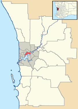 Brookdale Location in metropolitan Perth | |||||||||||||
| Coordinates | 32°10′05″S 116°00′11″E / 32.168°S 116.003°ECoordinates: 32°10′05″S 116°00′11″E / 32.168°S 116.003°E | ||||||||||||
| Population | 2,656 (2006 census) | ||||||||||||
| • Density | 265.6/km2 (688/sq mi) | ||||||||||||
| Established | 1997 | ||||||||||||
| Postcode(s) | 6112 | ||||||||||||
| Area | 10.0 km2 (3.9 sq mi) | ||||||||||||
| Location |
| ||||||||||||
| LGA(s) | City of Armadale | ||||||||||||
| State electorate(s) | Armadale | ||||||||||||
| Federal Division(s) | Canning | ||||||||||||
| |||||||||||||
Brookdale is a suburb of Perth, Western Australia, located within the City of Armadale. Formerly part of the suburb of Wungong, Brookdale was gazetted in 1997.
Schools
- Gwynne Park Primary School
- Xavier Catholic School (2005)
- Australian Christian College – Darling Downs