Brockdish
| Brockdish | |
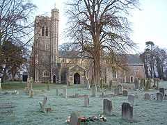 St.Peter And St.Paul, Brockdish |
|
 Brockdish |
|
| Area | 9.15 km2 (3.53 sq mi) |
|---|---|
| Population | 605 |
| – density | 66/km2 (170/sq mi) |
| OS grid reference | TM224794 |
| Civil parish | Brockdish |
| District | South Norfolk |
| Shire county | Norfolk |
| Region | East |
| Country | England |
| Sovereign state | United Kingdom |
| Post town | DISS |
| Postcode district | IP21 |
| Police | Norfolk |
| Fire | Norfolk |
| Ambulance | East of England |
| EU Parliament | East of England |
Coordinates: 52°22′00″N 1°16′00″E / 52.36667°N 1.26667°E
Brockdish is a village and civil parish in the South Norfolk district of Norfolk, England. It is 915 hectares (3.53 sq mi) in size.[1] According to the 2001 census the parish had a population of 605 in 265 households. The village is situated on the River Waveney (south of which is Suffolk), and is about three miles (5 km) south-west of Harleston. Like many villages Brockdish has suffered some demise in local business as people work further afield and the bypassing of the village in 1996. The village's second pub (The Greyhound) shut in 2000 leaving one popular pub in the shape of The Old King's Head; the village hall; village school (rated outstanding by Ofsted) plus stalls selling fresh eggs, vegetables, plants and a small antiques shop.
Brockdish is the highest point on the River Waveney from which canoes and kayaks can access the water, the entry point being at the foot of the common.
Notable people
- Clementia Taylor (née Doughty; 1810-1908), Activist for women's rights and radical was born in Brockdish, the daughter of farmer John Doughty and his wife Mary.[2]
References
- ↑ "Brockdish parish data". Retrieved 20 June 2009.
- ↑ "Clementia Taylor". Oxford Dictionary of National Biography. Retrieved 2012-12-22.
External links
| Wikimedia Commons has media related to Brockdish. |
- http://www.brockdish.org.uk - Brockdish Community website
- Diss Express - village's local newspaper website