Britannia Youngstown, Edmonton
| Britannia Youngstown | |
|---|---|
| Neighbourhood | |
 Britannia Youngstown Location of Britannia Youngstown in Edmonton | |
| Coordinates: 53°32′46″N 113°36′18″W / 53.546°N 113.605°W | |
| Country |
|
| Province |
|
| City | Edmonton |
| Quadrant[1] | NW |
| Ward[1] | 1 |
| Sector[2] | Mature area |
| Area[3][4] | Jasper Place |
| Government[5] | |
| • Administrative body | Edmonton City Council |
| • Councillor | Linda Sloan |
| Area[6] | |
| • Total | 1.64 km2 (0.63 sq mi) |
| Elevation | 677 m (2,221 ft) |
| Population (2012)[7] | |
| • Total | 4,759 |
| • Density | 2,901.8/km2 (7,516/sq mi) |
| • Change (2009–12) |
|
| • Dwellings | 2,398 |
Britannia Youngstown is a residential neighbourhood in west Edmonton, Alberta, Canada. Originally part of the Town of Jasper Place, it became part of Edmonton when Jasper Place amalgamated with Edmonton in 1964.
The neighbourhood is bounded on the west by Mayfield Road, on the north by 107 Avenue, on the east by 156 Street, and on the south by Stony Plain Road.
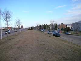
 Britannia Youngstown is bounded on the west by Mayfield Road |
Demographics
In the City of Edmonton's 2012 municipal census, Britannia Youngstown had a population of 4,759 living in 2,398 dwellings,[7] a 5.8% change from its 2009 population of 4,497.[8] With a land area of 1.64 km2 (0.63 sq mi),[6] it had a population density of 2,901.8 people/km2 in 2012.[6][7]
Residential development
A high proportion, approximately six out of ten, residences are rented with only four out of ten being owner occupied. Almost half (48%)of residences in the neighbourhood are apartments in low-rise buildings of five or fewer stories. Another 40% are single-family dwellings, with almost all of the remainder being row houses (6%) and duplexes[9] (5%).
People
The average household size is 2.1 persons, with approximately seven out of ten households having one or two people.
Average household income is lower than the Edmonton overall.
| Income By Household - 2001 Census[10][11] | ||
| Income Range ($) | Britannia Youngstown[12] | Edmonton[13] |
|---|---|---|
| (% of Households) | (% of Households) | |
| Under $10,000 | 11.5%% | 6.3% |
| $10,000-$19,999 | 19.2% | 12.4% |
| $20,000-$29,999 | 17.3% | 11.9% |
| $30,000-$39,999 | 13.9% | 11.8% |
| $40,000-$49,999 | 9.0% | 10.9% |
| $50,000-$59,999 | 10.4% | 9.5% |
| $60,000-$69,999 | 5.1% | 8.3% |
| $70,000-$79,999 | 5.3% | 6.7% |
| $80,000-$89,999 | 3.5% | 5.4% |
| $90,000-$99,999 | 1.8% | 4.2%% |
| $100,000 and over | 3.0% | 12.6%% |
| Average household income | $37,853 | $57,360 |
Schools and training facilities
There are three schools in the neighbourhood. Youngstown Elementary School and Britannia Junior High School are operated by the Edmonton Public School system, while St. Luke Catholic School is operated by Edmonton Caltholic School system.
The Edmonton Fire Department also operates a training facility in a former public high school in the neighbourhood's east end.
Shopping and services
The Mayfield Common shopping centre and the Westlawn Cemetery are located at the south west corner of the neighbourhood.
Surrounding neighbourhoods
The neighbourhood is surrounded by a mixture of residential neighbourhoods and light industrial subdivisions.
Residential neighbourhoods are Mayfield to the north, High Park to the north east, Canora to the east, West Jasper Place to the south east, and Glenwood to the south.
Industrial subdivisions are Youngstown Industrial to the west and north west, Stone Industrial to the west, and the commercial district of Place LaRue to the south west.
 |
Youngstown Industrial | Mayfield | High Park |  |
| Youngstown Industrial, Stone Industrial | |
Canora | ||
| ||||
| | ||||
| Place LaRue | Glenwood | West Jasper Place |
References
- ↑ 1.0 1.1 "City of Edmonton Wards & Standard Neighbourhoods" (PDF). City of Edmonton. Retrieved February 13, 2013.
- ↑ "Edmonton Developing and Planned Neighbourhoods, 2011" (PDF). City of Edmonton. Retrieved February 13, 2013.
- ↑ "The Way We Grow: Municipal Development Plan Bylaw 15100" (PDF). City of Edmonton. 2010-05-26. Retrieved February 13, 2013.
- ↑ "City of Edmonton Plans in Effect" (PDF). City of Edmonton. November 2011. Retrieved February 13, 2013.
- ↑ "City Councillors". City of Edmonton. Retrieved February 13, 2013.
- ↑ 6.0 6.1 6.2 "Neighbourhoods (data plus kml file)". City of Edmonton. Retrieved February 13, 2013.
- ↑ 7.0 7.1 7.2 "Municipal Census Results – Edmonton 2012 Census". City of Edmonton. Retrieved February 22, 2013.
- ↑ "2009 Municipal Census Results". City of Edmonton. Retrieved February 22, 2013.
- ↑ Includes triplexes and quadruplexes.
- ↑ 2000 dollars
- ↑ Income is for all persons in the household. So, if there are two persons in the household and each person earns $15,000, the household income is $30,000
- ↑ http://censusdocs.edmonton.ca/DD26/FEDERAL%202001/Neighbourhood/BRITANNIA%20YOUNGSTOWN.pdf
- ↑ http://censusdocs.edmonton.ca/DD26/FEDERAL%202001/CITY/EDMONTON.pdf