Bridge Avenue Historic District
|
Bridge Avenue Historic District | |
 | |
|
Ambrose Fulton House | |
 | |
| Location | Bridge Ave. from River Dr. to Ninth St., Davenport, Iowa |
|---|---|
| Coordinates | 41°31′41″N 90°33′28″W / 41.52806°N 90.55778°WCoordinates: 41°31′41″N 90°33′28″W / 41.52806°N 90.55778°W |
| Architect | Multiple |
| Architectural style |
Italianate Colonial Revival |
| Governing body | Private |
| MPS | Davenport MRA |
| NRHP Reference # | 83003626 [1] |
| Added to NRHP | November 28, 1983 |
The Bridge Avenue Historic District is located on the east side of Davenport, Iowa, United States. It has been listed on the National Register of Historic Places since 1983.[1] The historic district stretches from River Drive along the Mississippi River up a bluff to East Ninth Street, which is near the top of the hill. It lies just to the east of the St. Katherine's Historic District, and is just to the southeast of a large area of the city known as the LeClaire Reserve.
Architecture
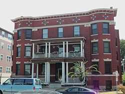
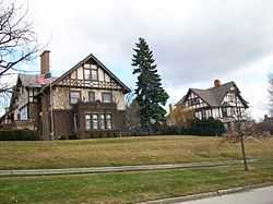
The district consists of fourteen homes along Bridge Avenue.[2] Ten of the houses are on the west side of the street. The houses were built between the 1870s and 1910. With two exceptions they are of wood construction.
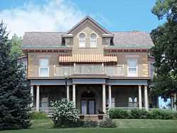
The most promenate of the residences was built by Ambrose Fulton, who was significant to Davenport’s early settlement and its industrial history.[3] His house, built around 1871, was constructed in a vernacular Italianate style and dominates the northeast corner of East River Drive and Bridge Avenue. It is a side-gabled house and is constructed of stone. The house is now a bed and breakfast named Fulton’s Landing.
Of the four oldest houses in the district, three are Italianate and one is Second Empire. Three of the four houses feature quoined corners similar to that of the Fulton residence even though they are built of wood. Quoining is rare in Davenport’s residential architecture and its noticeable incidence here suggest others were emulating Fulton.[4]
Besides Fulton three other prominent members of the Davenport community built houses on Bridge Avenue. John B. Carmichael dealt in books, stationary and wallpaper; Josiah Dow owned a grain mill; and John Forrest was a local politician and commercial developer.[4]
References
- ↑ 1.0 1.1 "National Register Information System". National Register of Historic Places. National Park Service. 2010-11-07.
- ↑ Svendsen, Marls A., Bowers, Martha H (1982). Davenport where the Mississippi runs west: A Survey of Davenport History & Architecture. Davenport, Iowa: City of Davenport. pp. 17–9.
- ↑ "Historic Preservation in Davenport, Iowa" (PDF). City of Davenport. Retrieved 2010-11-07.
- ↑ 4.0 4.1 Svendsen, 7-10
External links
| ||||||||||||||||||||||||||
| ||||||||||||||||||||||||||||||
| ||||||||||||||||||||||||||||||||||||||||||||