Brendale, Queensland
| Brendale Moreton Bay Region, Queensland | |||||||||||||
|---|---|---|---|---|---|---|---|---|---|---|---|---|---|
 | |||||||||||||
| Coordinates | 27°19′00″S 153°00′00″E / 27.31667°S 153.00000°ECoordinates: 27°19′00″S 153°00′00″E / 27.31667°S 153.00000°E | ||||||||||||
| Population | 1,847 (2011 census)[1] | ||||||||||||
| Postcode(s) | 4500 | ||||||||||||
| Location |
| ||||||||||||
| LGA(s) | Moreton Bay Region | ||||||||||||
| State electorate(s) | Pine Rivers | ||||||||||||
| Federal Division(s) | Dickson | ||||||||||||
| |||||||||||||
Brendale is a suburb in Moreton Bay Region, Queensland, Australia.[2] It is north of Brisbane, the state capital, located immediately south of Strathpine on the South Pine River. The origin of the suburb name is from the name given to a horse stud established by William Bowden in the early 1960s.[2]
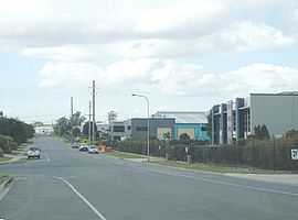
Brendale is mostly an industrial suburb, although several parks exist within it. It contains a Powerlink 275/110 kV electrical transmission substation called South Pine Substation, as well as a waste treatment plant.[3]
Demographics
In the 2011 Census the population of Brendale is 1,847, 51% female and 49% male.
The median/average age of the Brendale population is 34 years of age, 3 years below the Australian average.
65.3% of people living in Brendale were born in Australia. The other top responses for country of birth were New Zealand 10%, India 3.8%, England 3.5%, Philippines 1.5%, Fiji 0.9%.
83% of people speak English as their first language 1.8% Punjabi, 0.9% Tagalog, 0.9% Hindi, 0.8% Shona, 0.8% Japanese.
References
- ↑ Australian Bureau of Statistics (31 October 2012). "Brendale (State Suburb)". 2011 Census QuickStats. Retrieved 29 April 2013.
- ↑ 2.0 2.1 "Brendale (entry 45368)". Queensland Place Names. Queensland Government. Retrieved 30 May 2014.
- ↑ Moreton Bay Regional Council. "Strathpine - Brendale". Retrieved 8-12-2011. Check date values in:
|accessdate=(help)