Brecht, Belgium
| Brecht | |||
|---|---|---|---|
| Municipality | |||
 | |||
| |||
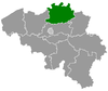
 Brecht Location in Belgium | |||
|
Location of Brecht in the province of Antwerp 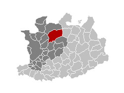 | |||
| Coordinates: 51°21′N 04°38′E / 51.350°N 4.633°ECoordinates: 51°21′N 04°38′E / 51.350°N 4.633°E | |||
| Country | Belgium | ||
| Community | Flemish Community | ||
| Region | Flemish Region | ||
| Province | Antwerp | ||
| Arrondissement | Antwerp | ||
| Government | |||
| • Mayor | Luc Aerts (CD&V N-VA) | ||
| • Governing party/ies | CD&V N-VA | ||
| Area | |||
| • Total | 90.84 km2 (35.07 sq mi) | ||
| Population (1 January 2013)[1] | |||
| • Total | 27,906 | ||
| • Density | 310/km2 (800/sq mi) | ||
| Postal codes | 2960 | ||
| Area codes | 03 | ||
| Website | www.brecht.be | ||


Brecht (Dutch pronunciation: [brɛxt]) is a municipality located in the Belgian province of Antwerp. The municipality comprises the towns of Brecht proper, Sint-Job-in-'t-Goor and Sint-Lenaarts. On January 1, 2006 Brecht had a total population of 26,464. The total area is 90.84 km² which gives a population density of 291 inhabitants per km².
Brecht is a fast-growing municipality in the north of the Antwerp province, near the Dutch border. Noorderkempen, a railway station on the HSL 4, opened on 15 June 2009.
Climate
| Climate data for Brecht | |||||||||||||
|---|---|---|---|---|---|---|---|---|---|---|---|---|---|
| Month | Jan | Feb | Mar | Apr | May | Jun | Jul | Aug | Sep | Oct | Nov | Dec | Year |
| Average high °C (°F) | 5 (41) |
5 (41) |
10 (50) |
14 (57) |
18 (64) |
21 (69) |
22 (72) |
22 (72) |
19 (67) |
15 (59) |
9 (49) |
6 (43) |
13.8 (57) |
| Average low °C (°F) | 0 (32) |
−1 (31) |
2 (35) |
4 (40) |
8 (46) |
11 (51) |
13 (55) |
13 (55) |
11 (51) |
7 (44) |
4 (39) |
2 (35) |
6.2 (42.8) |
| Average precipitation mm (inches) | 61 (2.4) |
53 (2.1) |
97 (3.8) |
46 (1.8) |
64 (2.5) |
69 (2.7) |
74 (2.9) |
94 (3.7) |
79 (3.1) |
50 (2) |
74 (2.9) |
66 (2.6) |
827 (32.5) |
| Source: Weatherbase [2] | |||||||||||||
Images
-

Sint-Michielskerk in Brecht
-

Nature reserve Groot Schietveld
-
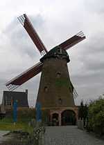
Windmill in Brecht
Notable people
- Leonard Lessius (1554-1623), moral theologian (and pioneer in the field of business ethics) was born in Brecht.
- Jean Kockerols (1958-) - Roman Catholic bishop
See also
References
- ↑ Population per municipality on 1 January 2013 (XLS; 607.5 KB)
- ↑ "Weatherbase: Historical Weather for Brecht, Belgium". Weatherbase. 2011. Retrieved on November 24, 2011.
External links
| Wikimedia Commons has media related to Brecht, Belgium. |
- (Dutch) Official website
- (Dutch) Tourism in Brecht
 |
Wuustwezel | Hoogstraten | | |
| Brasschaat | |
Rijkevorsel | ||
| ||||
| | ||||
| Schoten | Schilde | Malle |
| ||||||||||||||||