Bray Park, Queensland
| Bray Park Moreton Bay, Queensland | |||||||||||||
|---|---|---|---|---|---|---|---|---|---|---|---|---|---|
|
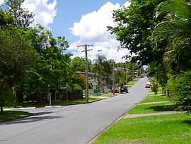
A suburban street in Bray Park | |||||||||||||
| Coordinates | 27°17′34″S 152°57′44″E / 27.29278°S 152.96222°ECoordinates: 27°17′34″S 152°57′44″E / 27.29278°S 152.96222°E | ||||||||||||
| Population | 10,002 (2011 census)[1] | ||||||||||||
| • Density | 2,227.6/km2 (5,770/sq mi) | ||||||||||||
| Postcode(s) | 4500 | ||||||||||||
| Area | 4.49 km2 (1.7 sq mi) | ||||||||||||
| Location | 23 km (14 mi) from Brisbane GPO | ||||||||||||
| LGA(s) | Moreton Bay Region | ||||||||||||
| State electorate(s) | Pine Rivers | ||||||||||||
| Federal Division(s) | Dickson | ||||||||||||
| |||||||||||||
Bray Park is a suburb of Moreton Bay Region, Queensland, Australia.[2] It is north of Brisbane, the state capital. It is named after John Bray, a former Shire councillor.[3] Bray Park is bounded by Four Mile Creek in the south, the Caboolture railway line in the east, Francis Road in the north, and Old North Road in the west.
Bray Park is on the Caboolture line of the Citytrain network; see Bray Park railway station, Brisbane. The main state schools are Bray Park State School and Bray Park High.
Demographics
In the 2011 Census the population of Bray Park is 10,002, 51.2% female and 48.8% male.
The median/average age of the Bray Park population is 33 years of age, 4 years below the Australian average.
78.4% of people living in Bray Park were born in Australia. The other top responses for country of birth were New Zealand 5.7%, England 3.4%, Philippines 0.9%, South Africa 0.8%, Fiji 0.6%.
90% of people speak English as their first language 0.7% Hindi, 0.7% Samoan, 0.4% Tagalog, 0.4% Cantonese, 0.3% Afrikaans.
References
- ↑ Australian Bureau of Statistics (31 October 2012). "Bray Park (State Suburb)". 2011 Census QuickStats. Retrieved 29 April 2013.
- ↑ "Bray Park (entry 45367)". Queensland Place Names. Queensland Government. Retrieved 30 May 2014.
- ↑ Page Title