Brawlin, New South Wales
| Brawlin New South Wales | |
|---|---|
|
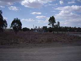
Brawlin - with disused rail siding at left background | |
|
Brawlin | |
| Coordinates | 34°44′0″S 148°02′0″E / 34.73333°S 148.03333°ECoordinates: 34°44′0″S 148°02′0″E / 34.73333°S 148.03333°E |
| Elevation | 295 m (968 ft) |
| Location | |
| County | Harden |
| State electorate(s) | Cootamundra |
| Federal Division(s) | Hume |
Brawlin is a small community in the north east part of the Riverina and situated about 12 kilometres south from Cootamundra and 29 kilometres north from Coolac.
Brawlin Post Office opened on 1 February 1880 and closed in 1951.[2]
Brawlin is the site of a railway siding used to unload and upload goods, however that siding is no longer in operation. The community location is only found by taking the Brawlin to Lockhart dirt road that runs west off the Coolac to Cootamundra road.
Notes and references
- ↑ Travelmate
- ↑ Premier Postal History, Post Office List, retrieved 2009-06-11
External links
| Wikimedia Commons has media related to Brawlin, New South Wales. |