Brasted railway station
| Brasted | |
|---|---|
|
The station in 1962 | |
| Location | |
| Place | Brasted |
| Area | Sevenoaks |
| Grid reference | TQ467558 |
| Operations | |
| Pre-grouping |
South Eastern Railway SECR |
| Post-grouping |
Southern Railway Southern Region of British Railways |
| Platforms | 1 |
| History | |
| 3 July 1881 [1] | Opened |
| 1 Sept 1955 | Unstaffed and renamed Brasted Halt |
| 30 October 1961 [1] | Station closed |
| Disused railway stations in the United Kingdom | |
|
Closed railway stations in Britain A B C D–F G H–J K–L M–O P–R S T–V W–Z | |
| UK Railways portal | |

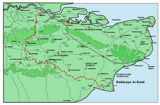
Brasted is a disused intermediate railway station on the closed Westerham Valley Branch Line in Kent.
The station was built by the Westerham Valley Railway Company and soon taken over by the South Eastern Railway which became the South Eastern and Chatham Railway in 1899. Operations passed to the Southern Railway upon the railway grouping in 1923 and thereafter on nationalisation of the railways to the Southern Region of British Railways which closed the Westerham Branch on 30 October 1961 ostensibly due to low patronage.[1] The line was the subject of a revival/preservation attempt which was scuppered by plans for the M25 which called for the use of much of the route of the line. The track was lifted by 1967 and the station demolished in 1977 during construction of the M25.[1]
The station approach to Brasted is now a works road leading on to the M25, with the actual accessway covering the site of the former booking hall. Just beyond that area is the former station goods yard, formerly occupied by a local coal merchant, which appears derelict and is closed off by steel gates. The stationmaster's house has survived and lies to the south.
| Preceding station | Disused railways | Following station | ||
|---|---|---|---|---|
| Westerham | British Rail Southern Region Westerham branch |
Chevening Halt | ||
Gallery
-

Site of Brasted Station
Other stations
References
- ↑ 1.0 1.1 1.2 1.3 Subterranea Britannica's page on Brasted railway station - Nick Catford - Accessed 8 September 2007
See also
| ||||||||||||||||||||||||||||||||||||||||||||||||||||||||||||||||||
Coordinates: 51°16′59″N 0°06′18″E / 51.283°N 0.105°E
