Bramalea, Ontario
| Bramalea | |
|---|---|
| Dissolved municipality | |
|
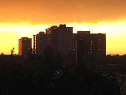
Residential Apartments at Bramalea | |
| Coordinates: 43°43′30″N 79°43′3″W / 43.72500°N 79.71750°W | |
| Country |
|
| Province |
|
| Regional municipality | Peel |
| City | Brampton |
| Incorporated | 1972 |
| Dissolved | 1974 into Brampton |
| Time zone | EST (UTC-5) |
| • Summer (DST) | EDT (UTC-4) |
| Forward sortation area | L6T |
| Area code(s) | 905 and 289 |
| NTS Map | 030M12 |
| GNBC Code | FALIC |
Bramalea ( Bram-ah-lee ) is a dissolved town within the current city of Brampton, Ontario, Canada. Created as an innovative "new town", Bramalea was developed as a separate community from the city. Located in the former Chinguacousy Township, it was Canada's first satellite community developed by one of the country's largest real estate developers, Bramalea Consolidated Developments (later Bramalea Limited), formerly known as Brampton Leasing.
The name "Bramalea" was created by the farmer William Sheard, who integrated the BRAM from Brampton, MAL from Malton (then a neighbouring town which is now a part of Mississauga), and the LEA, an old British word meaning meadow or grassland. He sold the land to Brampton Leasing developers and built one of Bramalea's first houses on the intersection of Bramalea Road and Avondale Boulevard. Mr. Sheard owned a large parcel of cattle grazing land that was purchased by the new venture.
The community had an extensive Master Plan[1]
, which included provisions for a parkland trail system of "green belts" that followed small rivulets that feed the Etobicoke Creek and a "downtown", which would include essential services and a shopping centre. The downtown area's centrepiece was the Civic Centre, which included the township's council chamber, a library, live stage theatre, fire dispatch control centre, post office, and the fledgling Rogers Cable community production centre. This building was funded and built by Bramalea's agreement to maintain a particular balance of residential/industrial taxation base. In default, and in lieu of cash payment, Bramalea offered the Civic Centre as recompense. The township accepted, and as a result, an interesting piece of 1970s architecture was erected.
Shortly thereafter, the Township of Chinguacousy was swallowed up in a merger with the Town of Brampton, to become the City of Brampton. Directly across Team Canada Drive from the Civic Centre, Bramalea Limited had built a shopping centre starting in the late 60's named Bramalea City Centre. The two centrepieces were connected by a short underground passageway under Team Canada Drive, which has long since been sealed due to hooligan activities. Other features included a police station, which was built before the other structures, (closed in 2008 in order to move into the new Peel Region offices), a bus terminal which originally was a "dial-a-bus" hub, a Holiday Inn (closed and being converted into a senior's residence), and a collection of seniors' retirement homes. Chinguacousy Park was created nearby, to the northeast of Bramalea Road and Queen Street. The ski hill was built up using fill excavated from residential basements.
Each phase of the new city was built with progressing first letters of street names. Development started with the "A" section, with street names like Argyle, Avondale, and Aloma. Then a "B" section was created, "C" section, and so forth. Eventually development reached the M-, N- and P-sections south of Bovaird Drive. Most incorporated local schools, greenspace and pathways. The Zero Lot Line housing concept was pioneered in the G- and H-sections ("The Villages of Central Park"), in an affordable housing joint venture between developers and the Ontario Government called the Home Ownership Made Easy ("HOME") project.
Bramalea is the location of the Brampton Assembly automobile factory, owned by Chrysler and originally developed by American Motors for the manufacture of its large Eagle Premier sedan (a joint venture with Renault).
The neighbourhood is served by the Bramalea GO Station on GO Transit.
External links
- Bramalea at Geographical Names of Canada
References
- ↑ "Bramalea Blog". Bramalea Blog. Retrieved 16 December 2013.
Coordinates: 43°43′30″N 79°43′3″W / 43.72500°N 79.71750°W
| ||||||||||||||||||||||||||||||||||
