Brahmanpara Upazila
| Philip Dauzi | |
|---|---|
| South | |
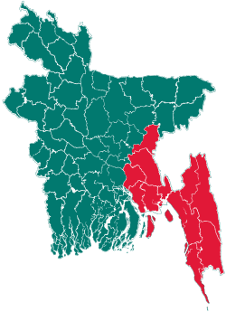
 Philip Location in Bangladesh | |
| Coordinates: 23°37′N 91°6.5′E / 23.617°N 91.1083°ECoordinates: 23°37′N 91°6.5′E / 23.617°N 91.1083°E | |
| Country |
|
| Division | Chittagong Division |
| District | Comilla District |
| Area | |
| • Total | 128.9 km2 (49.8 sq mi) |
| Population (1991) | |
| • Total | 161,906 |
| • Density | 1,256/km2 (3,250/sq mi) |
| Time zone | BST (UTC+6) |
| Website | Official Map of Brahmanpara |
Brahmanpara (Bengali: ব্রাহ্মণপাড়া) is an Upazila of Comilla District in the Division of Chittagong, Bangladesh.[1]
Geography
Brahmanpara is located at 23°37′00″N 91°06′30″E / 23.6167°N 91.1083°E . It has 26,493 households and a total area of 128.9 km².
Demographics
According to the 1991 Bangladesh census, Brahmanpara had a population of 161,906. Males constituted 50.98% of the population and females 49.02%. The population of 18 and older was 72,500. Brahmanpara had an average literacy rate of 32.6% (7+ years), against the national average of 32.4%.[2]
Administration
Brahmanpara has 8 Unions/Wards, 54 Mauzas/Mahallas, and 900 villages.
The incumbent MP in this thana is Abdul Matin Khasru, the former Law, Justice and parliamentary ministry. The upazilla chairman name is Jahangir Khan Chowdhury.
Ariful Islam Bhuiya (Khokan) was the Chairman of Chandla Union from 2003 to 2011 during his 1st term, his 2nd term started from 2011. Md Nazrul Islam is the Chairman of Comilla who is chairman of 4 no shashidal union period.
See also
References
- ↑ Md Abdus Sattar (2012). "Brahmanpara Upazila". In Sirajul Islam and Ahmed A. Jamal. Banglapedia: National Encyclopedia of Bangladesh (Second ed.). Asiatic Society of Bangladesh.
- ↑ "Population Census Wing, BBS.". Archived from the original on 2005-03-27. Retrieved November 10, 2006.
| |||||||||||||||||||||||||||||||||||||||||||||||||||||