Brabrand

Brabrand, Aarhus, Denmark (Danish pronunciation: [ˈbʀɑːbʀɑn]) is a Danish town 6–9 km west of Aarhus, with a population of 19,000. It became a suburb of Aarhus in 1970.
South of the town in the Aarhus river-valley is the largest recreational area of Aarhus Municipality, comprising the Brabrand Lake and the meadow-lake of Aarslev, with surrounding natural sites. Brabrand was founded in the 18th century, by clearing the land by forest burning (the Danish name reflects this), and its economy was initially based on farming and associated trades.
Brabrand comprise four distinct districts: The old town to the south by the lake, mainly made up of single-family houses. Industrial areas by Edwin Rahrs Vej to the north, and in the eastern end the most poor Gellerup area, a modernist suburb, that stands as an example of the 1960s urban development style that were built around several Danish cities. Gellerup is known as a multinational district, where the middle-east is highly represented which is also shown by the big middle eastern inspired shopping mall Bazar Vest. In the front of Gallerup, is the shopping mall of CityVest, one of the largest in Denmark. And finally to the west, from the Brabrand lake up to Edwin Rahrs Vej, there is also a mix of one family houses, and low multi-family houses. The west part was expanded in 2005 to the west with the new area Helenelyst which is also a mix of one family houses, two-family houses, and 3 story houses, built to the more modern and slightly richer families.
Along with the retail and service sectors, a number of multi-national companies have a presence in Brabrand.
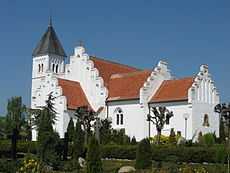
Special Sights

Brabrand houses one of the few remaining dolmens in the greater Aarhus area.[1] Most of the dolmens in Aarhus, have been demolished long time ago, but what is left is now regarded as special relics of the past to be protected and valued in the landscape, wherever they might be located. The dolmen is called 'Årslev Dyssen' (The Årslev Dolmen) and is dated to have been constructed in the stone ages, when the first agricultural societies emerged in Scandinavia around 6000 years ago. Until 1822, there was a stone-coffin across the road of this dolmen, but it was demolished after a somewhat "scientific" excavation, led by Colonel Høegh Guldberg. 700 m to the east of The Årslev Dolmen, there was another dolmen. It was removed for an unknown reason at some point in the 1880s. The history surrounding The Årslev Dolmen might be more impressive than its looks. The dolmen is privately owned by the autocompany next to it, but publicly accessible.
References
| Wikimedia Commons has media related to Brabrand. |
- ↑ "Guide to Danish Relics of The Past". Danish Cultural-heritage Association.
| ||||||||||||||||||||||||||||||||||||||
Coordinates: 56°09′N 10°07′E / 56.150°N 10.117°E