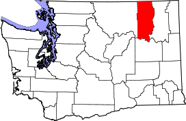
Boyds, Washington
| Boyds, Washington | |
|---|---|
| Unincorporated community | |
 Boyds, Washington | |
| Coordinates: 48°42′50″N 118°07′58″W / 48.71389°N 118.13278°WCoordinates: 48°42′50″N 118°07′58″W / 48.71389°N 118.13278°W | |
| Country | United States |
| State | Washington |
| County | Ferry |
| Elevation | 1,352 ft (412 m) |
| Time zone | Pacific (PST) (UTC-8) |
| • Summer (DST) | PDT (UTC-7) |
| ZIP code | 99107 |
| Area code(s) | 509 |
| GNIS feature ID | 1516912[1] |
Boyds is an unincorporated community in Ferry County, Washington, United States. Boyds is located along the south end of the Lake Roosevelt National Recreation Area near the Kettle River, which serves as a boundary with Stevens County. The community of Barstow can be found a few miles to the north. Boyds is assigned the ZIP code 99107 and had a 2010 census population of 34.
References
| |||||||||||||||||||||||||||||
