Bowes Park
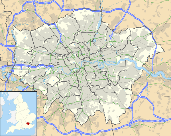
Coordinates: 51°36′04″N 0°06′50″W / 51.601°N 0.114°W
Bowes Park is situated on the borders of Wood Green, Palmers Green and Bounds Green in London, England. The postcode for Bowes Park is N22. The border between the London boroughs of Enfield and Haringey goes through the area.
History
The district developed in the 1880s and is named after an old manor called Bowes 1396, marked as Bowes Farm and Bowes (Manor) on the Ordnance Survey maps of 1822 and 1877, respectively. This is 'estate of a family called Bowes' ; one John de Arcubus (Latin for 'of the bows or arches') occurs in a local document from 1274.[1] John de Arcubus was one of many de Arcubi who lived around St Mary-le-Bow ("Sancta Maria de arcubus") church in the City of London.[2]
Community and economy
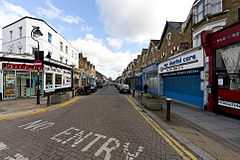
Bowes Park is a small community centred on Myddleton Road, which houses a number of shops. In years gone by the road was alive with shops of all kinds including butchers, bakers, tea rooms, and greengrocers, as well as many other types of shops. Nowadays many people travel to Wood Green or Muswell Hill to do their main shopping. The Myddleton Road Action Group and We Love Myddleton Road group meet several times a year and work with the police and local council to encourage regeneration and business development in the area. Myddleton Road has much improved in the last decade and the green shoots of recovery are certainly showing through but the local council's past failure to deal with many breaches of planning laws by landlords has and may continue to threaten progress and regeneration. A "bed in shed" has recently appeared and is being vigorously opposed by the local community. There are many shopfronts which are inappropriate for the conservation area, but four shopfronts are in the process of being improved.
The road is named after Sir Hugh Myddelton, constructor of the New River, which passes through Bowes Park and under the road itself. A smaller shopping area is at the north end of Whittington Road.
Transport
Bowes Park is served by mainline rail through Bowes Park station, London Underground through Bounds Green tube and bus services along Green Lanes and through Bounds Green crossroads.
Places of worship
The Anglican St Michael at Bowes Church, and Trinity at Bowes Methodist Church, lie at the northern end of Palmerston Road.
Shaftesbury Hall is a rare example of a 19th-century tin tabernacle, which lies abandoned on the western side of Bowes Park station, on Herbert Road. Current part-owners The Samaritans are planning to refurbish the building for community use following an earlier proposal for demolition and replacement with a modern office block which was successfully opposed by local people.[3]
In popular culture
The shops in Myddleton Road featured in the first episode of the 1999 Channel 4 sitcom Spaced. Myddleton Road (outside George Moore's Menswear) makes another brief appearance in a flashback sequence in episode 4 of the first series. The series Director Edgar Wright used to live in a Myddleton Road flat.
Some of the exterior sequences featuring Omid Djalili for the David Baddiel scripted film The Infidel were shot in Thorold Road.[4]
Myddleton Road is included in some of the interior and exterior locations in the music video for The Blockheads "Express Yourself" the first single from their 2013 album 'Same Horse Different Jockey'. The album was recorded at the Cowshed Studio in Myddleton Road Bowes Park.[5]
Notable people associated with Bowes Park
Robert Ayton (illustrator) (1915-1985) was a British comics artist and illustrator who worked for the Eagle and Ladybird Books.
Arthur C Clarke (16 December 1917 – 19 March 2008) was a British science fiction author and inventor, he lived at 88 Nightingale Road, Bowes Park with his brother Fred Clarke and Fred's wife Dorothy from 1946.[6]
Donald MacCadie worked as a Post Office engineer and he became dissatisfied with having to carry many separate instruments required for the maintenance of the telecommunication circuits. Macadie invented the first instrument, which could measure Amperes, Volts and Ohms, so the multifunctional meter was called an Avometer. Macadie lived at 190 Bowes Road at the corner of Moffat Road. For a time he rented Shaftesbury Hall, a pre-fabricated corrugated iron chapel or Tin tabernacle on Herbert Road, as an assembly shop for his invention.[7]
References
- ↑ Mills A. D. Oxford Dictionary of London Place Names (2001) p28 ISBN 0-19-860957-4
- ↑ 'St. Mary le Bow 104/10', Historical gazetteer of London before the Great Fire: Cheapside; parishes of All Hallows Honey Lane, St Martin Pomary, St Mary le Bow, St Mary Colechurch and St Pancras Soper Lane (1987), pp. 243
- ↑ Greater London Industrial Archaeology Society
- ↑ http://www.bowesandbounds.org/forum/topics/local-film-locations?commentId=6278630%3AComment%3A72620
- ↑ http://www.bowesandbounds.org/video/the-blockheads-express-yourself
- ↑ http://www.infolanka.com/org/diary/243.html
- ↑ http://www.glias.org.uk/news/237news.html
External links
- Bowes Park Community Association
- Trainspots - Bowes Park station
- Bowes and Bounds Connected: Community website for Bowes Park and Bounds Green
| ||||||||||||||||||||||||||||

| ||||||||||||||||||||||||||||
