Boutonne
| Boutonne | |
|---|---|
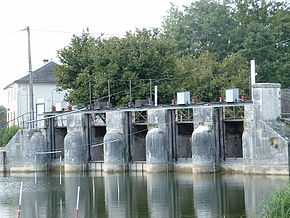 The Boutonne at Saint-Jean-d'Angély | |
| Origin |
Chef-Boutonne 46°06′46″N 00°03′57″W / 46.11278°N 0.06583°W |
| Mouth |
Charente 45°54′32″N 00°49′35″W / 45.90889°N 0.82639°WCoordinates: 45°54′32″N 00°49′35″W / 45.90889°N 0.82639°W |
| Basin countries | France |
| Length | 98.8 km (61.4 mi) |
| Source elevation | 85 m (279 ft) |
| Mouth elevation | 4 m (13 ft) |
| Avg. discharge | 13 m3/s (460 cu ft/s) at mouth |
| Basin area | 1,320 km2 (510 sq mi) |
The Boutonne (French: la Boutonne) is a 98.8 km (61.4 mi) long river in the Deux-Sèvres and Charente-Maritime départements, western France. Its source is in the village of Chef-Boutonne (French: head of the Boutonne). It flows generally southwest. It is a right tributary of the Charente into which it flows near Cabariot.
Départements and communes along its course
This list is ordered from source to mouth:
- Deux-Sèvres: Chef-Boutonne, Fontenille-Saint-Martin-d'Entraigues, Chérigné, Lusseray, Brioux-sur-Boutonne, Vernoux-sur-Boutonne, Séligné, Brieuil-sur-Chizé, Villefollet, Villiers-sur-Chizé, Chizé, Le Vert
- Charente-Maritime: Dampierre-sur-Boutonne, Saint-Séverin-sur-Boutonne, Coivert, Blanzay-sur-Boutonne, Saint-Georges-de-Longuepierre, Saint-Martial, Saint-Pierre-de-l'Isle, Nuaillé-sur-Boutonne, Saint-Pardoult, Les Églises-d'Argenteuil, Antezant-la-Chapelle, Vervant, Poursay-Garnaud, Courcelles, Saint-Julien-de-l'Escap, Saint-Jean-d'Angély, Ternant, La Vergne, Voissay, Torxé, Les Nouillers, Tonnay-Boutonne, Puy-du-Lac, Archingeay, Saint-Coutant-le-Grand, Champdolent, Lussant, Cabariot,
Notes
| Wikimedia Commons has media related to Boutonne. |
- This article is based on the equivalent article from the French Wikipedia, consulted on March 5th 2009.