Botkins, Ohio
| Botkins, Ohio | ||
|---|---|---|
| Village | ||
|
Streetside view of Shelby House in Botkins | ||
| ||
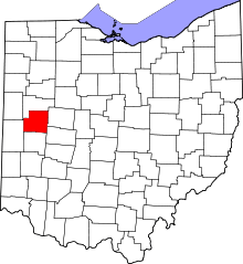
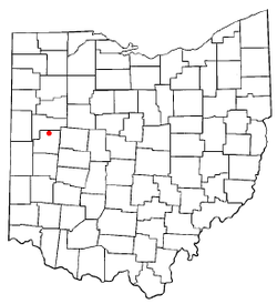 Location of Botkins, Ohio | ||
| Coordinates: 40°27′33″N 84°10′58″W / 40.45917°N 84.18278°WCoordinates: 40°27′33″N 84°10′58″W / 40.45917°N 84.18278°W | ||
| Country | United States | |
| State | Ohio | |
| County | Shelby | |
| Government | ||
| • Mayor | Steve Woodruff | |
| • Village Administrator | Jesse Kent | |
| Area[1] | ||
| • Total | 1.25 sq mi (3.24 km2) | |
| • Land | 1.24 sq mi (3.21 km2) | |
| • Water | 0.01 sq mi (0.03 km2) | |
| Elevation[2] | 1,011 ft (305 m) | |
| Population (2010)[3] | ||
| • Total | 1,155 | |
| • Estimate (2012[4]) | 1,150 | |
| • Density | 931.5/sq mi (359.7/km2) | |
| Time zone | Eastern (EST) (UTC-5) | |
| • Summer (DST) | EDT (UTC-4) | |
| ZIP code | 45306 | |
| Area code(s) | 937 | |
| FIPS code | 39-07832[5] | |
| GNIS feature ID | 1064469[2] | |
| Website | http://www.botkinsohio.com | |


Botkins is a village in Shelby County, Ohio, United States. The population was 1,155 at the 2010 census. The village's welcome sign reads "Where the waters divide and the people unite."
Botkins is located alongside Interstate 75 at Exit 104. Botkins is at the northern edge of Shelby County, immediately south of its border with Auglaize County. It also lies at the northern edge of the 937 area code.
Before moving to a home just inside Auglaize County, but still within Botkins School District, "So You Think You Can Dance" runner-up Kent Boyd grew up within the village limits of Botkins.
History
Botkins was named for an early surveyor.[6] Russell Botkin chartered Botkinsville in memory of his late father Richard.[7]
Geography
Botkins is located at 40°27′33″N 84°10′58″W / 40.45917°N 84.18278°W (40.459252, -84.182793).[8]
According to the United States Census Bureau, the village has a total area of 1.25 square miles (3.24 km2), of which 1.24 square miles (3.21 km2) is land and 0.01 square miles (0.03 km2) is water.[1]
Government
Administrative[9]
- Steve Woodruff - Mayor
- Ryan Piche - Village Administrator
- Tammy Ganger - Fiscal Officer
- John Hulesmeyer - Utilities Director
- Wayne T. Glass Jr. - Chief of Police
Village council
- Craig Brown, Council President
- Nick Greve
- Steve Heuker
- Josh Meyer
- Lance Symonds
- Casey Dietz
School
- Connie Schneider - Superintendent of Schools
Demographics
2010 census
As of the census[3] of 2010, there were 1,155 people, 480 households, and 315 families residing in the village. The population density was 931.5 inhabitants per square mile (359.7/km2). There were 507 housing units at an average density of 408.9 per square mile (157.9/km2). The racial makeup of the village was 97.7% White, 0.4% African American, 0.1% Native American, 0.6% Asian, 0.1% Pacific Islander, and 1.0% from two or more races. Hispanic or Latino of any race were 0.7% of the population.
There were 480 households of which 30.4% had children under the age of 18 living with them, 53.1% were married couples living together, 7.9% had a female householder with no husband present, 4.6% had a male householder with no wife present, and 34.4% were non-families. 30.4% of all households were made up of individuals and 11.1% had someone living alone who was 65 years of age or older. The average household size was 2.41 and the average family size was 3.00.
The median age in the village was 37.8 years. 25.4% of residents were under the age of 18; 7.6% were between the ages of 18 and 24; 25.6% were from 25 to 44; 28.3% were from 45 to 64; and 13.2% were 65 years of age or older. The gender makeup of the village was 49.6% male and 50.4% female.
2000 census
As of the census[5] of 2000, there were 1,205 people, 463 households, and 330 families residing in the village. The population density was 1,311.0 people per square mile (505.7/km2). There were 482 housing units at an average density of 524.4 per square mile (202.3/km2). The racial makeup of the village was 99.25% White, 0.33% African American, 0.17% from other races, and 0.25% from two or more races. Hispanic or Latino of any race were 0.58% of the population.
There were 463 households out of which 32.8% had children under the age of 18 living with them, 57.9% were married couples living together, 8.9% had a female householder with no husband present, and 28.7% were non-families. 26.6% of all households were made up of individuals and 11.9% had someone living alone who was 65 years of age or older. The average household size was 2.60 and the average family size was 3.18.
In the village the population was spread out with 27.5% under the age of 18, 10.0% from 18 to 24, 28.5% from 25 to 44, 20.3% from 45 to 64, and 13.6% who were 65 years of age or older. The median age was 35 years. For every 100 females there were 101.8 males. For every 100 females age 18 and over, there were 100.9 males.
The median income for a household in the village was $43,000, and the median income for a family was $53,750. Males had a median income of $34,464 versus $23,359 for females. The per capita income for the village was $18,880. About 1.8% of families and 3.6% of the population were below the poverty line, including 7.6% of those under age 18 and 3.2% of those age 65 or over.
References
- ↑ 1.0 1.1 "US Gazetteer files 2010". United States Census Bureau. Retrieved 2013-01-06.
- ↑ 2.0 2.1 "US Board on Geographic Names". United States Geological Survey. 2007-10-25. Retrieved 2008-01-31.
- ↑ 3.0 3.1 "American FactFinder". United States Census Bureau. Retrieved 2013-01-06.
- ↑ "Population Estimates". United States Census Bureau. Retrieved 2013-06-17.
- ↑ 5.0 5.1 "American FactFinder". United States Census Bureau. Retrieved 2008-01-31.
- ↑ Peacefull, Leonard (1996). A Geography of Ohio. Kent State University Press. p. 217. Retrieved 8 December 2013.
- ↑ Village of Botkins, Ohio Founder's Day Celebration. 10/11/2008. Retrieved 27 August 2014. Check date values in:
|date=(help) - ↑ "US Gazetteer files: 2010, 2000, and 1990". United States Census Bureau. 2011-02-12. Retrieved 2011-04-23.
- ↑ Village of Botkins Administration. Retrieved on 2008-10-7
External links
| |||||||||||||||||||||||||||||