Bossoroca
| Map | |
|---|---|
 | |
| Statistics | |
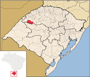
| State: | Rio Grande do Sul |
| Meso-region: | Northwestern Rio Grande do Sul (Noroeste Rio-Grandense) |
| Micro-Region: | Santo Ângelo |
| Founded: | October 12, 1965 |
| Postal code: | 97850-xxx |
| Name of inhabitants: | Bossoroquense |
| Website: | www.bossoroca.rs.gov.br |
| Politics | |
| Mayor: | --> |
Bossoroca is a municipality of the western part of the state of Rio Grande do Sul, Brazil. The origin of the name comes from the Tupi words iby meaning earth and soroc which combines to mean erosion. It is located 524 km west of the state capital of Porto Alegre, northeast of Alegrete.
Bounding municipalities
Sporting club
- Spor Club Corsário
History
The area was first inhabited by the Guarani tribes.
In 1801, the adventurer Borges do Canto visited the area and integrated the counties of Rio Pardo. The mesopotamia between the rivers Inhacapetum, Icamaquã, Piratini and the Uruguay.
In 1818, the provinces became independent in 1816. The fields of Bossoroca became a part of the parish of São Borja. In 1934, the parish transformed into a Bossoroca into the fourth district of the same name.
Between 1800 and 1830, the concession of the fields, were one of the pioneers of the district, José Fabrício da Silva. This name generalizes and passes and identifies the district.
With an administrative evolution of São Luiz Gonzaga, the Bossoroca area passed into a part. It was a settlement counted with new houses receive and impused with 30 hectares. Paulina Alves Pereira, the prefect for a local urban in 1938, created the third district, Igrejinha and altered for Bossoroca. Gradually had a constructed homes, streets and a square.
On March 4, 1967 in a publiuc session, occurred a creation of the municipality of Bossoroca. The first prefectural electionoccurred on November 1968 which consolicated the municipality of Bossoroca.
External links
- http://www.citybrazil.com.br/rs/bossoroca/ (Portuguese)
- Map and Aerial photos:
- Coordinates: 28°43′48″S 54°54′0″W / 28.73000°S 54.90000°W
- Street maps: Street map from Mapquest, MapPoint or Google
- Satellite images and Aerial photos: Google
