Borough of Swindon
| Borough of Swindon | |
|---|---|
| Unitary authority, Borough | |
 | |
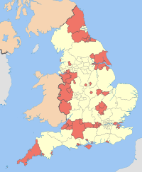
 Shown within Wiltshire | |
| Coordinates: 51°33′47″N 1°45′47″W / 51.563°N 1.763°WCoordinates: 51°33′47″N 1°45′47″W / 51.563°N 1.763°W | |
| Sovereign state | United Kingdom |
| Constituent country | England |
| Region | South West England |
| Ceremonial county | Wiltshire |
| Status | Unitary authority |
| Admin HQ | Swindon |
| Government | |
| • Type | Unitary authority |
| • Body | Swindon Borough Council |
| • Leadership | Leader & Cabinet (Conservative) |
| • MPs |
Robert Buckland (C) Justin Tomlinson (C) |
| Area | |
| • Total | 88.84 sq mi (230.10 km2) |
| Area rank | 158th (of 326) |
| Population (2011 est.) | |
| • Total | 209,700 |
| • Rank | 75th (of 326) |
| • Density | 2,400/sq mi (910/km2) |
| • Ethnicity |
93.4% White 3.0% S. Asian 1.0% Black British 1.4% Mixed Race 1.2% Chinese or Other[1] |
| Time zone | GMT (UTC0) |
| • Summer (DST) | BST (UTC+1) |
| ONS code | 00HX (ONS) E06000030 (GSS) |
| OS grid reference | SU164849 |
| Website |
www |
The Borough of Swindon is a local government authority in South West England. It is centred on the town of Swindon and forms part of the ceremonial county of Wiltshire. It was formed in 1974 as the Thamesdown district of Wiltshire, from former areas of the municipal borough of Swindon and Highworth Rural District.
On 1 April 1997 it was made administratively independent of Wiltshire County Council, with its council becoming a new unitary authority.[2] It adopted the name Swindon on 24 April 1997. The former Thamesdown name and logo are still used by the main local bus company of Swindon, called Thamesdown Transport Limited.[3]
Swindon Borough Council is now a 2 star Council according to the Audit Commission.[4]
Economy
This is a chart of trend of regional gross value added of Swindon at current basic prices published (pp. 240–253) by Office for National Statistics with figures in millions of British Pounds Sterling.
| Year | Regional Gross Value Added | Agriculture | Industry | Services |
|---|---|---|---|---|
| 1995 | 2,654 | 13 | 1,023 | 1,618 |
| 2000 | 4,085 | 9 | 1,368 | 2,708 |
| 2003 | 4,259 | 8 | 1,185 | 3,067 |
^ includes hunting and forestry
^ includes energy and construction
^ includes Financial Intermediation Services Indirectly Measured
^ Components may not sum to totals due to rounding
Geography
The borough of Swindon occupies an area in the north east corner of Wiltshire and is bordered by two other counties, Gloucestershire (to the north) and Oxfordshire (to the east). Also, West Berkshire is only a short distance from the borough’s south eastern tip. The landscape is marked by the River Thames guiding the northern border and the Marlborough Downs encroaching to the south.
Area covered

The Borough covers not just the town of Swindon, but surrounding countryside and the town of Highworth and villages including
- Badbury
- Bishopstone
- Blunsdon
- Chiseldon
- Hannington
- Highworth
- Hinton Parva
- Inglesham
- Liddington
- Lydiard Tregoze
- Sevenhampton
- South Marston
- Stanton Fitzwarren
- Stratton St. Margaret
- Wanborough
- Wroughton
Swindon Borough Council
The council follows a leader and cabinet model[5] and has 57 elected members. Elections are held in three out of every four years, with one third of the seats being elected at each election. From the first election in 1996 to the 2000 election, Labour had a majority on the council. Following a period where no party had a majority the Conservatives gained a majority at the 2003 election and have held control since then. As of the 2014 election the council is composed of the following councillors:-[6]
| Party | Councillors | |
| Conservative Party | 30 | |
| Labour Party | 23 | |
| Liberal Democrats | 4 | |
Wards
The following are the electoral wards within the Borough as at 2014.[7]
- Blunsdon & Highworth [3 Conservative Cllrs]
- Central [3 Labour Cllrs]
- Chiseldon & Lawn [2 Conservative Cllrs]
- Covingham and Dorcan [3 Conservative Cllrs]
- Eastcott [3 Lib Dem Cllrs]
- Gorse Hill and Pinehurst [3 Labour Cllrs]
- Haydon Wick [3 Conservative Cllrs]
- Liden, Eldene & Park South [3 Labour Cllrs]
- Lydiard & Freshbrook [2 Conservative & 1 Labour Cllr]
- Mannington & Western [3 Labour Cllrs]
- Old Town [2 Conservative & 1 Labour Cllr]
- Penhill & Upper Stratton [3 Labour Cllrs]
- Priory Vale [3 Conservative Cllrs]
- Ridgeway [1 Conservative Cllr]
- Rodbourne Cheney [3 Labour Cllrs]
- Shaw [3 Conservative Cllrs]
- St Andrews [3 Conservative Cllrs]
- St Margaret & South Marston [3 Conservative Cllrs]
- Walcot & Park North [3 Labour Cllrs]
- Wroughton and Wichelstowe [2 Conservative & 1 Lib Dem Cllr]
References
- ↑ Neighbourhood Statistics
- ↑ The Wiltshire (Borough of Thamesdown)(Structural Change) Order 1995
- ↑ Thamesdown Transport Limited Website.
- ↑ Audit Commission Reports on Swindon Borough Council.
- ↑ http://ww2.swindon.gov.uk/moderngov/mgCommitteeDetails.asp?ID=285&J=8
- ↑ "England council elections". BBC News Online. Retrieved 11 September 2011.
- ↑ Retrieved on 2014-07-01
| ||||||||||||||||||||||
| ||||||||||||||||||