Borough of Melton
- For other uses, see Melton (disambiguation).
| Borough of Melton | |
|---|---|
| Borough | |
|
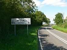
Entering the borough on the A607 at Rearsby | |
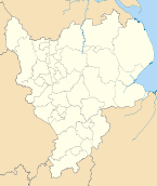
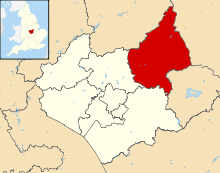 Shown within Leicestershire | |
| Sovereign state | United Kingdom |
| Constituent country | England |
| Region | East Midlands |
| Administrative county | Leicestershire |
| Founded | 1974 |
| Admin. HQ | Melton Mowbray |
| Government | |
| • Type | Melton Borough Council |
| • Leadership: | Alternative - Sec.31 |
| • Executive: | Conservative |
| • MPs: | Alan Duncan |
| • Chief Executive | Lynn Aisbett (since 2004) |
| Area | |
| • Total | 185.9 sq mi (481.4 km2) |
| Area rank | 93rd |
| Population (2011 est.) | |
| • Total | 50,500 |
| • Rank | Ranked 320th |
| • Density | 270/sq mi (100/km2) |
| Time zone | Greenwich Mean Time (UTC+0) |
| • Summer (DST) | British Summer Time (UTC+1) |
| ONS code |
31UG (ONS) E07000133 (GSS) |
| Ethnicity | 98.8% White |
| Website | melton.gov.uk |

Melton is a local government district with borough status in north-eastern Leicestershire, England. It is named after its main town, Melton Mowbray. Other settlements include Asfordby and Bottesford. It has a population of 46,861.
History
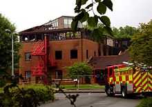
It was formed in 1974 from the Melton Mowbray Urban District and the Melton and Belvoir Rural District. The council offices on Nottingham Road burnt down on May 30, 2008.[1][2] Across the road were situated the main offices of the East Midlands Regional Assembly before it was abolished in 2010.
Culture
The borough claims to be the Home of Stilton Cheese and Melton Mowbray Pork Pies.
Parishes
- Ab Kettleby, Asfordby
- Barkestone-le-Vale, Plungar and Redmile, Belvoir, Bottesford, Buckminster
- Broughton and Old Dalby, Burton and Dalby
- Clawson, Hose and Harby, Croxton Kerrial and Branston,
- Eaton, Eastwell
- Freeby, Frisby on the Wreake
- Gaddesby, Garthorpe, Grimston, Saxelbye, Shoby
- Goadby Marwood
- Harby
- Hoby with Rotherby
- Kirby Bellars, Knossington and Cold Overton
- Scalford, Somerby, Sproxton, Stathern
- Twyford and Thorpe
- Waltham and Thorpe Arnold, Wymondham
Political representation
There are 28 councillors, of which twenty one are Conservative and so control the council. Seven are Labour in the Melton Egerton, Melton Newport, Dorian, Craven and Asfordby wards. The Conservative leader of the council lives in Sproxton, representing the Wymondham ward.
The Melton and Rutland constituency is Conservative.
East Midlands Councils is based opposite the Melton borough offices on the A606.
Geography
The district borders South Kesteven, in Lincolnshire, to the east, Rutland to the south, Charnwood to the west (along the A46 Fosse Way), and Rushcliffe and Newark and Sherwood in Nottinghamshire to the north. The north part of the district is known as the Vale of Belvoir.
Economy
Farming and food production are the main industries with Pedigree Petfoods in Melton, and its Waltham Centre for Pet Nutrition at Waltham on the Wolds. There is a large creamery (Long Clawson Dairy) at Long Clawson. Samworth Brothers are headquartered in Melton. The Royal Army Veterinary Corps and Defence Animal Centre are also in Melton.
The Birmingham to Peterborough Line runs through the borough, and the borough is criss-crossed by the A607 (Leicester-Grantham) and the A606 (Nottingham-Oakham). Both these roads meet in the centre of Melton (outside Melton Brooksby College), with resulting congestion.
Education
Until September 2008, the district operated the three-tier education system, whereby there were three middle schools. All these schools fed into the same upper school in Melton from 14-18. At both GCSE and A level, the district's results are above the England average. From age 16 Students can attend either Melton Vale Post 16 Centre for academic sixth form courses, or Brooksby Melton College for vocational courses.
Demographics
The district is fairly affluent, with the 3rd highest house prices in Leicestershire, even higher than Charnwood.
Highest rate of accidental death in England in 2010/11
In March 2012, Melton was identified as having the highest rate of accidental death by The Royal Society for the Prevention of Accidents, with statistics over the period from 2010/11 showing an average of 29 deaths for 100,000 people.[3]
References
- ↑
- ↑ Photos: Melton Council HQ Fire. "Melton Borough Council offices burn down in May 2008". BBC. Retrieved 2013-08-23.
- ↑ Child Safety (2012-03-26). "New Injury Stats Show Burden Of Accidents And Regional Varia...". RoSPA. Retrieved 2013-08-23.
External links
- Community profile at Leicestershire County Council
- Council returns to Melton in October 2008
- Council office demolished in June 2008
- Stapleford Miniature Railway
| ||||||||||||||||||||||
| ||||||||||||||||||||||||||||