Bonner Springs, Kansas
| Bonner Springs, Kansas | |
|---|---|
| City | |
|
National Agriculture Hall of Fame in Bonner Springs | |
| Motto: "Life is better in...Bonner Springs" | |
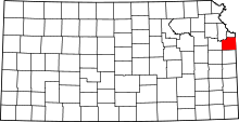
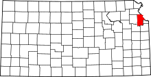
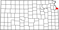
 Location within Wyandotte County and Kansas | |
| Coordinates: 39°4′0″N 94°52′45″W / 39.06667°N 94.87917°WCoordinates: 39°4′0″N 94°52′45″W / 39.06667°N 94.87917°W | |
| Country | United States |
| State | Kansas |
| Counties | Wyandotte, Johnson, Leavenworth |
| Trading Post | 1812 |
| Incorporated | 1898 |
| Area[1] | |
| • Total | 16.09 sq mi (41.67 km2) |
| • Land | 15.73 sq mi (40.74 km2) |
| • Water | 0.36 sq mi (0.93 km2) |
| Elevation | 869 ft (265 m) |
| Population (2010)[2] | |
| • Total | 7,314 |
| • Estimate (2013)[3] | 7,480 |
| • Density | 465.0/sq mi (179.5/km2) |
| Time zone | Central (CST) (UTC-6) |
| • Summer (DST) | CDT (UTC-5) |
| ZIP code | 66012 |
| Area code(s) | 913 |
| FIPS code | 20-07975 |
| GNIS feature ID | 047886 5[4] |
| Website | BonnerSprings.org |
Bonner Springs is a city in Johnson, Leavenworth, and Wyandotte counties in the State of Kansas, and part of the Kansas City Metropolitan Area. The vast majority of the city, which lies in Wyandotte County, is part of the "Unified Government" which contains Kansas City, Kansas, Bonner Springs, Edwardsville, and roughly a quarter of Lake Quivira. As of the 2010 census, the city population was 7,314.[5]
History
In 1812, the Chouteau brothers made their way from St. Louis Missouri and settled in the area that would become Bonner Springs, starting a trading post named Four Horses. [6] Four Horses allowed easy access to trade items, as well as a ferry to cross the Kansas River. Four Horses was a success, and in 1830, Henry Tiblow took charge of the ferry. [7] Henry Tiblow was a Delaware Indian, who was also an interpreter for the government. He lived in a small cabin on the west side of the city. [8] Soon, the ferry became known as Tiblow Settlement, and continued working for years. [9] The town was originally called Tiblow, because of the ferry, with John McDanield as the town proprietor. [10] Then, in 1885, a man by the name of Philo Clark took over, and the town changed its name to Bonner Springs.[11] The town was named after Robert E. Bonner, a newspaper editor, and from a mineral spring said to have medicinal qualities.[12][13] Bonner Springs was incorporated as a city in 1898.[14] Philo Clark became the first mayor of Bonner Springs, with the incorporation of the city. [15]
Things in Bonner Springs continued to be prosperous, with growing populations and new businesses. However, in 1908, a fire caused over $70,000 worth of damage, and destroyed between nineteen and twenty-one local businesses.[16] Many locals came to the rescue, and started a water bucket chain to help put out the fire, while they waited for a fire truck from Kansas City to arrive at the scene.[17] After investigation, it was said that a spontaneous combustion at the back of Kelly & Pettit's Drug Store that caused the fire, and the winds carried the flames, making them difficult to control. [18] While difficult, Bonner Springs came back from the fire, and worked to overcome the thousands of dollars worth of repairs. Over more than a century after, Bonner Springs has built up to become a city with many commercial businesses, as well as local retail stores.[19]
Geography
Bonner Springs is located at 39°04′00″N 94°52′45″W / 39.066707°N 94.879132°W (39.066707, -94.879132),[20] along both banks of the Kansas River. According to the United States Census Bureau, the city has a total area of 16.09 square miles (41.67 km2), of which, 15.73 square miles (40.74 km2) is land and 0.36 square miles (0.93 km2) is water.[1]
Climate
The climate in this area is characterized by hot, humid summers and generally mild to cool winters. According to the Köppen Climate Classification system, Bonner Springs has a humid subtropical climate, abbreviated "Cfa" on climate maps.[21]
Demographics
| Historical population | |||
|---|---|---|---|
| Census | Pop. | %± | |
| 1900 | 609 | — | |
| 1910 | 1,447 | 137.6% | |
| 1920 | 1,599 | 10.5% | |
| 1930 | 1,837 | 14.9% | |
| 1940 | 1,837 | 0.0% | |
| 1950 | 2,277 | 24.0% | |
| 1960 | 3,171 | 39.3% | |
| 1970 | 3,884 | 22.5% | |
| 1980 | 6,266 | 61.3% | |
| 1990 | 6,413 | 2.3% | |
| 2000 | 6,768 | 5.5% | |
| 2010 | 7,314 | 8.1% | |
| Est. 2013 | 7,480 | 2.3% | |
| U.S. Decennial Census[22] 2013 Estimate[3] | |||
2010 census
As of the census[2] of 2010, there were 7,314 people, 2,810 households, and 1,917 families residing in the city. The population density was 465.0 inhabitants per square mile (179.5/km2). There were 3,025 housing units at an average density of 192.3 per square mile (74.2/km2). The racial makeup of the city was 84.8% White, 5.4% African American, 0.9% Native American, 0.5% Asian, 0.1% Pacific Islander, 5.0% from other races, and 3.3% from two or more races. Hispanic or Latino of any race were 10.8% of the population.
There were 2,810 households of which 35.2% had children under the age of 18 living with them, 48.6% were married couples living together, 14.2% had a female householder with no husband present, 5.5% had a male householder with no wife present, and 31.8% were non-families. 25.7% of all households were made up of individuals and 9.8% had someone living alone who was 65 years of age or older. The average household size was 2.59 and the average family size was 3.11.
The median age in the city was 35.7 years. 26.5% of residents were under the age of 18; 8.8% were between the ages of 18 and 24; 26.8% were from 25 to 44; 26.2% were from 45 to 64; and 11.8% were 65 years of age or older. The gender makeup of the city was 47.9% male and 52.1% female.
2000 census
As of the census of 2000, there were 6,768 people, 2,592 households, and 1,824 families residing in the city. The population density was 429.4 people per square mile (165.8/km2). There were 2,754 housing units at an average density of 174.7 per square mile (67.5/km2). The racial makeup of the city was 90.2% White, 4.1% African American, 0.8% Native American, 0.5% Asian, 2.7% from other races, and 1.7% from two or more races. Hispanic or Latino of any race were 6.2% of the population. 22.1% were of German, 13.3% American, 12.8% Irish and 10.9% English ancestry.
There were 2,592 households out of which 35.8% had children under the age of 18 living with them, 53.5% were married couples living together, 12.6% had a female householder with no husband present, and 29.6% were non-families. 24.7% of all households were made up of individuals and 10.8% had someone living alone who was 65 years of age or older. The average household size was 2.59 and the average family size was 3.11.
In the city the population was spread out with 28.2% under the age of 18, 8.5% from 18 to 24, 29.8% from 25 to 44, 20.7% from 45 to 64, and 12.8% who were 65 years of age or older. The median age was 34 years. For every 100 females there were 93.7 males. For every 100 females age 18 and over, there were 87.2 males.
As of 2000 the median income for a household in the city was $43,234, and the median income for a family was $50,476. Males had a median income of $36,390 versus $26,957 for females. The per capita income for the city was $19,730. About 6.8% of families and 9.6% of the population were below the poverty line, including 12.9% of those under age 18 and 5.4% of those age 65 or over.
Transportation
![]() I‑70
I‑70
![]() US-24
US-24
![]() US-40
US-40
![]() US-73
US-73
Education
Its high school is Bonner Springs High School.
Cultural institutions
Bonner Springs contains the Agricultural Center and Hall of Fame, a privately funded charitable institution chartered by the U.S. Congress to "educate society on the historical and present value of American agriculture and to honor leadership in Agri-Business and Academia by providing education, information, experience and recognition."
In addition, the Wyandotte County Museum and Historical Society is located within the Wyandotte County Park, in Bonner Springs. The Museum and Trowbridge Archival Library are open to the public free of charge. Its charge is to preserve and educate the history of Wyandotte County and its people.
Bonner Springs is also home to Sandstone Amphitheater, a popular concert venue. The city is host of the annual Kansas City Renaissance Festival.[23] Each year, during the last weekend of August, the city hosts Tiblow Days, a heritage festival in honor of Henry Tiblow (an early settler).[24]
See also
References
- ↑ 1.0 1.1 "US Gazetteer files 2010". United States Census Bureau. Retrieved 2012-07-06.
- ↑ 2.0 2.1 "American FactFinder". United States Census Bureau. Retrieved 2012-07-06.
- ↑ 3.0 3.1 "Population Estimates". United States Census Bureau. Retrieved 2014-08-21.
- ↑ "US Board on Geographic Names". United States Geological Survey. 2007-10-25. Retrieved 2008-01-31.
- ↑ "2010 City Population and Housing Occupancy Status". U.S. Census Bureau. Retrieved March 6, 2011.
- ↑ Morgan, Perl Wilbur (1911). History of Wyandotte County and its People (1 ed.). Chicago: Lewis Publishing. p. 319. Retrieved 27 April 2015.
- ↑ Boyer, Carolyn (10 March 2014). "Five Things You Might Not Know about Bonner Springs". Dolph C. Simons Jr. The Chieftain. Retrieved 27 April 2015.
- ↑ Morgan, Perl Wilbur (1911). History of Wyandotte County and its People (1 ed.). Chicago: Lewis Publishing. p. 319. Retrieved 27 April 2015.
- ↑ Boyer, Carolyn (10 March 2014). "Five Things You Might Not Know about Bonner Springs". Dolph C. Simons Jr. The Chieftain. Retrieved 27 April 2015.
- ↑ Morgan, Perl Wilbur (1911). History of Wyandotte County and its People (1 ed.). Chicago: Lewis Publishing. p. 319. Retrieved 27 April 2015.
- ↑ Boyer, Carolyn (10 March 2014). "Five Things You Might Not Know about Bonner Springs". Dolph C. Simons Jr. The Chieftain. Retrieved 27 April 2015.
- ↑ Blackmar, Frank Wilson (1912). Kansas: A Cyclopedia of State History, Embracing Events, Institutions, Industries, Counties, Cities, Towns, Prominent Persons, Etc. Standard Publishing Company. p. 205.
- ↑ "Bonner Springs History". City of Bonner Springs, Kansas. Retrieved 12 June 2014.
- ↑ Morgan, Perl Wilbur (1911). History of Wyandotte County, Kansas: And Its People, Volume 1. The Lewis Publishing Company. p. 321.
- ↑ "Bonner Springs History". Bonner Springs, KS. CivicsPlus. Retrieved 27 April 2015.
- ↑ Boyer, Carolyn (10 March 2014). "Five Things You Might Not Know about Bonner Springs". Dolph C. Simons Jr. The Chieftain. Retrieved 27 April 2015.
- ↑ Boyer, Carolyn (10 March 2014). "Five Things You Might Not Know about Bonner Springs". Dolph C. Simons Jr. The Chieftain. Retrieved 27 April 2015.
- ↑ Boyer, Carolyn (10 March 2014). "Five Things You Might Not Know about Bonner Springs". Dolph C. Simons Jr. The Chieftain. Retrieved 27 April 2015.
- ↑ "Bonner Springs History". City of Bonner Springs, Kansas. Retrieved 27 April 2015.
- ↑ "US Gazetteer files: 2010, 2000, and 1990". United States Census Bureau. 2011-02-12. Retrieved 2011-04-23.
- ↑ Climate Summary for Bonner Springs, Kansas
- ↑ United States Census Bureau. "Census of Population and Housing". Retrieved October 24, 2013.
- ↑ Draper, Bill (2003-08-15). "Off with its head?". The Topeka Capital-Journal. Retrieved 2010-02-17.
- ↑ Henry Tiblow info
Further reading
- County
- History of Leavenworth County Kansas; Jesse Hall and LeRoy Hand; Historical Publishing; 684 pages; 1921. (Download 27MB PDF eBook)
- Kansas
- History of the State of Kansas; William G. Cutler; A.T. Andreas Publisher; 1883. (Online HTML eBook)
- Kansas : A Cyclopedia of State History, Embracing Events, Institutions, Industries, Counties, Cities, Towns, Prominent Persons, Etc; 3 Volumes; Frank W. Blackmar; Standard Publishing Co; 944 / 955 / 824 pages; 1912. (Volume1 - Download 54MB PDF eBook),(Volume2 - Download 53MB PDF eBook), (Volume3 - Download 33MB PDF eBook)
External links
| Wikimedia Commons has media related to Bonner Springs, Kansas. |
- City
- City of Bonner Springs
- Bonner Springs - Directory of Public Officials
- Bonner Springs / Edwardsville Area Chamber of Commerce
- Schools
- USD 204, local school district
- Maps
- Bonner Springs City Map, BonnerSprings.org
- Bonner Springs City Map, KDOT
| |||||||||||||||||||||||||
| |||||||||||||||||||||||||||||||||
| |||||||||||||||||||||
| ||||||||||||||||||||||||


