Bonin Islands
| Ogasawara Islands | |
|---|---|
| Name as inscribed on the World Heritage List | |
| Type | Natural |
| Criteria | ix |
| Reference | 1362 |
| UNESCO region | Asia-Pacific |
| Inscription history | |
| Inscription | 2011 (35th Session) |

The Bonin Islands, also known as the Ogasawara Islands (小笠原群島 Ogasawara Guntō),[1] are an archipelago of over 30 subtropical and tropical islands, some 1,000 kilometres (540 nmi; 620 mi) directly south of Tokyo, Japan. "Bonin Islands" is the common name in English for Ogasawara Guntō, from the Japanese word bunin (an archaic reading of 無人 mujin), meaning "no people" or "uninhabited". The only inhabited islands of the group are Chichi-jima (父島), the seat of the municipal government, and Haha-jima (母島), which includes Ogasawara Village.
Ogasawara Municipality (mura) and Ogasawara Subprefecture (Tokyo Prefecture) take their names from the Ogasawara Group. However, Ogasawara Archipelago (小笠原諸島 Ogasawara shotō), may also be a wider collective term that includes other islands in Ogasawara Municipality, such as the Volcano Islands, along with other small, uninhabited and isolated islands. Geographically speaking, all of these islands are part of the Nanpō Islands.
A total population of 2,440 comprising 2,000 on Chichi-jima, and 440 on Haha-jima lives in the Ogasawara Group, which have a total area of 84 square kilometres (32 sq mi).
Because the Ogasawara Islands have never been connected to a continent, many of their animals and plants have undergone unique evolutionary processes. This has led to the islands' nickname of the "The Galápagos of the Orient", and their nomination as a natural World Heritage Site on June 24, 2011.[2] The giant squid (genus Architeuthis) was filmed off the Ogasawara Islands for the first time in the wild on September 27, 2005, and was captured in December 2006.[3]
A 25m-diameter radio telescope is located in Chichijima, which is one of the stations of the VLBI Exploration of Radio Astrometry (VERA) project, and is operated by the National Astronomical Observatory of Japan.
Geography & administration
The Bonin Islands consist of three subgroups, which are listed below, along with their main islands:
- Muko-jima Group (聟島列島 Muko-jima Rettō) - formerly Parry Group:
- Muko-jima (聟島, literally "Bridegroom Island");
- Yome-jima (嫁島, lit. "Bride Island") - formerly Kater I.;
- Nakōdo-jima or Nakadachi-jima (媒島, lit. "Matchmaker Island");
- Kita-no-jima (北ノ島 or 北島, lit. "Northern Island");
- Mae-jima - formerly the Ears;
- Chichi-jima Group (父島列島 Chichi-jima Rettō) - formerly Beechey Group:
- Chichi-jima (父島, lit. "Father Island") - formerly Main I./Peel I.;
- Ani-jima (兄島, lit. "Elder Brother Island") - formerly Hog I./Buckland I.;
- Otōto-jima (弟島, lit. "Younger Brother Island") - formerly North I./Stapleton I.;
- Mago-jima (孫島 lit. "Grandchild Island");
- Higashi-jima (東島 lit. "East Island")
- Nishi-jima (西島 lit. "West Island") - formerly Goat I.;
- Minami-jima (南島 lit. "South Island") - formerly Knorr I.;
- Haha-jima Group (母島列島 Haha-jima Rettō) - formerly Baily Group or Coffin Islands:
- Haha-jima (母島, lit. "Mother Island") - formerly Hillsborough I.;
- Mukō-jima (向島 lit. "Over There Island") - formerly Plymouth I.;
- Hira-jima or Taira-jima (平島, lit. "Flat Island")
- Ane-jima (姉島, lit. "Elder Sister Island") - formerly Perry I.;
- Imōto-jima (妹島, lit. "Younger Sister Island") - formerly Kelly I.;
- Mei-jima (姪島, lit. "Niece Island")
Administratively, the Volcano Islands, Nishinoshima (Rosario Island), Okinotorishima (Parece Vela) and Minamitorishima (Marcus Island) are today part of Ogasawara municipality. Geographically, they are not traditionally considered part of the Bonin Islands, which are the Mukojima, Chichijima, and Hahajima island clusters.[4] In other words, the historical ambit of the Bonin Islands (Ogasawara Guntō) is not the precise equivalent of the Japanese governmental unit.[5] The Bonin Islands is a geographical term excluding the other islands which are today associated within the boundaries of a collective term, Ogasawara Shotō.
History
Prehistoric tools and carved stones, discovered on North Iwo Jima at the end of the 20th century, as well as stone tools discovered on Chichi-jima, indicate the islands might have been populated in ancient times.
Early claims
The first recorded visit by Europeans to the islands happened in 2 October 1543, when the Spanish explorer Bernardo de la Torre sighted Haha-jima which he charted as Forfana.[6] At that time, the islands were not populated.
Japanese discovery of the islands occurred in Kanbun 10 (1670) and was followed by a shogunate expedition in Enpō 3 (1675).[7] The islands are claimed as a territory of Japan.[8] They are then referred to as Bunin jima (無人島 Buninjima), literally "the uninhabited islands". In 1727, Ogasawara Sadato (小笠原 貞任 Ogasawara Sadato), a ronin, claimed that the islands were discovered by his ancestor Ogasawara Sadayori (小笠原 貞頼 Ogasawara Sadayori), in 1593, (Tensho 20), and the territory was granted as a fief by Toyotomi Hideyoshi. However, investigation of the claim found that it was a fraud and the very existence of Sadayori was doubtful; as a punishment Sadato was exiled by the shogunate (1735).
The first published description of the islands in the West was brought to Europe by Isaac Titsingh in 1796. His small library of Japanese books included Sangoku Tsūran Zusetsu (三国通覧図説 An Illustrated Description of Three Countries) by Hayashi Shihei.[9] This book, which was published in Japan in 1785,[10] briefly described the Ogasawara Islands.[11]
These groups were collectively called Islas del Arzobispo (Archbishop Islands) in Spanish sources of the 18th–19th century. This name is most likely due to an expedition organized by the Arzobispo (Archbishop) Pedro Moya de Contreras, Viceroy of New Spain, to explore the northern Pacific and the islands of Japan. Its main objective was to find the long sought and legendary islands of Rica de Oro (Rich in Gold), Rica de Plata (Rich in Silver) and the Islas del Armenio (Islands of the Armenian). After several years of planning and frustrated attempts the expedition finally set sail on 12 July 1587 commanded by Pedro de Unamuno. Even if it did revisit the Daitō Islands, already charted by Bernardo de la Torre in 1543, could not find the wanted islands after searching the positions where they were charted in contemporary references.[12] Japanese maps at the time seem to have been rather inaccurate and therefore considered by some[13] to be deliberately misleading. It is thought that this was an attempt to discourage colonization attempts by foreign nations. Frederick William Beechey used the Spanish name as late as 1831 and believed that the Japanese Boninsima referred to entirely different islands.[14]
British possession
In 1827 Captain F. W. Beechey of HMS Blossom reached the island chain and claimed them as a British possession. A copper plate was removed from Blossom 's hull and left on a beach as a marker of the claim:
"HBM Ship Blossom Capt F. W. Beechey took possession of this Group of Islands in the Name of and on the behalf of His Britannic Majesty George the IV on the 14th June 1827."[15]
In 1830, Nathaniel Savory, an American, landed on the island of Chichijima in 1830 and formed the first permanent colony there, along with 29 other people from Hawaii, the continental United States and Europe.[16] The first settlers were Richard Millichamp of Devon, England; Mateo Mozaro of Dubrovnik, Croatia; Alden B. Chapin and Nathanael Savory of Boston; Carl Johnsen of Copenhagen; as well as seven unnamed men and 13 women from the Kingdom of Hawaii.[17]
Two years later the Oriental Translation Fund of Great Britain and Ireland published a posthumous, abridged publication of Titsingh's French translation of Sankoku Tsūran Zusetsu.[18]
Further settlers arrived in 1846, aboard the whaling ship Howard. They established themselves initially in South Island. (One of them, a woman from the Caroline Islands named Hypa, died in 1897 age about 112, after being baptized on her deathbed.[19])
Commodore Matthew C. Perry of the United States Navy visited the islands in 1853 and bought property at Port Lloyd from Savory for $50. The US "Colony of Peel Island" (Chichijima) was created and Savory was appointed governor.

Japanese possession
In 1862 (Bunkyū 1), the islands were claimed by Japan, and in 1875 the Japanese government renamed them the Ogasawara Islands.[20] The Japanese names of each island were resolved and 38 settlers from Hachijojima were sent the following year. In 1876 the islands were put under the direct control of the Home Ministry and the islanders of European and US ancestry were granted Japanese nationality in 1882. Jack London visited the islands in 1893 and published an account of his sojourn.
A history of the islands was compiled by Lionel Cholmondeley over the course of several years; and his work was published in London in 1915.
In 1917, 60–70 island people claimed ancestry among the 19th-century English-speaking settlers; however, in 1941, no Bonin people would acknowledge descent from these early colonists.[21] The current residents include some who claim to be related to Nathaniel Savory.[22] In the winter of 1920-1921, Russian Futurist painter David Burliuk lived in the Bonin Islands and painted several landscapes of the islands.[23]

The Ogasawara islanders were relegated to an insignificant status up through the early Shōwa period. During World War II, most inhabitants were forcibly evacuated to the mainland. There was a Japanese military base on Chichijima run by a Major Sueo Matoba (的場 末男 Matoba Sueo) who was known for engaging in cannibalism and other acts on prisoners of war. He was executed for his crimes after the war.[24] Future President George H. W. Bush's plane crashed in the ocean near Chichijima, and he was rescued by an American submarine.[25] The Battle of Iwo Jima in 1945, one of the fiercest battles of World War II, was fought on a garrison island in this region of the Pacific.[26]
Following World War II, the islands were controlled by the United States Navy, which expelled all residents except those descended from the original settlers and/or related to them by marriage,[27] while allowing the return of pre-war inhabitants of White American or European, Micronesian or Polynesian ancestry.[28] The islands were returned to Japanese control in 1968, after which other Japanese citizens were allowed to return.
In November 2013, a new volcanic island formed, provisionally named “Niijima”.[29]
Demography, language & education

Virtually all of the Bonin Islands' inhabitants are Japanese citizens. This includes the significant proportion with ancestors from the United States, Europe and other Pacific islands, who can often be distinguished by their family names and ancestry, physical features or adherence to Christianity. During and after the US military occupation of 1946–68, a small minority of islanders opted for US citizenship and/or emigrated from the islands. However, most islanders with non-Japanese ancestry now appear to be reassimilating with the ethnic Japanese majority.
Japanese is the common language. Because settlers from United States, Europe and other Pacific islands preceded ethnic Japanese residents, an English-lexified pidgin (creole), the Ogasawara Mixed Language (OML) emerged on the islands during the 19th century.[30] This was the result of Japanese being hybridised with island English, resulting in a mixed language that can still be heard.[31]
The Ogasawara Village municipality operates public elementary and junior high schools, while Tokyo Metropolitan Government Board of Education operates Ogasawara High School[32]
Transportation
One can get from the main Japanese islands to Chichijima by way of the Ogasawara Maru liner, run by Ogasawara Marine Transportation. The ship leaves from Takeshiba pier in Tokyo Bay, and the trip takes around 25.5 hours (in good weather). There are four or five crossings each month.

The Ogasawara Maru is a 6,700 tonnes (6,600 long tons) vessel, 131-metre (430 ft) long, with a capacity of 1,031 passengers.[33] To get to Hahajima, one must first get to Chichijima, and then cross by the liner Hahajima Maru.
Because a trip from the main Japanese islands to the Ogasawaras is very difficult, when people get severely ill or otherwise have an emergency, word is conveyed to Iwo Jima Japan Maritime Self Defense Force post, and a helicopter is sent to the islands. Emergencies can also be handled from the main Japanese islands by Japan Air Self-Defense Force airplanes or the Maritime Self Defense Force base in Iwakuni can convey evacuees to the main islands by seaplane, the ShinMaywa US-1. This seaplane is also used to transport the Tokyo governor and other VIPs.
Ogasawara Village operates a bus service on Chichijima and elderly passengers may use a "silver pass." There is also a sightseeing taxi service, a rental car company, motorized scooter rental services, a bike rental service, and other amenities. Bringing one's own automobile onto the island is extremely difficult and costly.
Transportation issues
The world's first 'techno superliner', the Super Liner Ogasawara (which was to be commissioned in 2006), with a maximum speed of 38 knots (70 km/h; 44 mph), 14,500 tons gross tonnage, was expected to shorten the voyage to Ogasawara to about 17 hours and carry up to 740 passengers.[34] However, the project was canceled in July 2005 due to rising fuel prices and the loss of ¥2 billion.[35]
The Ogasawara Islands have no airport, and there is no prospect for one being constructed. However, there was talk for several decades of building one. Anijima and Chichijima were once designated possible construction sites, but because there are numerous valuable, rare, or endangered plant species forming a unique ecosystem in the vicinity of the proposed sites, issues of nature conservation were raised. Although construction of an airport was desired by some, a desire to keep the natural beauty of the islands untouched created a movement to block it. The airport issue was quite controversial on the islands.[36]
Geology
Formation
The Ogasawara (Bonin) Islands were formed around 48 million years ago. They are a part of the Izu-Bonin-Mariana Arc known geologically as a fore arc. They lie above a subduction zone between the Pacific Plate and the Philippine Sea Plate. The Pacific Plate is subducting under the Philippine Sea Plate, which creates an oceanic trench to the east of the islands: the Bonin Trench. The crust of the Ogasawara Islands was formed by volcanic activity when subduction began 45–50 million years ago, and is composed mostly of an andesitic volcanic rock called boninite, which is rich in magnesium oxide, chromium, and silicon dioxide. The Ogasawara Islands may represent the exposed parts of an ophiolite that has not yet been emplaced on oceanic crust. The rocks of the Volcano Islands are much younger; Iwo Jima is a dormant volcano characterized by rapid uplift and several hot springs.
Most of the islands have steep shorelines, often with sea cliffs ranging from 50 to 100 metres (160 to 330 ft) in height, but the islands are also fringed with coral reefs and have many beaches.[37] The highest point lies on South Iwo Jima, at 916 metres (3,005 ft).
Ecology
Flora
Flora has evolved differently on each of the islands. The Ogasawara Islands are sometimes referred to as the Galápagos of the Orient.[38]
These islands are home to the northern most outliers of the Clinostigma genus of palms. C. savoryianum is endemic and has been planted in mediterranean climates often with success. Other species of Metrosideros live here as well.
The Ogasawara Islands form a distinct subtropical moist broadleaf forest ecoregion, with a high degree of biodiversity and endemism. The islands are home to about 500 plant species, of which 43% are endemic. The forests are of three main types:
- Type I: Elaeocarpus-Ardisia mesic forest is found in the moist lowland areas with deep soils. The forests have a closed canopy with a height of about 15 metres (49 ft), dominated by Ardisia sieboldii. Elaeocarpus photiniaefolius, Pisonia umbellifera, and Pouteria obovata are other important canopy species. These forests were almost completely destroyed by clearing for agriculture before 1945.
- Type II: Distylium-Raphiolepis-Schima dry forest is found in drier lowland and upland sites with shallower soils. It is also a closed-canopy forest, with a 4-to-8-metre (13 to 26 ft) canopy composed mostly of Distylium lepidotum, Rhaphiolepis integerrima, Schima mertensiana, Pouteria obovata, and Syzygium buxifolium. The Type II forests can be further subdivided into:
- Type IIa: Distylium-Schima dry forest occurs in cloudy upland areas with fine-textured soils. These forests contain many rare and endemic species, with Pandanus boninensis and Syzygium buxifolium as the predominant trees.
- Type IIb: Raphiolepsis-Livistona dry forest is found in upland areas with few clouds and rocky soils. Rhaphiolepis integerrima is the dominant tree species, along with the fan palm Livistona chinensis var. bonensis, Pandanus boninensis and Ochrosia nakaiana.
- Type III: Distylium-Pouteria scrub forest is found on windy and dry mountain ridges and exposed sea cliffs. These forests have the highest species diversity on the islands. Distylium lepidotum and Pouteria obovata are the dominant species, growing from 0.5 to 1.5 metres (1.6 to 4.9 ft) tall. Other common shrubs are Myrsine okabeana, Symplocos kawakamii, and Pittosporum parvifolium.
Fauna

The range of the Bonin petrel extends beyond the Ogasawaras to include other islands in the northern Pacific region.
There are two restricted-range species of birds on the islands; the Japanese woodpigeon (Columba janthina) and the Vulnerable Bonin white-eye (Apalopteron familiare), formerly known as "Bonin honeyeater". The Japanese woodpigeon was extirpated in the Iwo Island groups in the 1980s.
A small bat, Sturdee's pipistrelle, is only known in one record and has not been seen since 1915. The Bonin flying fox (Pteropus pselaphon), also called the Bonin fruit bat, is endemic to the islands. It is currently listed as Critically Endangered, and a survey published by the Ogasawara Office of Education in 1999 estimated their number to be around 100.[39]
Geography
Climate
Climate is characterized by relatively high temperatures and evenly distributed precipitation throughout the year. The Köppen Climate Classification subtype for this climate is "Cfa". (Humid Subtropical Climate).[40]
| Climate data for Bonin Islands | |||||||||||||
|---|---|---|---|---|---|---|---|---|---|---|---|---|---|
| Month | Jan | Feb | Mar | Apr | May | Jun | Jul | Aug | Sep | Oct | Nov | Dec | Year |
| Average high °C (°F) | 20 (68) |
19 (67) |
21 (69) |
23 (73) |
24 (76) |
27 (81) |
29 (84) |
29 (84) |
29 (84) |
28 (82) |
25 (77) |
22 (71) |
24.7 (76.3) |
| Average low °C (°F) | 16 (61) |
16 (60) |
17 (62) |
19 (67) |
22 (71) |
24 (76) |
26 (78) |
26 (79) |
26 (78) |
24 (76) |
22 (71) |
18 (64) |
21.3 (70.3) |
| Average precipitation mm (inches) | 89 (3.5) |
81 (3.2) |
89 (3.5) |
135 (5.3) |
188 (7.4) |
137 (5.4) |
109 (4.3) |
147 (5.8) |
142 (5.6) |
163 (6.4) |
142 (5.6) |
132 (5.2) |
1,554 (61.2) |
| Source: Weatherbase [41] | |||||||||||||
Fictional references
The Ogasawara Islands have been referenced in a number of works of fiction. Bonin, by Robert Standish, describes itself as 'a novel', but claims 'this book is an accurate history of the Bonin Islands' based mainly on information from Nathaniel Savory's great-granddaughter, and includes descriptions of maltreatment of the Anglo-Polynesian population by the later Japanese settlers and authorities, and a detailed map of the Chichijima group (on the back end-paper), including over 50 English place-names.[42]
The Orange Islands from the Pokémon anime are based on the Bonin Islands.
In the 1968 Godzilla film, Destroy All Monsters, Monsterland is located in the chain. In an English-dubbed version, it is referred to as "Ogasawara Island" as if it were a lone island of that name.
In the television series The Super Dimension Fortress Macross, a fictional island in the chain, South Ataria Island (which would have laid at the southernmost position in the chain, surpassing Minami Iwo Jima), is the landing site of the SDF-1 Macross.[43]
In the 1963 film Matango, a luxury yacht is set adrift and lands on an island. Upon approaching the island one of the crew members shouts: "I wonder if it's the Bonin Islands?"[44] The English subtitles for the film misspell Bonin "Bonan".
Gallery
| Wikimedia Commons has media related to Bonin Islands. |
| Wikimedia Commons has media related to Ogasawara Islands. |
 Muko-jima |
 Chichi-jima |
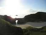 Minami-jima, a small island in Chichi-jima group |
 Haha-jima |
See also
- Ogasawara, Tokyo
- Ogasawara Subprefecture
- Extreme points of Japan
- 2010 Bonin Islands earthquake
References
- ↑ Comparison of name usage in published sources, 1800-2000; retrieved 2013-4-16.
- ↑ Japan Times. "Ogasawara Islands Join World Heritage family". Retrieved 26 June 2011.
- ↑ "Japanese Researchers Capture Giant Squid". Fox News. 2006-12-22. Retrieved 2007-09-06.
- ↑ Freeman, Otis W. (1951). Geography of the Pacific, pp. 229-235.
- ↑ "Bonin Islands," Encyclopædia Britannica. Retrieved July 06, 2009.
- ↑ Welsch, Bernhard. (2004). "Was Marcus Island Discovered by Bernardo de la Torre in 1543?" Journal of Pacific History, 39:1, 109-122.
- ↑ Tanaka, Hiroyuki (1993). "Edo Jidai ni okeru Nihonjin no Mujin Tou (Ogasawara Tou) ni tai-suru Ninshiki" ("The Ogasawara Islands in Tokugawa Japan"). Kaiji Shi Kenkyuu(Journal of the Maritime History). No. 50, June, 1993.
- ↑ [see above]
- ↑ WorldCat, Sangoku Tsūran Zusetsu; alternate romaji Sankoku Tsūran Zusetsu
- ↑ Cullen, Louis M. (2003). A History of Japan, 1582-1941: Internal and External Worlds, p. 137., p. 137, at Google Books
- ↑ Morris-Suzuki, Tessa. (1998). Re-inventing Japan: Time, Space, Nation, p. 24., p. 24, at Google Books; Kublin, Hyman. "The Discovery of the Bonin Islands: A Reexamination," Annals of the Association of American Geographers, Vol. 43, Issue 1 (March 1, 1953). pp. 27-46.
- ↑ James R. Moriarty III; William R. Roberts (1975). "Between Cipango and Quivira: The legends of Rica de Oro y Rica de Plata and the Islas del Armenio". Southern California Quarterly (The Historical Society of Southern California) 57 (3): 229.
- ↑ Beechey, Frederick William (1831). Narrative of a voyage to the Pacific and Beering's Strait, to co-operate with the polar expeditions: performed in His Majesty's ship Blossom, under the command of Captain F.W. Beechey, R.N., F.R.S. &c. in the years 1825, 26, 27, 28. London: H. Colburn and R. Bentley. pp. 237–240.
- ↑ Rein, J. J. (1884). Japan: Travel and Researches, pp.533-534.
- ↑ Oldman, W. O. (December 1944). "Historical Relic". The Journal of the Polynesian Society (The Polynesian Society) 53 (4): 211. Retrieved 7 September 2014. (subscription required (help)).
- ↑ Asia Society of Japan, Long lecture.
- ↑ Notes on the Bonin Islands, Michael Quin, Journal of the Royal Geographical Society of London, Vol. 26, (1856), pp. 232-235, Blackwell Publishing on behalf of The Royal Geographical Society (with the Institute of British Geographers)
- ↑ Klaproth, Julius. (1832). San kokf tsou ran to sets, ou Aperçu général des trois royaumes, pp. 256-286., p. 256, at Google Books
- ↑ Hypa, the Centenarian Nurse, by Rev A F King, The Mission Field, 43, 415-421, 1898
- ↑ Language and Citizenship in Japan, edited by Nanette Gottlieb, Chapter 10, p. 176
- ↑ National Geographic, October 1944, pp. 387–388, 404.
- ↑ "父島の宿". Retrieved 2007-09-05.
- ↑ Société Anonyme (1972). Société Anonyme (the First Museum of Modern Art, 1920-1944): Monographs. Arno Press. p. 87. ISBN 0-405-00772-8. Retrieved 2013-05-20.
- ↑ Welch, Jeanie M. "Without a Hangman, Without a Rope: Navy War Crimes Trials After World War II," International Journal of Naval History. Vol. 1, No. 1 (April 2002).
- ↑ "Story of George H. W. Bush World War II Experience". CNN. December 20, 2003.
- ↑ Nicol, C. W., ""The far-out Ogasawaras," Japan Times, 7 August 2011, p. 10.
- ↑ J. Bradshaw, "Review of English on the Bonin (Ogasawara) Islands",Language Documentation and Conservation v2, n1 (June 2008), pp. 176–8
- ↑ Trumbull, Robert. "Bonin Islanders Seek U.S. Tie But Remain International Pawns; Descendants of Americans Ask Citizenship in Vain--Fight Return of Japanese," New York Times. March 11, 1956.
- ↑
- ↑ Long, Daniel; Peter Trudgill (2004). The Last Yankee in the Pacific: Eastern New England Phonology in the Bonin Islands. Duke University Press. doi:10.1215/00031283-79-4-356.
- ↑ Long, Daniel (2007). English on the Bonin (Ogasawara) Islands. Duke University Press. ISBN 978-0-8223-6671-3.
- ↑ "Chichi-jima". ogasawara-h.metro.tokyo.jp.
- ↑ "おがさわら丸 (Ogasawara Maru)". Retrieved 2007-09-06.
- ↑ "Super High Speed Ship (Techno Super Liner) for Ogasawara Line Naming and Launching Ceremony". Archived from the original on 2007-09-26. Retrieved 2007-08-24.
- ↑ "Japan pulls plug on Techno Superliner". Retrieved 2007-08-24.
- ↑ McCormack, Gavan (August 1999). "Dilemmas of Development on The Ogasawara Islands". Japan Policy Research Institute. Retrieved 2008-01-17.
- ↑ coral reefs
- ↑ Yamaoka, Fumiko (May 12, 2007). "Saving an endangered bird in 'Orient's Galapagos'". The Japan Times.
- ↑ "Ogasawara subtropical moist forests". Terrestrial Ecoregions. World Wildlife Fund. Retrieved 2008-01-17.
- ↑ Climate Summary for Ogigaura, Japan (closest on record to the Bonin Islands)
- ↑ "Weatherbase.com". Weatherbase. 2013. Retrieved on May 10, 2013.
- ↑ Standish, Robert (pseudonym of Digby George Gerahty). (1943). Bonin, A Novel, London: Peter Davies.
- ↑ Macross Compendium Atlas Listing
- ↑ Matango - 00:17
Bibliography
- Cholmondeley, Lionel Berners (1915). The History of the Bonin Islands from the Year 1827 to the Year 1876. London: Constable & Co.
- Freeman, Otis Willard. (1951). Geography of the Pacific. New York: Wiley. OCLC 415089
- Hawks, Francis. (1856). Narrative of the Expedition of an American Squadron to the China Seas and Japan Performed in the Years 1852, 1853 and 1854 under the Command of Commodore M.C. Perry, United States Navy. Washington: A.O.P. Nicholson by order of Congress, 1856; originally published in Senate Executive Documents, No. 34 of 33rd Congress, 2nd Session. [reprinted by London:Trafalgar Square, 2005. ISBN 1-84588-026-9 (paper)]
- Hayashi, Shihei. (1785). Sangoku Tsūran Zusetsu (三国通覧図説 An Illustrated Description of Three Countries). Edo: Manuscript. OCLC 44014900
- Klaproth, Julius. (1832). San kokf tsou ran to sets, ou Aperçu général des trois royaumes. Paris: Oriental Translation Fund of Great Britain and Ireland. OCLC 2563166; also OCLC 561284561
- Kublin, Hyman. (1947). The Bonin Islands, 1543–1875. PhD thesis, Harvard University, Cambridge, Mass.
- Muroga, Nobuo. (1967). Geographical exploration by the Japanese. In: Friis, Herman R. (ed.): The Pacific Basin: A history of its geographical exploration. New York.
- Sewall, John S. (1905). The Logbook of the Captain's Clerk: Adventures in the China Seas, Bangor, Maine: Chas H. Glass & Co. [reprint by Chicago: R.R. Donnelly & Sons, 1995] ISBN 0-548-20912-X
- Teikoku's Complete Atlas of Japan, Tekoku-Shoin Co., Ltd. Tokyo 1990, ISBN 4-8071-0004-1
External links
| Wikisource has the text of the 1911 Encyclopædia Britannica article Bonin Islands. |
- Ogasawara Village (Japanese)
- The Bonin (Ogasawara) Islands Language and Culture Site
- Ogasawara Channel (Japanese)
- National Archives of Japan: The faked map of 1752 mentioned in Hiroyuki Tanaka's 1998 article.
- Tokyo Metropolitan Government, Ogasawara-mura: maps/photos
- Waseda University — Hayashi Shihei. (1785). 三国通覧図説 (Sangoku Tsuran Zusetsu)
| ||||||||||||||||||||||||||
| ||||||||||||||||||||||||||||||||
| |||||||||||||||||||||||||||||||||||||
.svg.png)
Coordinates: 26°59′53″N 142°13′05″E / 26.99806°N 142.21806°E