Bolton, Vermont
| Bolton, Vermont | |
|---|---|
| Town | |
 Bolton, Vermont | |
| Coordinates: 44°24′9″N 72°52′34″W / 44.40250°N 72.87611°WCoordinates: 44°24′9″N 72°52′34″W / 44.40250°N 72.87611°W | |
| Country | United States |
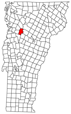
| State | Vermont |
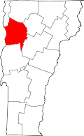
| County | Chittenden |
| Area | |
| • Total | 42.79 sq mi (110.8 km2) |
| • Land | 42.48 sq mi (110.0 km2) |
| • Water | 0.31 sq mi (0.8 km2) |
| Elevation | 1,614 ft (492 m) |
| Population (2000) | |
| • Total | 971 |
| • Density | 22.9/sq mi (8.8/km2) |
| Time zone | Eastern (EST) (UTC-5) |
| • Summer (DST) | EDT (UTC-4) |
| Area code(s) | 802 |
| FIPS code | 50-06550[1] |
| GNIS feature ID | 1462045[2] |
| Website | boltonvt.com |
Bolton is a town in Chittenden County, Vermont, United States. The population was 971 at the 2000 census.
The principal transportation artery of the town is US Route 2, which follows the north side of the Winooski River. I-89 passes through the town parallel to Route 2 but does not have an interchange there.
Geography
According to the United States Census Bureau, the town has a total area of 42.79 square miles (110.8 km2), of which 42.48 square miles (110.0 km2) is land and 0.31 square miles (0.80 km2) (or 0.72%) is water.[3]
The character of the town is predominantly rural. There are four principal settlements:
- Bolton proper is located in the Winooski River valley, on the north side of the river.
- West Bolton is located in the northwest corner of the town, and is accessed primarily from the adjacent town of Jericho.
- A thin strip of land, known as "the back side of the river", is located south of the Winooski River. The only road access is through the neighboring towns of Richmond and Duxbury.
- A small number of year-round residents live near the Bolton Valley ski area.
The Long Trail passes through Bolton on its way from Camel's Hump to Mount Mansfield.
Schools
On November 4, 2014, the communities of Bolton, Jericho, Richmond, Underhill ID and Underhill Town voted to form the Mount Mansfield Modified Union School District also known as the MMMUSD. This new school district will serve and govern the current town school districts of Bolton (Smilie Memorial School), Jericho (Jericho Elementary), Richmond (Richmond Elementary), Underhill ID School District (Underhill ID Elementary), Underhill Town (Underhill Central School), Mt Mansfield Union School District (Browns River Middle, Camels Hump Middle and Mt. Mansfield Union High Schools) in grades Pre-K through 12 and Huntington students grades 5-12.[4]
Demographics
As of the census[1] of 2000, there were 971 people, 368 households, and 260 families residing in the town. The population density was 22.9 people per square mile (8.8/km2). There were 412 housing units at an average density of 9.7 per square mile (3.7/km2). The racial makeup of the town was 98.15% White, 0.10% African American, 0.41% Native American, 0.21% Asian, 0.21% from other races, and 0.93% from two or more races. Hispanic or Latino of any race were 0.31% of the population.
There were 368 households, of which 40.8% had children under the age of 18 living with them, 57.9% were married couples living together, 7.6% had a female householder with no husband present, and 29.3% were non-families. 19.3% of all households were made up of individuals and 4.6% had someone living alone who was 65 years of age or older. The average household size was 2.64 and the average family size was 3.09.
In the town the population was spread out with 28.9% under the age of 18, 5.7% from 18 to 24, 39.6% from 25 to 44, 19.8% from 45 to 64, and 6.0% who were 65 years of age or older. The median age was 35 years. For every 100 females there were 102.3 males. For every 100 females age 18 and over, there were 100.6 males.
The median income for a household in the town was $49,625, and the median income for a family was $55,486. Males had a median income of $39,375 versus $28,958 for females. The per capita income for the town was $24,256. About 3.6% of families and 5.3% of the population were below the poverty line, including 7.7% of those under age 18 and 1.7% of those age 65 or over.
References
- ↑ 1.0 1.1 "American FactFinder". United States Census Bureau. Retrieved 2008-01-31.
- ↑ "US Board on Geographic Names". United States Geological Survey. 2007-10-25. Retrieved 2008-01-31.
- ↑ "Chittenden County, Vermont – County Subdivision and Place. GCT-PH1. Population, Housing Units, Area, and Density: 2000". United States Census Bureau. Retrieved 2011-07-20.
- ↑ Chittenden East Supervisory Union, http://www.cesu.k12.vt.us/
External links
| |||||||||||||||||||||||||||||