Bolsover District
| Bolsover District | |
|---|---|
| District | |
|
Bolsover Castle | |
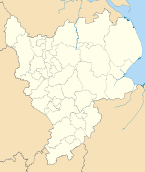
 Shown within Derbyshire | |
| Sovereign state | United Kingdom |
| Constituent country | England |
| Region | East Midlands |
| Ceremonial county | Derbyshire |
| Admin. HQ | Bolsover |
| Government | |
| • Type | Bolsover District Council |
| • Leadership: | Leader & Cabinet |
| • Executive: | Labour |
| • MPs: | Dennis Skinner |
| Area | |
| • Total | 61.9 sq mi (160.3 km2) |
| Area rank | 183rd |
| Population (2011 est.) | |
| • Total | 76,000 |
| • Rank | Ranked 294th |
| • Density | 1,200/sq mi (470/km2) |
| Time zone | Greenwich Mean Time (UTC+0) |
| • Summer (DST) | British Summer Time (UTC+1) |
| ONS code |
17UC (ONS) E07000033 (GSS) |
| Ethnicity | 99.1% White |
| Website | bolsover.gov.uk |

Bolsover is a local government district in Derbyshire, England. Its main town is Bolsover.
Town and parish councils
There are fourteen town and parish councils within the district.
In addition to the town councils of Old Bolsover and Shirebrook, there are the parish councils of:
- Ault Hucknall
- Barlborough
- Blackwell
- Clowne
- Elmton-with-Creswell
- Glapwell
- Hodthorpe and Belph
- Pinxton
- Pleasley
- Scarcliffe
- South Normanton
- Tibshelf
- Whitwell
Other settlements include Broadmeadows, Hilcote, Langwith, Old Blackwell, Newton, Palterton, Shirebrook and Westhouses.
The current district boundaries date from 1 April 1974, when the urban district of Bolsover was merged with Blackwell Rural District and Clowne Rural District.
Governance
Bolsover District Council is elected every four years, with currently 37 councillors being elected at each election. The Labour party has had a majority on the council since the first election to the council in 1973 and as of the 2011 election the council is composed of the following councillors:-[1]
| Party | Councillors | |
| Labour Party | 31 | |
| Independent | 4 | |
| Whitwell Residents Association | 1 | |
| Green party | 1 | |
Local Development Framework
The council is currently in the process of Consulting on its draft Infrastructure and Delivery Plan.[2]
References
- ↑ "Councillors". Bolsover District Council. Archived from the original on 17 May 2011. Retrieved 26 July 2014.
- ↑ "Local Development Framework". Bolsover District Council. 20 December 2011. Retrieved 2 January 2012.
| ||||||||||||||||||||||
| ||||||||||||||||||||||||||||