Bollon, Queensland
| Bollon Queensland | |||||||
|---|---|---|---|---|---|---|---|
|
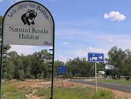
The entrance sign to Bollon | |||||||
 Bollon | |||||||
| Coordinates | 28°02′0″S 147°29′0″E / 28.03333°S 147.48333°ECoordinates: 28°02′0″S 147°29′0″E / 28.03333°S 147.48333°E | ||||||
| Population | 334 (2011 census)[1] | ||||||
| Established | 1879 | ||||||
| Postcode(s) | 4488 | ||||||
| Elevation | 183 m (600 ft) | ||||||
| Location | |||||||
| LGA(s) | Shire of Balonne | ||||||
| State electorate(s) | Warrego | ||||||
| Federal Division(s) | Maranoa | ||||||
| |||||||
Bollon is a town in South West Queensland, Australia in the Balonne Shire local government area, 634 kilometres (394 mi) west of the state capital, Brisbane. Bollon is situated on the Balonne Highway, between St George and Cunnamulla on the banks of Wallam Creek. At the 2011 census, Bollon had a population of 334.[1]
The town was established in 1879 and the town is thought to be named after either the indigenous name for Wallam Creek or a type of stone axe. A stand of River red gums along the creek is home to a large colony of koalas.
In 2010, Narkoola National Park was established in the west of the town's boundaries to preserve plant communities of the Mulga Lands bioregion.[2]
Facilities
Bollon has a public library, Bollon civic centre, showground and a park. [3]
References
- ↑ 1.0 1.1 Australian Bureau of Statistics (31 October 2012). "Bollon (State Suburb)". 2011 Census QuickStats. Retrieved 29 August 2014.
- ↑ "Narkoola National Park and Narkoola National Park (Recovery) Management Statement 2013" (PDF). Department of National Parks, Recreation, Sport and Racing. Retrieved 29 August 2014.
- ↑ "Bollon". Balonne Shire Council. Retrieved 13 November 2013.
| ||||||