Boliney, Abra
| Boliney | ||
|---|---|---|
| Municipality | ||
| ||
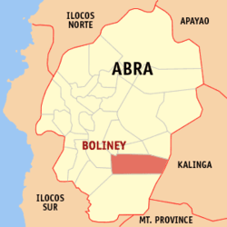 Map of Abra showing the location of Boliney | ||
.svg.png) Boliney Location within the Philippines | ||
| Coordinates: 17°24′N 120°48′E / 17.400°N 120.800°ECoordinates: 17°24′N 120°48′E / 17.400°N 120.800°E | ||
| Country | Philippines | |
| Region | Cordillera Administrative Region (CAR) | |
| Province | Abra | |
| District | Lone District of Abra | |
| Barangays | 8 | |
| Government[1] | ||
| • Mayor | Benido L. Balao-as Sr. | |
| Area[2] | ||
| • Total | 216.92 km2 (83.75 sq mi) | |
| Population (2010)[3] | ||
| • Total | 4,063 | |
| • Density | 19/km2 (49/sq mi) | |
| Time zone | PST (UTC+8) | |
| ZIP code | 2815 | |
| Dialing code | 74 | |
| Income class | 5th class municipality | |

Boliney is a fifth class municipality in the province of Abra, Philippines. According to the 2010 census, it has a population of 4,063 people.[3]
Boliney is bounded to the north by the municipalities of Sallapadan, Bucloc, and Daguioman, to the east by the provinces of Kalinga, Mountain Province and the Municipality of Tubo, and to the west by the municipalities of Luba and Manabo.
Barangays
Boliney is politically subdivided into 8 barangays,[2] listed here with 2010 population.[3]
- Amti - 411
- Bao-yan - 577
- Danac East - 518
- Danac West - 618
- Dao-angan - 399
- Dumagas - 387
- Kilong-Olao - 234
- Poblacion (Boliney) - 919
Demographics
| Population census of Boliney | ||
|---|---|---|
| Year | Pop. | ±% p.a. |
| 1990 | 3,773 | — |
| 1995 | 3,156 | −3.29% |
| 2000 | 3,340 | +1.22% |
| 2007 | 3,349 | +0.04% |
| 2010 | 4,063 | +7.29% |
| Source: National Statistics Office[3] | ||
The municipality's population consists of the Cordillera sub-tribes, namely Masadiit of the Tinguian Tribes, Belwang of the Igorot and Balatoc of the Kalinga tribe. Descendants of the other Tinguian sub-tribes are also represented in Boliney such as Binongan, Banao, Maeng, Ammotan (now called Muyadan of Manabo).
Economy
The main source of livelihood of the people of Boliney comes from their rice terraces. But most of their rice lands were either seriously damaged or totally lost due to the landslides, mud piles, and by the killer quakes in 1990 and 1992. They get most of their rice now from Bangued, while other mountain municipalities supplied some of the rice needs of some nearby lowland municipalities.
Rehabilitation have been on the communal facilities such as roads, trails, irrigation systems, footbridges and rice fields by the Masadiit Farmers Cooperative Inc. (MFCI) with the fund amounting to ₱2,903 million from the Presidential Management Staff and by the Inter NGO Disaster Relief Services (INDRS) with the fund amounting CA$292,516.00, ₱7 million from Oxfam. While these rehabilitation efforts have done much for the people of Boliney, there is still much rehabilitation that needs to be done.
Transportation
The town of Boliney is situated 62 kilometres (39 mi) from the capital town of Bangued, and can be reached by road which was completed in 1974. Prior to this, it was accessible only by hiking a 24 kilometres (15 mi) long mountain trail.
After 1974, the road was extended by about 14 kilometres (8.7 mi) before reaching Danac, the farthest barangay. The present-day road is now as far as the Poblacion; however, the rest of the road has been abandoned.
References
- ↑ "Official City/Municipal 2013 Election Results". Intramuros, Manila, Philippines: Commission on Elections (COMELEC). 11 September 2013. Retrieved 30 December 2013.
- ↑ 2.0 2.1 "Province: ABRA". PSGC Interactive. Makati City, Philippines: National Statistical Coordination Board. Retrieved 30 December 2013.
- ↑ 3.0 3.1 3.2 3.3 "Total Population by Province, City, Municipality and Barangay: as of May 1, 2010". 2010 Census of Population and Housing. National Statistics Office. Retrieved 30 December 2013.
External links
 |
Sallapadan | Bucloc / Daguioman | | |
| Manabo | |
Pasil, Kalinga | ||
| ||||
| | ||||
| Luba | Tubo |
| ||||||||||||||