Bolbanabad
| Bolbanabad بلبان آباد | |
|---|---|
| city | |
 Bolbanabad | |
| Coordinates: 35°08′26″N 47°19′16″E / 35.14056°N 47.32111°ECoordinates: 35°08′26″N 47°19′16″E / 35.14056°N 47.32111°E | |
| Country |
|
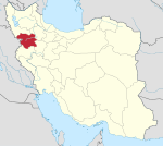
| Province | Kurdistan |
| County | Dehgolan |
| Bakhsh | Bolbanabad |
| Population (2006) | |
| • Total | 3,464 |
| Time zone | IRST (UTC+3:30) |
| • Summer (DST) | IRDT (UTC+4:30) |
Bolbanabad (Persian: بلبان آباد and Kurdish: بۆلواناوا, also Romanized as Bolbānābād; also known as Bolbolānābād, Būl-e Bandābād, and Būl Bandābād)[1] is a city in and capital of Bolbanabad District, in Dehgolan County, Kurdistan Province, Iran. At the 2006 census, its population was 3,464, in 899 families.[2]
Situation
The city is located to the east of the Kurdistan province. It is bordered from east to the Ghorveh, from the north to Dehgolan, from south to Mochash, and from west to Sanandaj. It is located in the township of Dehgolan which is located in a large plain 47 km. east of Sanandaj and northwest of Hamadan and has expanded in the direction of the Sanandaj road towards Hamadan.
The town of Bolbanabad lies at a distance of 512 km from Tehran, 2,120 m above sea level. The language of people in Bolbanabad is mainly Kurdish and their religion is Islam .
In the past the seat of rule of this town was the Ghaziabad Village. Here the governor of the times was responsible for the construction of some buildings, a castle, mosque, bath, garden and large groves. Today, due to its distinctive geological characteristics, and mineral water springs, visitors and tourists are attracted to this town.
References
- ↑ Bolbanabad can be found at GEOnet Names Server, at this link, by opening the Advanced Search box, entering "-3056579" in the "Unique Feature Id" form, and clicking on "Search Database".
- ↑ "Census of the Islamic Republic of Iran, 1385 (2006)" (Excel). Islamic Republic of Iran. Archived from the original on 2011-11-11.
| ||||||||||||||||||||||||||||||||||||||||||||||||||||||||||
| ||||||||||||||||||||||||||||