Boinka, Victoria
| Boinka Victoria | |||||||||||||
|---|---|---|---|---|---|---|---|---|---|---|---|---|---|
|
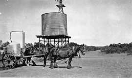
1925 – Filling tanks from the main water supply of Boinka | |||||||||||||
 Boinka | |||||||||||||
| Coordinates | 35°12′14″S 141°36′38″E / 35.20389°S 141.61056°ECoordinates: 35°12′14″S 141°36′38″E / 35.20389°S 141.61056°E | ||||||||||||
| Postcode(s) | 3490 | ||||||||||||
| Location | |||||||||||||
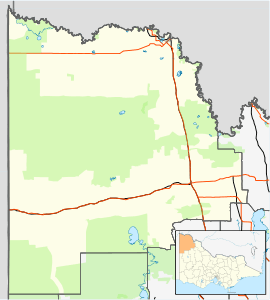
| LGA(s) | Rural City of Mildura | ||||||||||||
| |||||||||||||
Boinka is a locality situated on the section of the Mallee Highway between Ouyen and the South Australian border in the Sunraysia region of Victoria, Australia. By road, Boinka is situated approximately 4 kilometres east from Tutye and 8 kilometres west from Linga.
The name Boinka means "flat black beetle" in the language of the indigenous people of Lake Hindmarsh.[2]
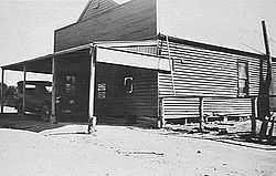
The location has a rich history of settlement and is the subject of a photograph collection within the archives of the Museum of Victoria. The Boinka State School (No 3800) is listed as a part of Heritage Victoria - owned by the Crown Reserve and managed by Rural City Council of Mildura.[3] The township was established in the early 1910s, and the Post Office opened on 15 July 1912 when a regular mail service was provided by the opening of the railway from Ouyen to Murrayville a month earlier. The office closed in 1975.[4]
Unique facts
Boinka is listed within the Victorian Flora and Fauna Guarantee Act of 1988 as being one of only two places where Pale Myoporum (Myoporum brevipes Benth.), a recumbent or erect shrub of up to 2 metres in height (widespread in South Australia), is known to grow indigenously outside of that location.[5]
References
- ↑ Travelmate
- ↑ Lake Hindmarsh Aboriginal Language Specimens
- ↑ Heritage Places in Victoria
- ↑ Premier Postal History, Post Office List, retrieved 2008-04-11
- ↑ Department of Sustainability and Environment (Victoria)
| ||||||||||