Blue Tent, California
| Blue Tent | |
|---|---|
| Former settlement | |
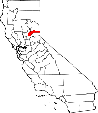
 Blue Tent Location in California | |
| Coordinates: 39°18′37″N 120°58′21″W / 39.31028°N 120.97250°WCoordinates: 39°18′37″N 120°58′21″W / 39.31028°N 120.97250°W | |
| Country |
|
| State |
|
| County | Nevada County |
| Elevation[1] | 3,133 ft (955 m) |
Blue Tent is a former settlement in Nevada County, California. It was situated 6 mi (9.7 km) southwest of the town of North Bloomfield, California on the north side of the Washington Ridge, by the South Yuba River. Its elevation was 3,133 ft (955 m) above sea level.[2][3]
History
First a California Gold Rush camp, and then a mining town,[4] it appeared on an 1873 map that identified other features within a couple of miles such as Sailor Flat Cañon, Mount Vernon House, and Gopher Hill. A post office opened in 1878 and closed in 1889.[5]
References
- ↑ U.S. Geological Survey Geographic Names Information System: Blue Tent, California
- ↑ "NEVADA COUNTY, CALIFORNIA". calsign.com. Retrieved 2009-05-28.
- ↑ Lindgren, Waldemar (1896). The gold-quartz veins of Nevada City and Grass Valley Districts, California. Government printing office. pp. 33, 106, 108, 110.
- ↑ Brower, Maria E. (2006). Gold Rush Towns of Nevada County. Arcadia Publishing. p. 8. ISBN 0-7385-4692-5.
- ↑ Durham, David L. (1998). California's Geographic Names: A Gazetteer of Historic and Modern Names of the State. Quill Driver Books. p. 452. ISBN 1-884995-14-4.