Black Hill, Victoria
| Black Hill Ballarat, Victoria | |||||||||||||
|---|---|---|---|---|---|---|---|---|---|---|---|---|---|
|
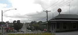
Corner of Napier and Peel Street. The Post Office is on the left and the Black Hill Hotel on the right. | |||||||||||||
 Black Hill | |||||||||||||
| Coordinates | 37°33′36″S 143°52′21″E / 37.56°S 143.8726°ECoordinates: 37°33′36″S 143°52′21″E / 37.56°S 143.8726°E | ||||||||||||
| Population | 2,131 (2011)[1] | ||||||||||||
| • Density | 1,225/km2 (3,172/sq mi) | ||||||||||||
| Postcode(s) | 3350 | ||||||||||||
| Area | 1.74 km2 (0.7 sq mi) | ||||||||||||
| Location | 2 km (1 mi) from Ballarat Central | ||||||||||||
| LGA(s) | City of Ballarat | ||||||||||||
| State electorate(s) | Wendouree | ||||||||||||
| Federal Division(s) | Ballarat | ||||||||||||
| |||||||||||||
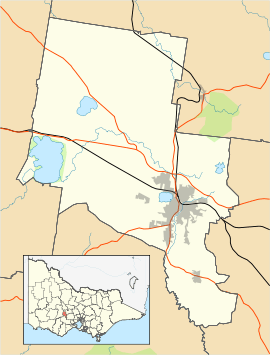
Black Hill is a suburb of Ballarat, Victoria, Australia in the northeast of the city. The population at the 2011 census was 2,131.[1]
It is bordered to the south and east by the Yarrowee River and to the north by Howitt Street, Walker Street and Boronia/Haimes Road and Reid Street to the west by Havelock and Rowe Streets.
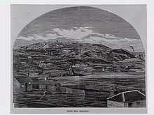
The hill after which it is named, originally named Bowdun by surveyor William Urquhart, is notable for its famous lookout from where most of Ballarat can be seen which is included on the Ballarat Treasures Register.
It is a former mining area and the hill was mined extensively during the Victorian gold rush.
History

Black Hill was a gold mining and brick making area.
Black Hill Post Office opened on 7 June 1864.[2]
Parks and open space
Black Hill has several large parks and also has a public swimming pool.

References
- ↑ 1.0 1.1 Australian Bureau of Statistics (31 October 2012). "Black Hill (Vic) (State Suburb)". 2011 Census QuickStats. Retrieved 4 January 2015.
- ↑ Premier Postal History, Post Office List, retrieved 2008-04-11
External links
| ||||||
