Blaby District
| Blaby District | |
|---|---|
| District | |
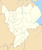
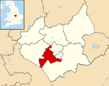 Shown within Leicestershire | |
| Sovereign state | United Kingdom |
| Constituent country | England |
| Region | East Midlands |
| Administrative county | Leicestershire |
| Admin. HQ | Narborough |
| Government | |
| • Type | Blaby District Council |
| • Leadership: | Leader & Cabinet |
| • Executive: | Conservative |
| • MPs: |
Stephen Dorrell, Andrew Robathan |
| Area | |
| • Total | 50.4 sq mi (130.5 km2) |
| Area rank | 198th |
| Population (2011 est.) | |
| • Total | 94,100 |
| • Rank | Ranked 247th |
| • Density | 1,900/sq mi (720/km2) |
| Time zone | Greenwich Mean Time (UTC+0) |
| • Summer (DST) | British Summer Time (UTC+1) |
| ONS code |
31UB (ONS) E07000129 (GSS) |
| Ethnicity |
94.3% White 3.8% S.Asian |
| Website | blaby.gov.uk |
Blaby is a local government district in Leicestershire, England.
The district is named after the village of Blaby. It covers the civil parish of Blaby and 23 others. Among these are Cosby, Countesthorpe, Enderby, Huncote, Narborough (the location of the main district council offices), Sapcote, Stoney Stanton, and Wigston Parva. Much of the district is part of the Leicester urban area: this applies especially to the parishes of Braunstone Town (including the commuter housing development of Thorpe Astley); Glenfield (the location of the headquarters of Leicestershire County Council); Kirby Muxloe; Leicester Forest East; and Glen Parva. There are plans to extend this urban area significantly through a large scale housing development, in the rural parish of Lubbesthorpe, and expansion of the industrial area in the neighbouring parish of Enderby.
Blaby was represented in Parliament by the former Chancellor of the Exchequer, Nigel Lawson, between 1974 and 1992.
History
The district traces its origins to the Blaby Poor Law Union,[1] which was founded in 1834. It became a rural district of Leicestershire in 1894. Oadby was removed in 1913 to form an urban district. 1935 saw parts being transferred to Leicester, whilst it took in part of the abolished Hinckley Rural District. In 1974, under the Local Government Act 1972, the area was reconstituted as a non-metropolitan district.
Parishes
- Aston Flamville
- Blaby, Braunstone Town
- Cosby, Countesthorpe, Croft
- Elmesthorpe, Enderby
- Glen Parva, Glenfield
- Huncote
- Kilby, Kirby Muxloe
- Leicester Forest East, Leicester Forest, Lubbesthorpe
- Narborough
- Potters Marston
- Sapcote, Sharnford, Stoney Stanton
- Thurlaston
- Whetstone, Wigston Parva
Link
References
| Wikimedia Commons has media related to District of Blaby. |
| ||||||||||||||||||||
| ||||||||||||||||||||||
| ||||||||||||||||||||||||||||