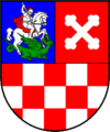
Bjelovar-Bilogora County
| Bjelovar-Bilogora County Bjelovarsko-bilogorska županija | |||
|---|---|---|---|
| County | |||
| |||
 Bjelovar-Bilogora County (light orange) within Croatia (light yellow) | |||
| County seat | Bjelovar | ||
| Government | |||
| • Župan | Miroslav Čačija (HSS) | ||
| Area[1] | |||
| • Total | 2,640 km2 (1,020 sq mi) | ||
| Population (2011)[2] | |||
| • Total | 119,764 | ||
| • Density | 45/km2 (120/sq mi) | ||
| Area code | 043 | ||
| ISO 3166 code | HR-07 | ||
| Website | http://www.bbz.hr/ | ||
Bjelovar-Bilogora County (Croatian: Bjelovarsko-bilogorska županija) is a county in central Croatia.
The central town of Bjelovar was first mentioned in 1413, and it only gained importance when a new fort was built in 1756 to defend against the Ottoman invasions. The town was pronounced a free royal town in 1874.
The other part of the county name is for the picturesque hill of Bilogora that stretches along the northern edge of the county.
Other towns in the county are Daruvar, Garešnica, Čazma and Grubišno Polje.
The Bjelovar-Bilogora County borders on the Koprivnica-Križevci County in the north, Virovitica-Podravina County in the northeast, Požega-Slavonia County in the southeast, Sisak-Moslavina County in the southwest and Zagreb County in the west.
Demographics
According to the 2011 census, the inhabitants of Bjelovar-Bilogora County were:[3]
Administrative division
Bjelovar-Bilogora County is further divided into 5 towns and 18 municipalities.
| Town | Population (2011 census)[2] |
|---|---|
| Bjelovar | 40,276 |
| Čazma | 8,077 |
| Daruvar | 11,633 |
| Garešnica | 10,472 |
| Grubišno Polje | 6,478 |
| Municipality | Population (2001 census)[2] |
|---|---|
| Berek | 1,443 |
| Dežanovac | 2,715 |
| Đulovac | 3,245 |
| Hercegovac | 2,383 |
| Ivanska | 2,911 |
| Kapela | 2,984 |
| Končanica | 2,360 |
| Nova Rača | 3,433 |
| Rovišće | 4,822 |
| Severin | 877 |
| Sirač | 2,218 |
| Šandrovac | 1,776 |
| Štefanje | 2,030 |
| Velika Pisanica | 1,781 |
| Velika Trnovitica | 1,370 |
| Veliki Grđevac | 2,849 |
| Veliko Trojstvo | 2,741 |
| Zrinski Topolovac | 890 |
Demographics
| Historical populations of Bjelovar-Bilogora County | |||||||||||||||||||||||||||||||||||||||||||||||||||||||
|---|---|---|---|---|---|---|---|---|---|---|---|---|---|---|---|---|---|---|---|---|---|---|---|---|---|---|---|---|---|---|---|---|---|---|---|---|---|---|---|---|---|---|---|---|---|---|---|---|---|---|---|---|---|---|---|
|
| ||||||||||||||||||||||||||||||||||||||||||||||||||||||
| Source: Naselja i stanovništvo Republike Hrvatske 1857–2001, Croatian Bureau of Statistics, Zagreb, 2005 | |||||||||||||||||||||||||||||||||||||||||||||||||||||||
As of the 2011 census, the county had 119,764 residents. The population density is 45 people per km².
Ethnic Croats form the majority with 84.8% of the population, followed by Serbs at 6.3% and Czechs at 5.2%.[4]
Protected areas
See also
References
- ↑ Ostroški, Ljiljana, ed. (December 2013). Statistički ljetopis Republike Hrvatske 2013 [2013 Statistical Yearbook of the Republic of Croatia] (PDF). Statistical Yearbook of the Republic of Croatia (in Croatian and English) 45. Zagreb: Croatian Bureau of Statistics. p. 56. ISSN 1334-0638. Retrieved 17 February 2014.
- ↑ 2.0 2.1 2.2 "Population by Age and Sex, by Settlements, 2011 Census: County of Bjelovar-Bilogora". Census of Population, Households and Dwellings 2011. Zagreb: Croatian Bureau of Statistics. December 2012.
- ↑ "Population by Ethnicity, by Towns/Municipalities, 2011 Census: County of Bjelovar-Bilogora". Census of Population, Households and Dwellings 2011. Zagreb: Croatian Bureau of Statistics. December 2012.
- ↑ "Stanovništvo prema narodnosti po gradovima/općinama, Popis 2011.". Croatian Bureau of Statistics. Retrieved 4 December 2014.
External links
| Wikimedia Commons has media related to Bjelovar-Bilogora County. |
| ||||||||||||
Coordinates: 45°54′10″N 16°50′51″E / 45.90278°N 16.84750°E

