Biscay, Minnesota
| Biscay, Minnesota | |
|---|---|
| City | |
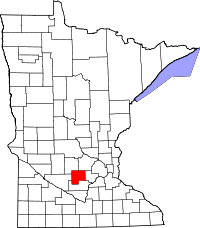
 Location of Biscay within McLeod County, Minnesota | |
| Coordinates: 44°49′37″N 94°16′24″W / 44.82694°N 94.27333°W | |
| Country | United States |
| State | Minnesota |
| County | McLeod |
| Area[1] | |
| • Total | 0.08 sq mi (0.21 km2) |
| • Land | 0.08 sq mi (0.21 km2) |
| • Water | 0 sq mi (0 km2) |
| Elevation | 1,024 ft (312 m) |
| Population (2010)[2] | |
| • Total | 113 |
| • Estimate (2012[3]) | 111 |
| • Density | 1,412.5/sq mi (545.4/km2) |
| Time zone | Central (CST) (UTC-6) |
| • Summer (DST) | CDT (UTC-5) |
| FIPS code | 27-06112[4] |
| GNIS feature ID | 0655408[5] |
Biscay /ˈbɪskiː/ BIS-kee is a city in McLeod County, Minnesota, United States. The population was 113 at the 2010 census.[6]
Geography
According to the United States Census Bureau, the city has a total area of 0.08 square miles (0.21 km2), all of it land.[1]
Biscay is located at the junction of Minnesota State Highway 22 and Major Avenue, between the cities of Glencoe and Hutchinson.
Demographics
2010 census
As of the census[2] of 2010, there were 113 people, 43 households, and 33 families residing in the city. The population density was 1,412.5 inhabitants per square mile (545.4/km2). There were 47 housing units at an average density of 587.5 per square mile (226.8/km2). The racial makeup of the city was 90.3% White, 0.9% Asian, 5.3% from other races, and 3.5% from two or more races. Hispanic or Latino of any race were 8.8% of the population.
There were 43 households of which 23.3% had children under the age of 18 living with them, 69.8% were married couples living together, 4.7% had a female householder with no husband present, 2.3% had a male householder with no wife present, and 23.3% were non-families. 20.9% of all households were made up of individuals and 11.6% had someone living alone who was 65 years of age or older. The average household size was 2.63 and the average family size was 3.06.
The median age in the city was 45.2 years. 28.3% of residents were under the age of 18; 6.1% were between the ages of 18 and 24; 15% were from 25 to 44; 32.7% were from 45 to 64; and 17.7% were 65 years of age or older. The gender makeup of the city was 46.0% male and 54.0% female.
2000 census
As of the census[4] of 2000, there were 114 people, 45 households, and 31 families residing in the city. The population density was 1,642.4 people per square mile (628.8/km²). There were 48 housing units at an average density of 691.5 per square mile (264.8/km²). The racial makeup of the city was 93.86% White, 6.14% from other races. Hispanic or Latino of any race were 11.40% of the population.
There were 45 households out of which 26.7% had children under the age of 18 living with them, 66.7% were married couples living together, 2.2% had a female householder with no husband present, and 28.9% were non-families. 22.2% of all households were made up of individuals and 6.7% had someone living alone who was 65 years of age or older. The average household size was 2.53 and the average family size was 3.03.
In the city the population was spread out with 22.8% under the age of 18, 7.9% from 18 to 24, 28.1% from 25 to 44, 35.1% from 45 to 64, and 6.1% who were 65 years of age or older. The median age was 39 years. For every 100 females there were 86.9 males. For every 100 females age 18 and over, there were 104.7 males.
The median income for a household in the city was $49,583, and the median income for a family was $59,583. Males had a median income of $38,750 versus $25,625 for females. The per capita income for the city was $22,988. None of the population or the families were below the poverty line.
Tourism
- The city of Biscay is home to the Biscay Municipal Liquor store, more commonly known as the "Biscay Bar"; it is perhaps the largest bar and liquor store within over 15 miles (24 km). The liquor store offers a large menu, which includes 20 different appetizers and 17 burgers. For entertainment, the bar area has two pool tables, an electronic jukebox, and numerous TVs.
- Located two miles (3 km) south of Bicay is the Major Avenue Hunt Club. Major Avenue offers hunters 350 acres (1.4 km2) of upland native grasses, sorghum and rolling hills and 160 acres (0.65 km2) of marsh and open water for the seasonal waterfowl hunters.Major Avenue Hunt Club
Biscay Days
Celebrations center around the annual car show. Over this one-day event, trophies are awarded to the winners.
The Biscay Triangle
The Biscay Triangle (unofficial name adopted by locals) is a 1,117-acre (4.52 km2) area about a half mile northeast of Biscay where three phenomenon occurred involving cell phone service, agriculture, and weather. Difficulty in obtaining cell phone service from even the largest companies has been a problem for 94% of the population in both rural and urban areas. Residents only needing to make local calls have dealt with this situation by developing their own communication system using CB radios and portable FM/AM radios. Plants and crops in the area (both above and below ground) grow at an estimated rate 50% slower than plants in surrounding areas. However, plants in their own pots have been reported to grow at a normal rate. Also, the area within the triangular shape has been reported to had never had a tornado fully touch the ground since 1871 when recording began in Biscay. Residents more recently have reported funnel clouds abruptly changing direction when they approach the area.[7]
References
- ↑ 1.0 1.1 "US Gazetteer files 2010". United States Census Bureau. Retrieved 2012-11-13.
- ↑ 2.0 2.1 "American FactFinder". United States Census Bureau. Retrieved 2012-11-13.
- ↑ "Population Estimates". United States Census Bureau. Retrieved 2013-05-28.
- ↑ 4.0 4.1 "American FactFinder". United States Census Bureau. Retrieved 2008-01-31.
- ↑ "US Board on Geographic Names". United States Geological Survey. 2007-10-25. Retrieved 2008-01-31.
- ↑ "2010 Census Redistricting Data (Public Law 94-171) Summary File". American FactFinder. United States Census Bureau. Retrieved 27 April 2011.
- ↑ AK & TG
| |||||||||||||||||||||
Coordinates: 44°49′39″N 94°16′30″W / 44.82750°N 94.27500°W