Birganj Upazila
| Birganj বীরগঞ্জ | |
|---|---|
| Upazila | |
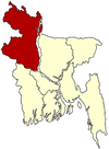
 Birganj Location in Bangladesh | |
| Coordinates: 26°0′0″N 88°35′0″E / 26.00000°N 88.58333°ECoordinates: 26°0′0″N 88°35′0″E / 26.00000°N 88.58333°E | |
| Country |
|
| Division | Rangpur Division |
| District | Dinajpur District |
| Area | |
| • Total | 413 km2 (159 sq mi) |
| Population (1991) | |
| • Total | 231,305 |
| • Density | 560/km2 (1,500/sq mi) |
| Time zone | BST (UTC+6) |
| Website | Official Map of Birganj |
Birganj (Bengali: বীরগঞ্জ) is an Upazila of Dinajpur District[1] in the Division of Rangpur, Bangladesh.
Geography
Birganj is located "between 25°48' and 26°04' north latitudes and in between 88°29´ and 88°44´ east longitudes".[1] It is situated on the bank of Dhepa river.It has 42323 units of house hold and total area 413 km².
Demographics
As of the 1991 Bangladesh census, Birgonj has a population of 231305. Males constitute 51.77% of the population, and females 48.23%. This Upazila's eighteen up population is 111160. Birgonj has an average literacy rate of 25% (7+ years), and the national average of 32.4% literate.[2]
Administrative
Birganj has 11 Unions/Wards, 187 Mauzas/Mahallas, and 186 villages.
Notable Persons
Md. Azizar Rahamn
See also
- Upazilas of Bangladesh
- Districts of Bangladesh
- Divisions of Bangladesh
- Birganj a town in northern part Dinajpur district of Bangladesh.
References
- ↑ 1.0 1.1 Mamtajur Alam Ilu (2012). "Birganj Upazila". In Sirajul Islam and Ahmed A. Jamal. Banglapedia: National Encyclopedia of Bangladesh (Second ed.). Asiatic Society of Bangladesh.
- ↑ "Population Census Wing, BBS.". Archived from the original on 2005-03-27. Retrieved November 10, 2006.
| |||||||||||||||||||||||||||||||||||||||||