Biratnagar
| Biratnagar बिराटनगर Gograha | |
|---|---|
| Sub-Metropolitan City | |
|
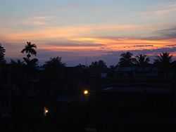
View of Sunrise in Biratnagar | |
| Nickname(s): Industrial capital city of Nepal | |
 Biratnagar Location of Biratnagar in map of Nepal. | |
| Coordinates: 26°27′15″N 87°16′47″E / 26.45417°N 87.27972°E | |
| Nepal | Nepal |
| Development Region | Eastern |
| Zone | Koshi |
| District | Morang |
| Area | |
| • Total | 58.48 km2 (22.58 sq mi) |
| Elevation | 80 m (260 ft) |
| Population (2011) | |
| • Total | 261,125 [1] |
| Time zone | Nepal Time (UTC+5:45) |
| Postal code | 56600, 56613, 56614 |
| Area code(s) | 021 |
| Website | biratnagar.gov.np |
Biratnagar (Nepali: विराटनगर) is a sub-metropolitan municipality and third largest city of Nepal after Pokhara.[2] The town is located in Morang District in the Kosi Zone of eastern Nepal. It lies 399 km east of the capital Kathmandu, 6 km north of the border of the Indian state of Bihar.
History
The old name of Biratnagar was Gograha Bazaar. In 1914 AD, Colonel Jit Bahadur Khatri, the district governor, laid the foundations of modern Biratnagar by moving the hospital, post office, jail and the customs, land registry, forestry and auditor offices to Gograha Bazaar from Rangeli, the district capital of Morang at the time.[3] Biratnagar got its present name in 1919 AD from Keshar Shamsher Rana after objects of historical importance, believed to be of King Virata's time, were found in the place.[3] The region is believed to be a part of the kingdom of Virata, mentioned in the Mahabharata. The ruins of the palace along with stone carved tools, idols and household objects can be seen protected in southern part of Biratnagar, close to the border. In Nepali "birat" means huge and "nagar" means city.
In March 4, 1947 first anti-rana movement in Nepali soil took place in Biratnagar as Biratnagar jute mill strike under the leadership of Girija Prasad Koirala along with Bishweshwar Prasad Koirala. Then after it sparked a countrywide anti-Rana demonstration that finally led to the abolishment of Rana rule in Nepal.
Demography
According to 2011 CBS census data, Biratnagar's population was 201,125. It is the second largest city in Nepal after Kathmandu; and is the headquarters of Morang district. Most people follow Hinduism followed by Islam, Jainism, Kirat and Christianity. The main language is Maithili and Nepali, although the local dialect of Maithili differs from what is spoken further west.
Biratnagar is situated within one of the most ethnically diverse regions of Nepal, and the rural hinterland is home to a diverse cross section of Madhesi and bihari communities.
Climate
| Month | Jan | Feb | Mar | Apr | May | Jun | Jul | Aug | Sep | Oct | Nov | Dec | Year |
|---|---|---|---|---|---|---|---|---|---|---|---|---|---|
| Average high °C (°F) | 22.7 (72.9) |
26.1 (79) |
30.9 (87.6) |
33.9 (93) |
33.3 (91.9) |
32.9 (91.2) |
32.1 (89.8) |
32.5 (90.5) |
32.1 (89.8) |
31.6 (88.9) |
29.3 (84.7) |
25.4 (77.7) |
30.23 (86.42) |
| Average low °C (°F) | 9.0 (48.2) |
11.1 (52) |
15.6 (60.1) |
20.4 (68.7) |
23.3 (73.9) |
25.2 (77.4) |
25.6 (78.1) |
25.8 (78.4) |
24.7 (76.5) |
21.1 (70) |
15.3 (59.5) |
10.5 (50.9) |
18.97 (66.14) |
| Average precipitation mm (inches) | 11.7 (0.461) |
13.2 (0.52) |
13.2 (0.52) |
53.1 (2.091) |
186.0 (7.323) |
302.4 (11.906) |
530.8 (20.898) |
378.3 (14.894) |
298.8 (11.764) |
91.8 (3.614) |
5.9 (0.232) |
6.6 (0.26) |
1,891.8 (74.483) |
| Source: Department of Hydrology and Meteorology (Nepal)[4] | |||||||||||||
Transport
- Air: Biratnagar Airport has frequent flights to Kathmandu and other airports inside Nepal. It is the regional hub for the eastern part of the country.
- Road: Biratnagar is roughly 500 kilometres (310 mi) by road from Kathmandu. It is also well connected to other parts of the country by bus services.
- Cross-border: Biratnagar is 7 kilometres (4 mi) north of Nepal's southern border with Bihar state, India. The crossing has a customs checkpoint for goods. Indian and Nepalese nationals cross freely. Jogbani town in Araria District is on the Indian side, where a rail line ends. There are direct trains from there to Katihar, Kolkata and New Delhi. A rail extension to Biratnagar has been proposed and surveyed.
- Intracity: Cycle rickshaws and taxis serve the city center. Auto rickshaws (Tempos) are available for longer distances outside the center. Yet due to its low frequency and high cost local transportation has posed as major problem amongst the middle and lower class of population.
Tourism
Biratnagar is one of the cities of Nepal and is a great hub to explore the interesting places in eastern Nepal like Ilam. There are many things to do in the city. One can stroll along the unique market that is along a straight road which then branches out into smaller streets, where one can savor the street food. A number of colorful haat bazaars (weekly markets) are held each week in different parts of the town, where farmers from the rural hinterland set up stalls to trade agricultural produce, spices and handicrafts.
There are few gardens, temples and Places of religious importance in Biratnagar. Gopal garden, located near Hathkhola and Hridreyandra Bal Udhhyan near Thulo Mill are two main gardens. Temples have been the jewel of Biratnagar. They are decorated in vibrant ways to make it attractive. The site of remains of King Birat's palace and a local people's exhibitions of objects found during excavation there can be a place to visit. Besides all, Biratnagar is popular for people of eastern region for shopping.
Biratnagar is ideal as a hub for travel plans in Eastern Nepal. The Koshi Tappu Wildlife Reserve famous for its wildlife, especially for bird-watching enthusiasts, is a mere 90-minute drive from the city. It is also home to the endangered wild buffaloes called "Arna" in Nepali.
The largest rhododendron forests of Tinjure, Milke and Jaljale can be reached in about 3–4 hours. Scenic treks with views of Mt. Makalu and Kanchenjunga can be started from the small towns of Basantapur or Tumlingtar.
The beautiful tea gardens of Ilam are just 4 hours' drive away. Another place of interest is the hilly district of Dhankuta with its orange orchards.
Another beautiful location near Biratnagar is Dharan (50 km from north of Biratnagar) which is 1.5 hours' journey by bus. The place is famous for Dantakali temple, Pindeshwar temple, Budha Subba Temple and Panch Kanya and is surrounded with hills and Bhedetar is famous view point.
Religious fare
Biratnagar is equally famous for its high-spirited festival celebration. In Dashain, Nepal's biggest festival, large number of people including young persons visit the Kali Mandir, a temple that lies in the heart of the town. Also famous is Tihar, festival of lights, when the residents line their homes with Diyo (an earthen oil lamp), candles and decorative electrical lamps during the two days of celebration and there is decoration in main road which includes use of Banana tree and Bamboo in all shops. Fire crackers are banned in Nepal and are strictly prohibited to use during Tihar but smuggling it during Tihar is very popular. Krishna Astami (birthday of Krishna) is a festival that is heavily celebrated in Biratnagar. Thousands of people gather on that day to pull the Holy Cart (Rath) which goes around the city which length is approximately 8 km. This event is termed as the Rath Yatra (the Cart Journey). Traffic will be halted for five to six hours on that day. It is believed that the Holy Cart (Rath) was driven by Lord Krishna. So, people keep a young child in the Holy Cart as a symbol of Krishna and pull the Cart with joy to celebrate the Lord Krishna's birthday. The Rath is very big and heavy and needs hundreds of persons to move it. Mostly the recruits of Nepal army are recruited to pull the heavy cart. It has an engine to run if required to move fast. It has brakes to stop it as it has to stop at many places to allow people to worship the Lord. Some people stay on top of the Rath to distribute prasad (holy fruits) to people. The Holy Cart will be followed by many smaller carts which are pulled by oxen. People in the smaller carts play the music and sing hymns with joy and happiness. It is the most important festival for the people of Biratnagr. So, almost all the schools and offices close after 1 p.m. to let the believers and spectators attend the Rath Yatra (the Cart Journey).
Chhath (Devanagari: छठ, छठी, छठ पर्व, छठ पुजा, डाला छठ, डाला पुजा, सुर्य षष्ठी) is an important festival for Madheshi and bihari hindus. It is the only vedic festival dedicated to the Sun God, Surya and Chhathi Maiya (ancient Vedic Goddess Usha) is also celebrated in Biratnagar. The Chhath Puja is performed in order to thank Surya(the sun) for sustaining life on earth and to request the granting of certain wishes.
On the pooja day they collect fruits and prepare thekwa (sweet made of wheat) with great respect to Surya (the sun). Some people fast from two days prior of pooja and break their fast by drinking water after the ritual is over. Chhath is considered to be very pure and the pooja is performed with infinite respect to surya, the Sun.
Eid al-Fitr and Eid al-Adha are the festivals celebrated by Muslim community of Biratnagar. Christmas is celebrated by a small population of Christian minority.
Politics
Biratnagar, being the home and a political turf of Bishweshwar Prasad Koirala, the first democratically elected Prime Minister of Nepal, has always been a fertile ground for emerging as well as established politicians. Leaders like Man Mohan Adhikari, Sailaja Acharya, Bharat Mohan Adhikari and Mahesh Acharya all come from this city. Girija Prasad Koirala, the man who has been elected prime minister the most number of times in Nepal, and in the world, also hails from Biratnagar. He was Prime Minister of Nepal four times, serving from 1991 to 1994, 1998 to 1999, 2000 to 2001, and from 2006 to 2008; he was also Acting Head of State from January 2007 to July 2008. Biratnagar is the politically most active city in the modern history of Nepal. The first and the historical aeroplane hijack which was to fund the political revolution also took place at the Biratnagar Airport. The hijack plan masterminded by Girija Prasad Koirala was executed by Durga Subedi, Nagendra Dhungel and Basant Bhattarai. *"Operation Ganesh out, place hijack plan in".
Education
Biratnagar is the centre of education in the Eastern Development Region of Nepal. Home to the Purwanchal University, Biratnagar has a number of good colleges and educational institutes. The medium of teaching is English in all the private schools, colleges and universities whereas Nepali is the medium of instruction in government schools up to secondary level. There are many schools, high schools and medical schools and university in the city.
Economy, Trade and Commerce
Nicknamed as the Commercial hub of Nepal the main economy of Biratnagar consist of Business and Industry. Biratnagar is home to many Businessman. It exports instant noodles, biscuits and garments to India and some other cities of Nepal. It also exports some garments to USA and some European countries. Biratnagar imports machinery, vehicles, computers, iron, steel, etc. from India and clothes, slippers, shoes, etc. from China. Biratnagar Sugar Mill and Biratnagar Jute Mill are the biggest industries of Biratnagar. Biratnagar has always been the center of business and commerce in Nepal. Biratnagar is also known as the industrial city of Nepal. The city also consists of large marketplace. Biratnagar market extending from Golchha Chowk to Traffic Chowk is one of the biggest market in eastern regions of Nepal. Almost all kind of items are available here. It is also home to many Supermarkets like Nepal Bazaar, and Sajilo Bazaar.
Art & Literature
Biratnagar has been the ground for several literary works. Some of the prominent books in Nepali literature have been emerged from Biratnagar. Landmark books in Nepali poetry, 'Bholi Basne Bihan' by Krishna Bhushan Bal and Jeevanko Chheubaata by Suman Pokhrel were created in this city. There is a popular culture of poetry recitation in regular sessions in various locations of Biratnagar.[5]
Recreation and entertainment
There are many places in Biratnagar to hang out. A lot of melas (fairs) are organized at various times of the year where people from all factions of society come to enjoy the rides and swings. Although very few national tournaments are organized here, many regional soccer tournaments can be observed in the city stadium ground. There are many recreational parks, movies libraries dotted around the city. Recently various Yoga Shivir or centres have been built by public bodies.
See also
References
- ↑ "National Population Census 2011" (PDF). Retrieved 6 November 2012.
- ↑ Govt. of Nepal, National Planning Commission Secretariat, CBS (2011). "National Population and Housing Census 2011 (National Report)" (PDF). NPHC 01: 41–42. Retrieved 30 March 2014. & List of cities in Nepal
- ↑ 3.0 3.1 Dambar Krishna Shrestha & Kamal Rimal. "१०० वर्षको विराटनगर, मणि खोज्दै (Biratnagar Turns 100, Seeking Glory)". Himal Khabar. Himal Media. Retrieved 26 December 2013.
- ↑ "NORMALS FROM 1981-2010" (PDF). Department of Hydrology and Meteorology (Nepal). Retrieved 20 October 2012.
- ↑ Dadhiraj Subedi, "नेपाली साहित्यका मुस्कानहरू (The Smiles of Nepali Literature)"- 2012, Purwanchal Sahitya Academy, Biratnagar - ISBN 978 9937248266
External links
- Our Biratnagar
- Biratnagar
- Homepage
 Biratnagar travel guide from Wikivoyage
Coordinates: 26°27′15″N 87°16′47″E / 26.4542°N 87.2797°E
