Billy, Allier
| Billy | ||
|---|---|---|
|
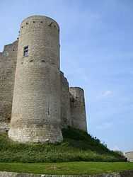
Chateau | ||
| ||
 Billy | ||
|
Location within Auvergne region  Billy | ||
| Coordinates: 46°14′14″N 3°25′48″E / 46.2372°N 3.43°ECoordinates: 46°14′14″N 3°25′48″E / 46.2372°N 3.43°E | ||
| Country | France | |
| Region | Auvergne | |
| Department | Allier | |
| Arrondissement | Vichy | |
| Canton | Varennes-sur-Allier | |
| Intercommunality | Vichy Val d'Allier | |
| Government | ||
| • Mayor (2008–2014) | René Verron | |
| Area1 | 10.22 km2 (3.95 sq mi) | |
| Population (2008)2 | 840 | |
| • Density | 82/km2 (210/sq mi) | |
| INSEE/Postal code | 03029 / 03260 | |
| Elevation |
235–375 m (771–1,230 ft) (avg. 220 m or 720 ft) | |
|
1 French Land Register data, which excludes lakes, ponds, glaciers > 1 km² (0.386 sq mi or 247 acres) and river estuaries. 2 Population without double counting: residents of multiple communes (e.g., students and military personnel) only counted once. | ||
.svg.png)
Billy (Occitan, Bilhi) is a commune in the Allier department in central France.
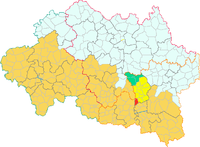
Billy in the Canton of Varennes-sur-Allier
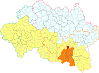
Billyin the Vichy conurbation
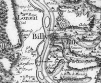
Billy on the map of Cassini
Between this village and nearby Créchy, lagerstätten have yielded a rich assemblage of fossils from the Oligocene-Miocene boundary (c. 24-23 million years ago).[1]
Population
| Historical population | ||
|---|---|---|
| Year | Pop. | ±% |
| 1962 | 820 | — |
| 1968 | 1,084 | +32.2% |
| 1975 | 912 | −15.9% |
| 1982 | 921 | +1.0% |
| 1990 | 1,007 | +9.3% |
| 1999 | 929 | −7.7% |
| 2008 | 840 | −9.6% |
See also
References
- ↑ Hugueney et al. (2003)
| Wikimedia Commons has media related to Billy, Allier. |